
colectora rover CY F60 pro rtk gps gnss surveying
- Category: >>>
- Supplier: Jiangsu Conwy Optoelectronic Technology Co. Ltd.
Share on (1600475488056):
Product Overview
Description
Product details

Key Features
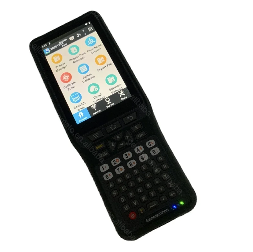
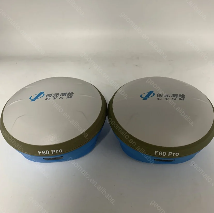
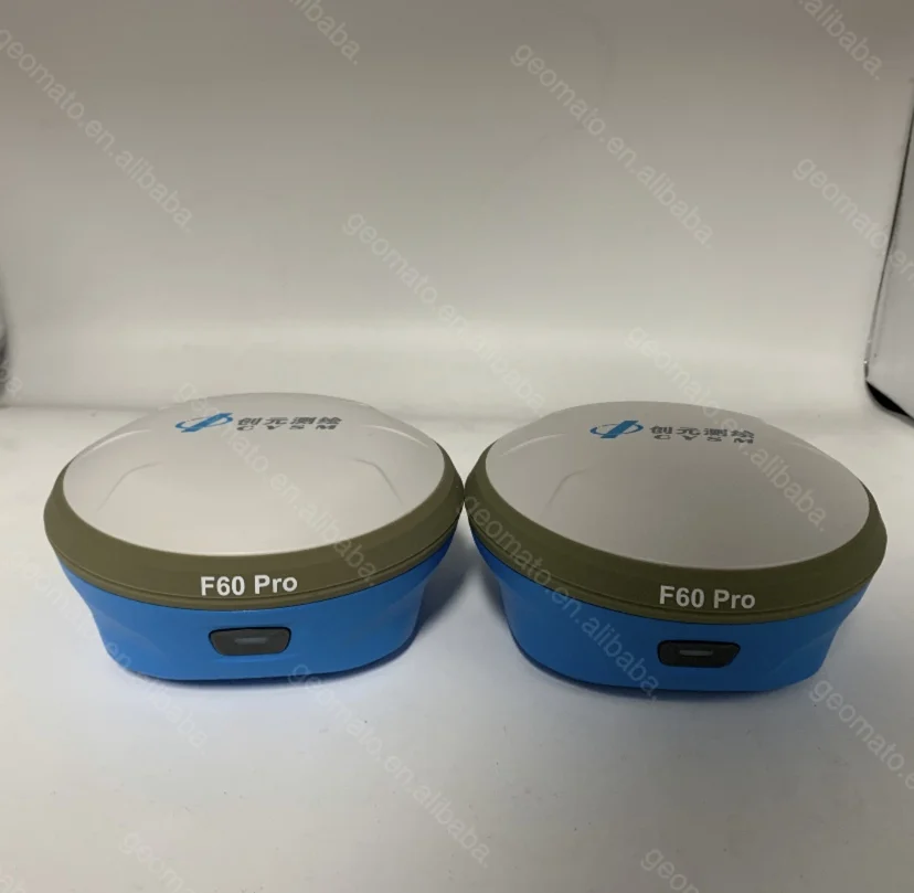
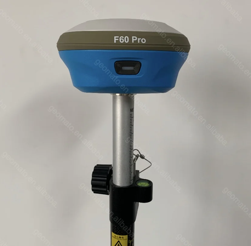
Highly integrated internal components The innovative technology made CY F60 pro has excellent combination with GNSS, 4G, Bluetooth and Wi-Fi antenna. F60 pro is also inserted with highly integrated Bluetooth, Wi-Fi and 4G network modules,which reduces the internal signals crosstalk. The powerful 360-degree omni-direction signal receiving in CY F60 pro enables full omnidirectional communications. Third generation tilt surveying technology Inserted with high-sensitive E-bubble and brand-new tilt survey algorithm, CY F60 pro is calibration-free.


Full Sky and L-Band
Compatible with 3 kinds of GNSS board, CY F90 tracks GPS, GLONASS, GALILEO, BEIDOU and can maximize the tracking to observe all visible GNSS satellite signals, thereby providing maximum performance for accuracy and real-time measurements. CY F90 also support L-Band function, can get cm accuracy just with one receiver.
High Performance
CY F90 can quickly search available satellites and soon get Fixed solution.
CY F90 with its advanced technology
ensures it works well even in harsh environment such as under heavy foliage.
ensures it works well even in harsh environment such as under heavy foliage.
Product Description
Specification
GNSS Engine | GNSS board | P328 | |
Channel | 394 | ||
Satellites | GPS: L1 C/A, L1P, L1C, L2P, L2C, L5 | ||
GLONASS: G1, G2, P1, P2 | |||
BeiDou: B1, B2, B3 | |||
Galileo: E1BC, E5a, E5b | |||
QZSS: L1 C/A, L2C, L5, L1C | |||
SBAS: L1 C/A, L5 | |||
L-Band: Atlas | |||
Tilt Survey: The forth generation tilt technology | |||
IMU function (Option) | |||
Real-Time Accuracy(rms) | SBAS | Horizon: 60cm(1.97ft); Vertical: 120cm(3.94ft) | |
Real-Time DGPS position | Horizon: 40cm(1.31ft); Vertical: 80cm(2.62ft) | ||
Real-Time Kinematic Position | Horizon: ±( 8mm+1ppm) ; Vertical: ±( 15mm+1ppm) | ||
Real-Time Performance Stop and Go solution | Instant-RTK Intialization | Typically <10s (Intialization for base lines <20km)99.9% reliability | |
RTK Intialization range | >40km | ||
Post Processing Accuracy(rms) | Static, Rapid Static | Horizontal: 2.5mm(0.008ft) +1.0ppm; | |
Vertical: 5mm(0.016ft)+1.0ppm | |||
Post-processing Kinematic | Horizontal: 10mm(0.033ft)+1.0ppm; Vertical: 20mm(0.066ft)+1.0ppm | ||
Solutions Field Software Suite | Surpad software | Main function include: F90 GNSS Support: configuration, monitoring and control | |
Volume computation | |||
Network connectivity, Coordinate System Support: predefined grid systems, predefined datums | |||
projections, Geoids, local grid | |||
Map view with colored lines Geodetic Geometry: intersection, azimuth/distance, offsetting, poly-line, curve, area | |||
Road Construction (3D): Survey Utilities: calculator, RW5 file | |||
Viewing: Data import/Export: DXF, SHP, RW5 | |||
Data logging | Recording Interval | 0.1-999 seconds | |
Physical | Flat design | ||
Size | 156mm*76mm | ||
Bottom cover | Aluminum magnesium alloy | ||
Memory | Internal memory | 8GB standard; supports extending to 32GB | |
I/O Interface | TNC port | connecting built-in radio antenna | |
5-pin lemo port | connecting external power supply and external radio | ||
7-pin lemo port | (USB+serial port): connecting PC and handheld | ||
Operating system | Linux | Based on Linux; Supports Web UI | |
Voice | Multi-language supported | ||
Tilt survey sensor | Automatic correct system by 30 degree | ||
Data format | Data format | RTCM 2.3 | |
RTCM 3.0.RTCM 3.X | |||
CMR, CMR+ | |||
NovAtelX/5CMRx | |||
Operation | Operation | RTK rover/base, post-processing | |
RTK Network rover | VRS, FKP, MAC | ||
Point-to-point GPRS through Real-time Data | |||
Server Software (internal GPRS or external cell phone) | |||
LandXML (FOIF Field Genius support) | Total Station support ( FOIF Field Genius) | ||
Import and stake directly from a DXF File (FOIF Field Genius) | |||
Office Software | Main functions include: Network post-processing | ||
Integrated transformation and grid system computations | |||
Pre-defined datums along with use-defined capabilities | |||
Survey mission planning | |||
Automatic vector processing | |||
Least-squares network adjustment | |||
Data analysis and quality control tools | |||
Coordinate transformations | |||
Reporting | |||
Exporting | |||
Geoid | |||
Environmental | Operating temperature | -30℃ to +65℃(-22°F to 149°F) | |
Storage temperature | -40℃ to +80℃(-40°F to 176°F) | ||
Humidity | 100% condensing | ||
Waterproof | IP67 (IEC60529) | ||
Shock | 2m (6.56ft) pole drop | ||
1.2m (3.94ft) free drop | |||
Power | 7.2v.2 removable batteries (total up to 6800mAh, supports single battery working) | ||
Optional System Components | Communication Module | Internal radio: UHF Link (410-470MHz) | |
1W | |||
External radio | R*&*both (5w/35w selectable) | ||
4G LTE module (EC25 series) | Fits various networks | ||
Bluetooth | 2.1+EDR Class 2 | ||
WiFi | IEEE 802.11 b/g/n | ||
Antenna | Built-in antenna, integrating GNSS, BT/WLAN and network antenna | ||
Controller | F58 | ||
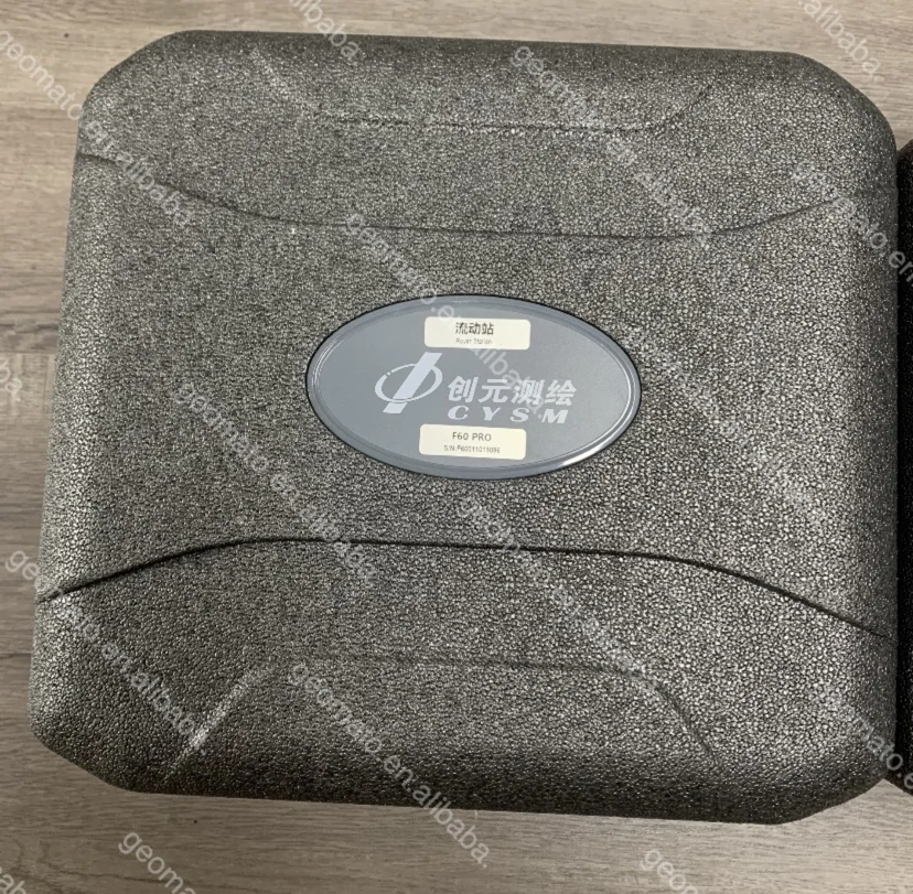
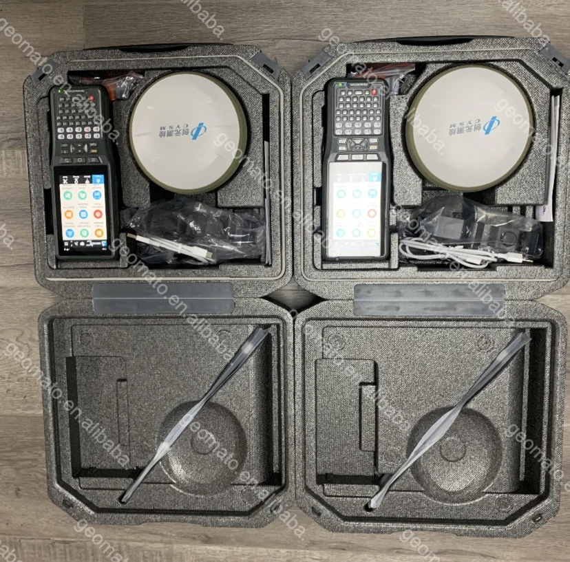
Packing & Delivery


The world standard packaging.
Why Choose Us
we are the OEM factory of Japan TAJIMA and Germany GEO-FENNEL and other famous worldwide brand.
And we are responsible for foreign trade business.We accept rebrand OEM and special design. And we can provide technology support.
We are willing to communicate with domestic and foreign companies to promote the progress and development of instrument technology.
Our Total Station is available in over 10 languages, including Chinese, Japanese, English, French, German,Italian, Russian, Ukrainian, Portuguese, Spanish, Czech, Turkish, etc. Moreover, We are now appointed as the production base of the well-known German instrument companies.We have a group of technicians who have been engaged in the research and development of photo-electric
products for a long time.
products for a long time.
FAQ
1.What kind payment method we accept?
T/T, L/C at sight, Western Union, Trade Assurance on Alibaba, Moneygram and Paypal
Note: Customer will be requested to pay 4% transaction fee upon total amount charged by EBAY
2.How can you guarantee payment safety ?
Our company supports TRADE ASSURANCE service. If you will choose payment through ALIBABA TRADE ASSURANCE service, you payment will be guaranteed. Because we are not able to receive payment until you confirm goods receipt.
3.What kinds of shipment for goods and how long time it takes ?
Our company supports DHL, FEDEX, UPS, TNT, CHINA POST, by sea and other methods. Shipping time is 2-3 days from payment receipt.
4.Does your company ship battery or not ?
Our company can receive battery order and ship to customer normally, except a few special countries
5.Do you have other items not displayed on your website ?
Yes, our company supplies full survey range products. If you are looking for product not displayed on our website. Please contact us freely. We will reply you on time.
6.Can your company help to purchase other kinds products ?
Yes, our company can help to purchase any kinds legal products for you.
7.Can your company accept factory check?
Yes, we accept any kinds factory check. You can arrange your staffs in China to come to our factory to check production and quality. If you want we can do the online video check too.
8.Can your company accept OEM rebrand?
Yes, we welcome all customers to come to our factory to talk about the rebrand services.
Recommend Products
We Recommend


New Arrivals
New products from manufacturers at wholesale prices


