
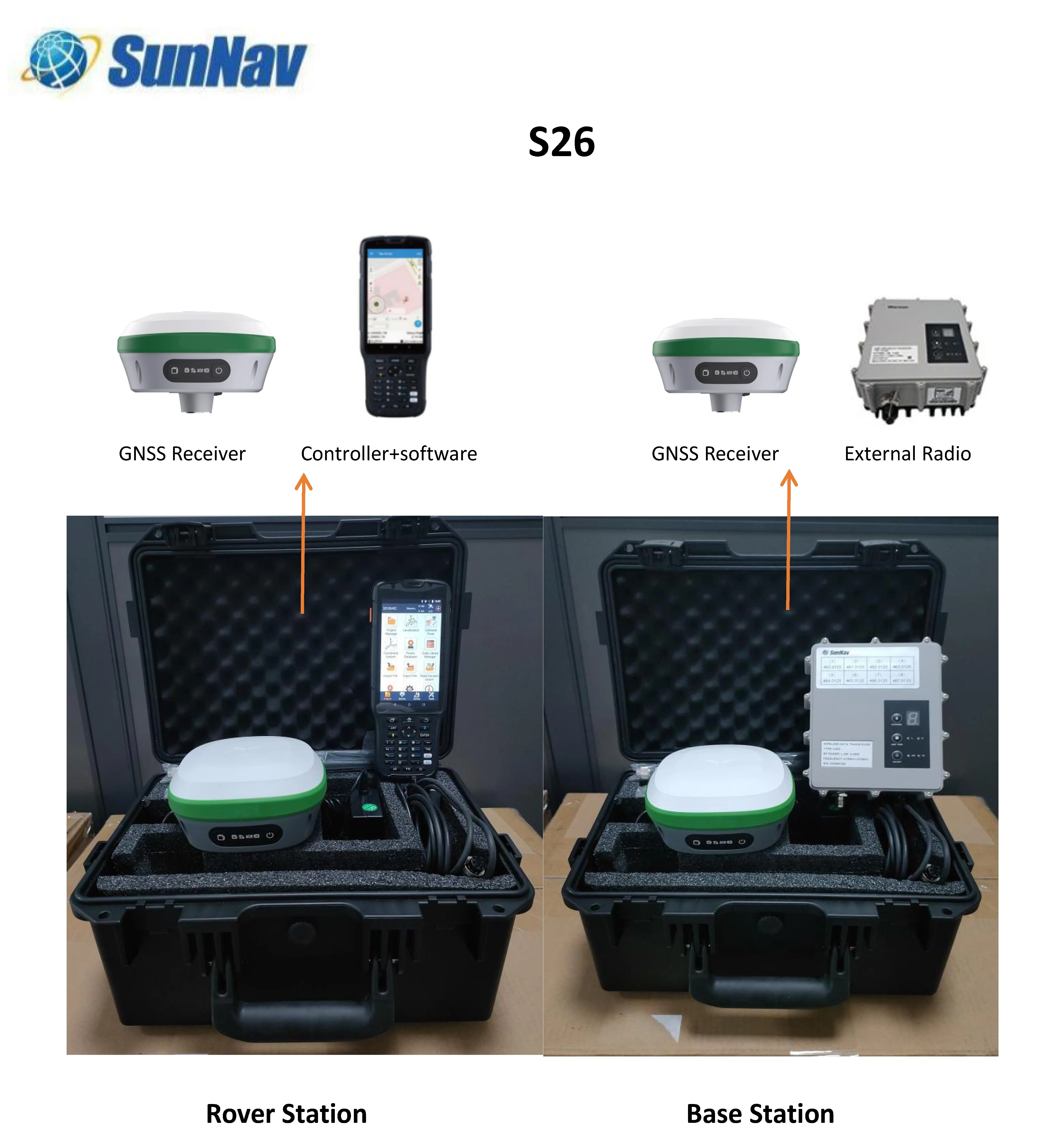

GNSS receiver 60 degree tilt survey with IMU S26 rover for land survey measurement equipment
- Category: >>>
- Supplier: Sunnav Technology Co. Ltd.
Share on (1600518156307):
Product Overview
Description
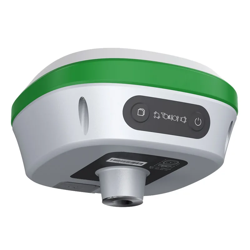
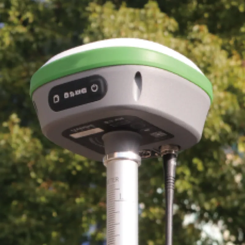
S26 GNSS RTK Receiver GPS Land Surveying Instrument
Key Features

Description
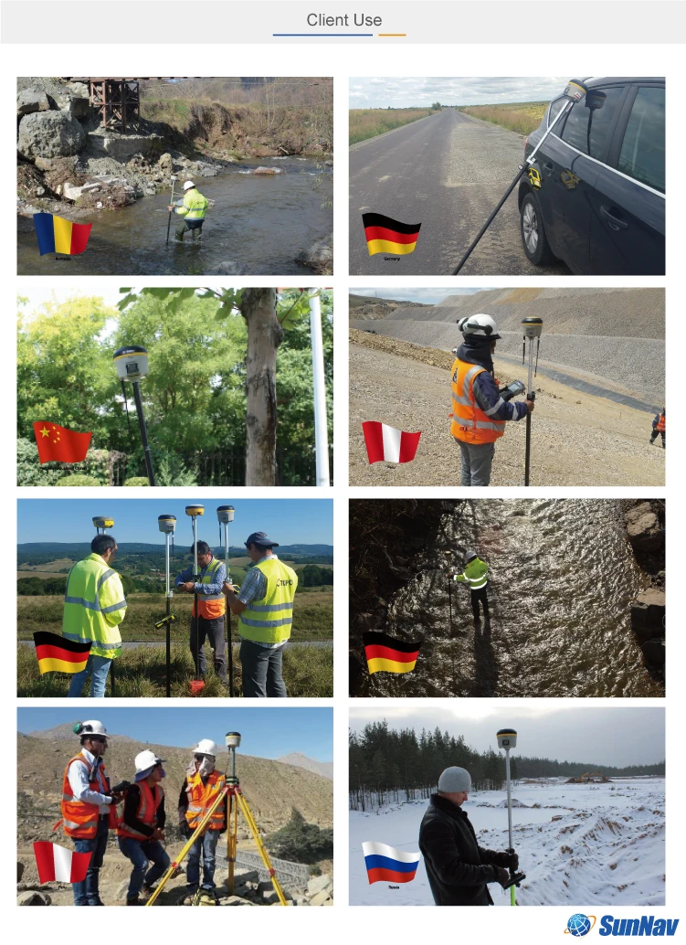
The S26 GNSS receiver removes barriers to portability without sacrificing performance. Featuring full GNSS technology, it offers best-in-class GNSS signal tracking even in a harsh environment, enabling GNSS surveying beyond usual constraints. The GNSS incorporates the latest innovations such as an inertial module providing automatic poletilt compensation in a very compact design.
Features
• THE POWER OF GNSS+IMU RTK TECHNOLOGY
Built-in inertial navigation module, you can measure it when you click it. As long as the pole point is aligned,
the precise coordinates can be measured even if the pole body is tilted. The measuring point efficiency is
increased by 20%, and the staking efficiency is increased by 30%.
• ALL-IN-ONE DESIGN
Built-in Blue-tooth, radio, storage, positioning,inertial navigation, antenna and other modules tomeet various
needs of measurement work
• BUILT-IN UHF RADIO
Built-in low-power transceiver integrated radio module, which can realize automatic switching between mobile
station and base station
• CAN BE EXTENDED TO DUAL ANTENNAS
Built-in integrated positioning and heading board,can be connected with an external antenna, to achieve high-
precision heading applications
• FULL CONSTELLATION MULTI-BAND
Fully support BDS, GPS, GLONASS, Galileo systems,adapt to a variety of complex and harsh environments,
and ensure centimeter-level positioning accuracy
• LARGE CAPACITY AND LONG BATTERY LIFE
Built-in battery with a capacity of up to 10000mAh, which can achieve more than 14 hours of continuous
battery life, ensuring long-term operation in harsh outdoor environments
• STRONG COMPATIBILITY
Adapt to transparent, TRIMTALK, South and so on ,multiple communication protocols
• NFC CONNECTION
Equipped with an NFC chip, users can easily connect the S12receiver and the data collector with just one
touch, without searching for pairing.
• TWO OPERATING MODES INTERCHANGE
Base station mode and rover mode can be switched freely according to needs
Parts

Useing
Technical Specificat
| GNSS Performance | |
| Channels | 432 channels based on Nebulas-II |
| GPS | L1,L2 |
| GLONASS | L1,L2 |
| Galileo | E1,E5a,E5b |
| BeiDou | B1,B2 |
| QZSS | L1,L2,L5 |
| GNSS Accuracies | |
| Real time kinematics(RTK) | Horizontal: 8 mm + 1 ppm RMS Vertical: 15 mm + 1 ppm RMS Initialization time:< 5 s Initialization reliability: > 99.9% |
| Post-processing kinematics (PPK) | Horizontal: 2.5 mm + 1 ppm RMS Vertical: 5 mm + 1 ppm RMS |
| Post-processing static | Horizontal: 2.5 mm + 0.5 ppm RMS Vertical: 5 mm + 0.5 ppm RMS |
| Positioning rate | Default 1 HZ, Maximum 20 HZ |
| Time to first fix | Cold start: < 25 s Hot start: < 10 s Signal re-acquisition: < 1 s |
| RTK tilt - compensated | Tilt angle 0~60°, Tilt accuracy 25mm (within 30° accuracy) |
| Hardware | |
| Size (L x W x H) | 140 mm x 140 mm x 88 mm (5.5 in × 5.5 in × 3.5 in) |
| Weight | 1.03 kg (2.27 lb) |
| Environment | Operating: -45°C to +75°C (-49°F to +167°F) Storage:-55°C to +85°C (-67°F to +185°F) |
| Humidity | 100% condensation |
| Ingress protection | IP67 waterproof and dustproof, protected from temporary immersion- to depth of 2 m |
| Shock | Survive a 2-meter pole drop |
| Tilt sensor | Calibration - free IMU for pole - tilt compensation. Immuneto magnetic disturbances. |
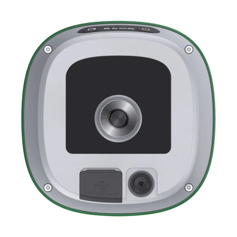
| Front panel | 4 LED indicates 2 physical buttons |
| Communication | |
| Blue-tooth | v4.0, Backward compatible with BT2.x |
| Ports | 1 x 9 PIN aviation plug, including power supply, COM RS232, CONFIG,RS232. 1 x UHF radio antenna interface |
| Build-in UHF radio | Standard Internal Rx/Tx: 410 - 470 MHz/840MHz Transmit Power: 0.5 W to 2 W Protocol: Transparent, TT450S,Trimtalk, TRMMARK3 |
| External Radio | Frequency: 410-470MHz Transmitting power: 35W Working Range: 15-20Km |
| Data formats | Link rate: 9600 bps to 460800 bps Range: Typical 5 km to 8 km RTCM2.x, RTCM3.x, CMR |
| Data storage | 8GB internal memory |
| Electrical | |
| Power consumption | 5W(depending on user settings) |
| Li -ion battery capacity | 10200mAh |
| Operating time on internal battery | 20h(Rover) 10h(Base) |
| External power input | 9V DC to 36V DC |
| Power consumption | As Rover<4.0W As Base<10.5W |
R&D and Production


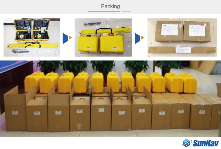
Packaging&Transport

Related Products
 |
 |  |
 |  |
We Recommend


New Arrivals
New products from manufacturers at wholesale prices


