
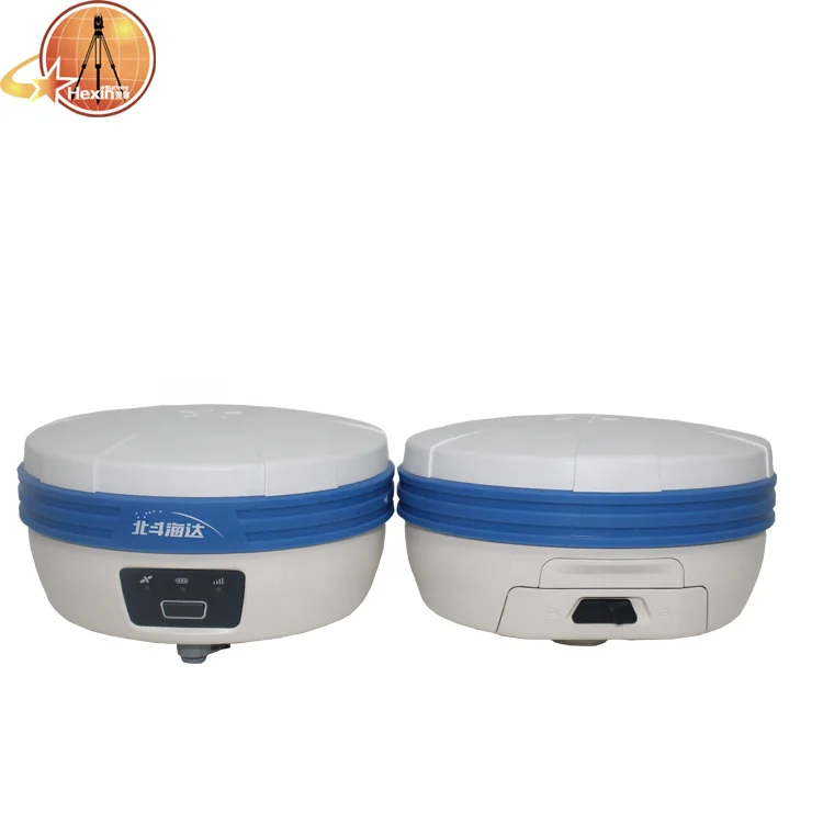
Lightweight design convenient use Hi target TS5 RTK GPS Base and Rover gnss with advanced multi path suppression technology
- Category: >>>
- Supplier: Shanghai Hexin Survey Instrument Company Ltd.
Share on (1600618021087):
Product Overview
Description
Product Description
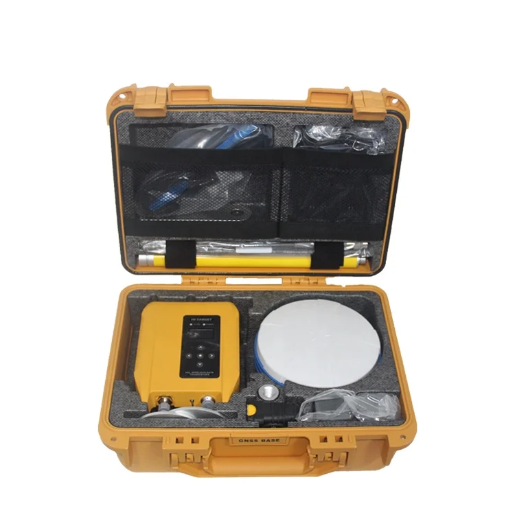
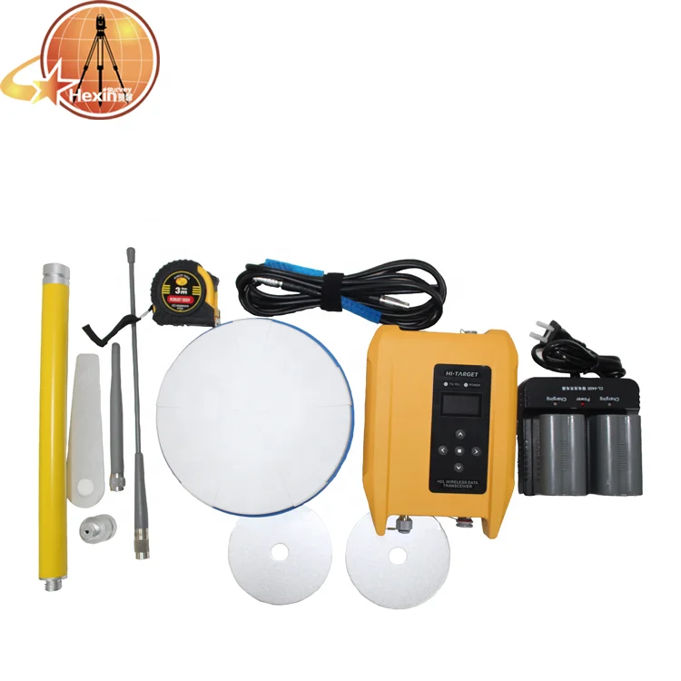
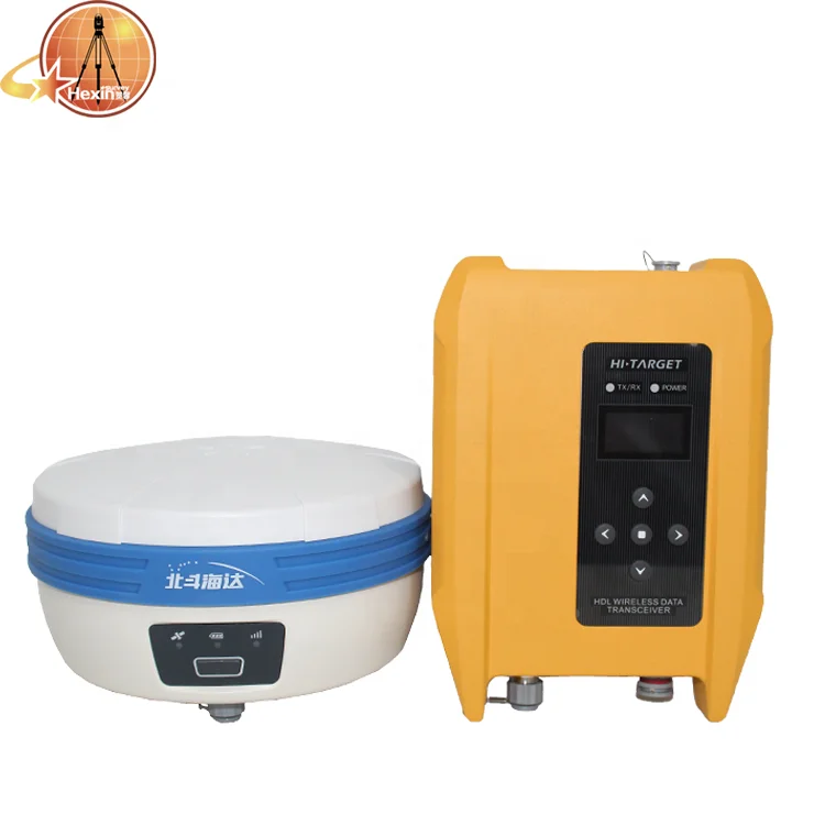
| TS5/rtk system |
 |
TS5/RTK SYSTEM powerful performance
TS5 miniaturized RTK system adopts domestic independent intellectual property rights multi-mode multi-frequency RTK algorithm, advanced multi-path suppression technology, lightweight structural design, new signal tracking technology to adapt to the harsh and complex environment, easy to achieve stable and reliable high-precision measurement operations.
Magnesium alloy body,small volume and large storage,built-in 4G full netcom,muiti-protocol radio,dual mode Blueto0th, NFC flash connection, MiniUSB interface,iHand30 Andriod controller. |  |
Key features of TS5 |
|
1.Detail advantage functions 1.Full-frequency air antenna 1) Stable and better noise resistance full-wave GNSS antenna; 2) Supports a wide range of satellite tracking signals; 3) Reduces the multipath effect influence. |
2.Multi-constellation GNSS engine 1) 800 tracking channels 2) Auto-selection satellite constellations; 3) Provides reliable results in harsh environments with its unique GNSS positioning algorithm. |
3.Smart application 1) Built-in Linux system and 8G storage; 2) Intelligent management of the static data; 3) Intelligent voice assistant for guiding field operations; 4) Standard Rinex data and Hi-Target raw data recorded simultaneously. |
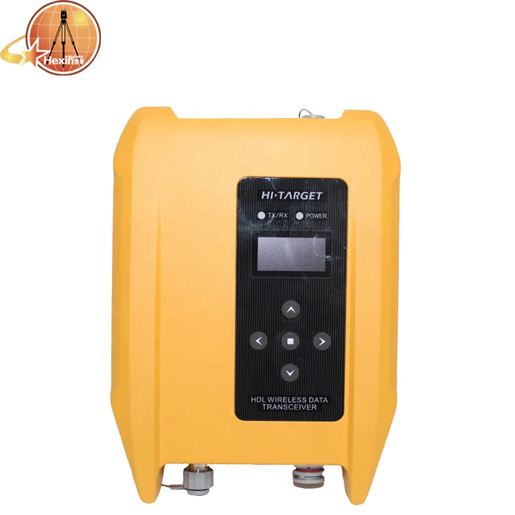
4.Data communication 1) Compatible with other vendors’ communication protocols; 2) Long transmission distance and good electromagnetic compatibility; 3) Perfectly compatible with a variety of CORS systems. |
5.WebUI 1) Intelligent query of the device information; 2) Intelligent management of the device status automaticall |

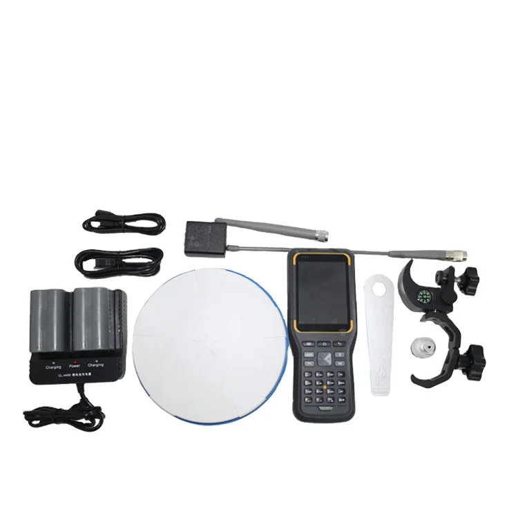
| iHand30 Controller |
Professional Field Controller The iHand30 is a rugged controller that is designed for data collection and GNSS device control. Based on the Android operating system, it is compatible with Hi-Target professional software and third-party Android software. Combining the physical keyboard with a touchscreen, it can boost efficient fieldwork and provide reliable solutions for users. |
| KEY FEATURES | |
| Hardware Configuration | OS: Android 6.0 Processer: 1.5GHz, 4 core Storage: RAM 2G, ROM 16GB (up to 32GB extension Micro-SD) Display: 3.7’’, 640 x 480, sunlight readable Camera: 8MP, tag available Sensors: G-sensor, E-compass, barometer, light readable sensor, gyro |
| Communication | Cellular mode: Dual SIM card, dual stand-by Cellular network: 4G TDD-LTE, ,WCDMA, GPRS Wi-Fi: IEEE 802.11b/g/n, 2.4GHz/5GHz Blueto0th: V2.0/4.0 USB: Type-C, supports OTG NFC |
| Physical | Weight: 440g(within battery) Size: 208mm*83mm*24mm Temperature: -20℃ ~ +60℃(Operating); -30℃~ +70℃(Storage) Free-fall: 1.2m Water/Dustpoof: IP67 |
| GNSS Features | GNSS: GPS, GLONASS, AGPS, 20 channels Update rate: 1Hz |
| Power Supply | Battery: Removable 3.7V lithium battery, 5200mAh Duration: 15 hours |
| Hi-Survey Road |
Survey Data Collection Software Hi-Survey Road is an Android software that is designed for all types of land survey and road engineering projects in the field. It is compatible with Hi-Target professional controllers, Android phones, tablets and other third-party Android devices. It is a sleek and easy-to-use software that supports the operating of big data with built-in tools. With customized industrial application solutions, more possibilities are created for users. |
| Product Display | ||
  |   |   |
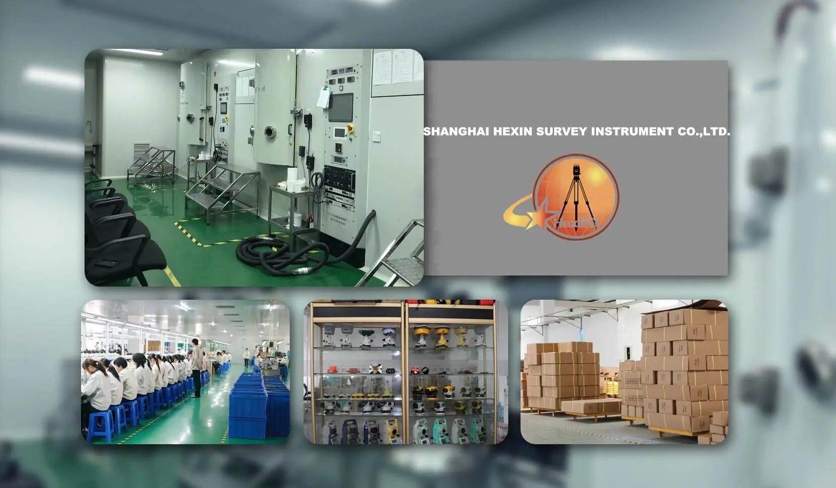
Company Information
- With 8 years' experience in geodetic surveying and cadastration surveying, we are a professional and leading enterprise in the surveying industry in Mainland China. We specialize in the R&D and manufacturing and sales of all kinds of surveying products, including total station, electronic theodolite, electronic distance meter, automatic level, laser level, reflector prism, surveying accessory, GPS receiver, mapping software, etc. The marketing model advocated by us is not a simple sense of "selling products", instead, pre-sales service, services during operation and after-sales service are integrated in entire operating activities. It makes the customers feel that they purchased not only a commodity, but also a professional service.
- We welcome new and old customers from all walks of life to contact us for future business relationships and achieving mutual success!
Our Services
- Any inquire will be replied within 12 hours.
- All our products have one year warranty, and we sure the products will be free from maintenance within warranty period.
- All products will have been strictly quality checked in factory before sending out.
Packaging & Shipping
- Packaging is absolutely fine, high-end and upscale.
- We have been dealing with foreign clients for more than 8 years.
- Before leaving the factory, every part is strictly tested.
- Please rest assured that we have all the necessary accessories for the instrument.
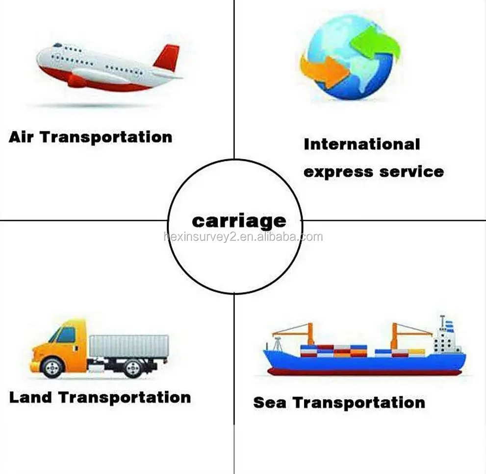
- We have strong cooperation with DHL, TNT, UPS, FEDEX, EMS, China Air Post.
- You can also choose your own shipping forwarder.

Contact us
- Any inquire will be replied within 12 hours.
- All our products have one year warranty, and we sure the products will be free from maintenance within warranty period.
- All products will have been strictly quality checked in factory before sending out.
please click on the text or the picture below to contact us.
We Recommend


New Arrivals
New products from manufacturers at wholesale prices


