
10kg capacity aircraft engine jet plane Gyrocopter autopilot lift Helicopter VTOL UAV Mapping drones with 4k hd camera and gps
- Category: >>>
- Supplier: Shenzhen Coolsport Equipment Co. Ltd.
Share on (1600620766563):
Product Overview
Description
Product Description

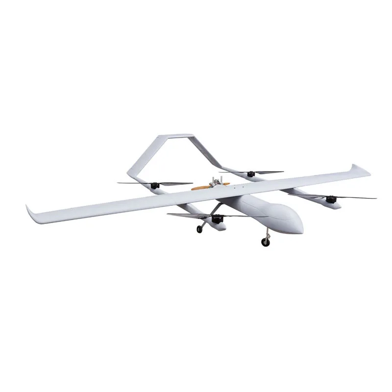
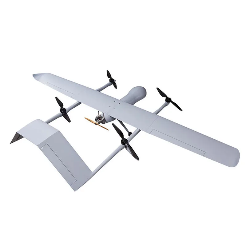
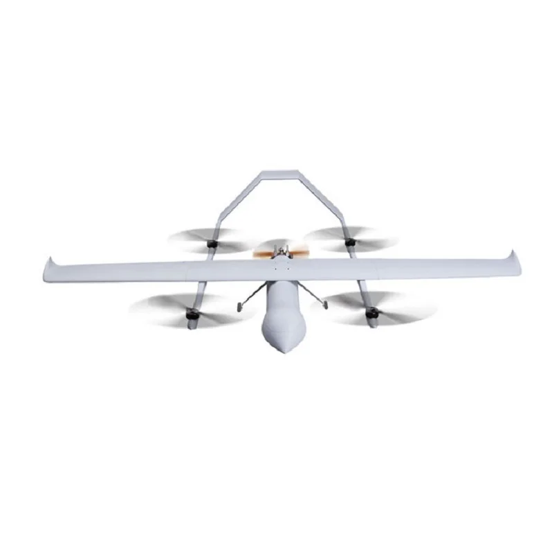
500km Range 20kg capacity Hybrid powered VTOL UAV Fixed Wing Drone with camera
Feature:
⚫ Hybrid power of oil and electricity.
⚫ Long range and Long endurance: endurance 2-3hrs@20kg load.
⚫ Maximum Altitude for take-off and landing up to 2,500m AMSL.
⚫ Vertically takingoff and vertically landing, no need of runway and catapult assistance rack
⚫ “One click” takingoff, return home, and landing, easy to operate.
⚫ Quick assemble and dis- assemble.
⚫ Support various payload, widely used in various industries and scenario.
⚫ Applied in industries: Transportation, Aerial mapping, Forest Fire fighting,
Feature:
⚫ Long range and Long endurance: endurance 2-3hrs@20kg load.
⚫ Maximum Altitude for take-off and landing up to 2,500m AMSL.
⚫ Vertically takingoff and vertically landing, no need of runway and catapult assistance rack
⚫ “One click” takingoff, return home, and landing, easy to operate.
⚫ Quick assemble and dis- assemble.
⚫ Support various payload, widely used in various industries and scenario.
⚫ Applied in industries: Transportation, Aerial mapping, Forest Fire fighting,
Product Paramenters
model | 460 | |
type | VTOL | |
Body size | length:1.55m,wing span:4.6m | |
wing | Full composite material | |
Landing gear | Carbon fiber | |
power | Electric-Hybrid | |
Flight data | ||
Cruise speed | 82.8-93.6(h/km) | |
Effective remote control radius | 30-200km | |
Maximum takeoff weight | 40kg | |
Endurance time | 5h-6H(20kg payload 2-3hours) | |
payload | 5-20kg | |
Wind resistance | Grade 6 | |
Practical ceiling | Fully automatic / semi-automatic / manual flight mode | |
Navigation system | GPS / mins integrated navigation system | |
UAV control system | ||
Flight control name | To guide flight control: Sagittarius | |
Flight control function | 1, industrial grade dual redundancy MEMS inertial measurement unit, triaxial magnetometer, barometric altimeter, airspeed meter and CNSs module. 2, GPS / mins integrated navigation system. Dual integrated navigation system 3, built in global geomagnetic model and polar flight tested magnetic compass calibration algorithm, which can calibrate thecompass with one click. 4, 10 mission routes, up to 200 waypoints for a single mission route. 5, it has fixed-point, equidistant and isochronous shutter photographing functions, and records POS data of aerial photographing points at the same time. 6, The built-in black box data recording function can cycle and record 60 minutes of flight data. It supports the external link data recorder to record up to 2000 hours of flight data | |
Positioning module | ||
positioning system | GPS / mins integrated navigation system | |
Positioning system function | The double-layer 17 order extended Kalman filter is used to fuse the information of inertial measurement unit, three-axis magnetometer, barometric altimeter and GNSS module, and automatically switch before GNSS / INS and AHRS / DR Navigation modes according to the presence or absence of satellite signals. | |
Route planning software | AheadX Space Ground control software | |
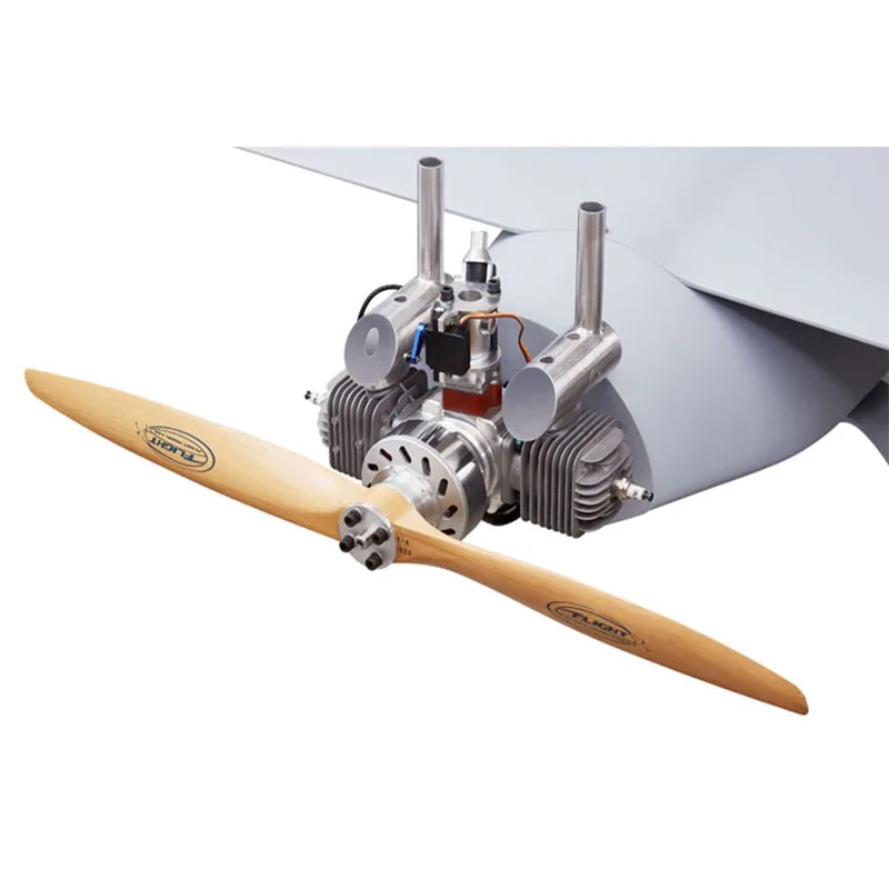
Powertrain - engine | ||
engine | Dla64 power on integrated engine EFI version | |
Engine function | aerospace aluminum, CNC precision processing stable performance and rapid acceleration performance long service life and low price it is suitable for use below 3000 meters above sea level Gasoline used: 92# 93# | |
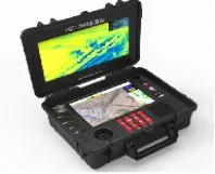
ground control station | ||
ground control station | YGS1000 ground control station | |
ground control station introduction | 1, upper and lower dual screens: the upper screen is 15.6 inches and the resolution is 1920 × 1080; 2, Lower screen 12.1 inches, resolution 1280 × 800, capacitive touch, support multi touch; 3, high integration: it only takes 5 minutes to turn it on to the flying state; 4, Intel 5th generation high performance i7 processor, 8g memory and 120g SSD hard disk 5, built in high-capacity 18650 lithium battery, with an outdoor endurance of 3 ~ 5 hours 6, operating system: win10 professional edition, 64 bit Chinese 7, overall size: 475 * 370 * 184mm overall weight: About 7kg 8,100km remote control distance / image transmission distance | |
Route planning software | AheadX Space Ground control software | |
function | 1, pre flight inspection 2, respond to various reconnaissance missions 3, return landing button 4, emergency landing point setting 5, when combined with the pod, the ground station displays the UAV reconnaissance 6, Track playback can analyze task execution | |
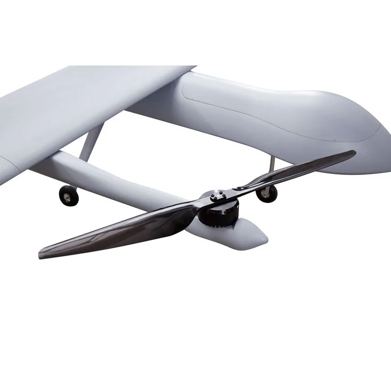
Product Details

Professional UAV Engine
Dla64 power on integrated engine EFI version
stable performance and rapid acceleration performance
long service life and low price
it is suitable for use below 3000 meters above sea level
Gasoline used: 92# 93#
aerospace aluminum, CNC precision processing
stable performance and rapid acceleration performance
long service life and low price
it is suitable for use below 3000 meters above sea level
Gasoline used: 92# 93#


Flight control function
1, industrial grade dual redundancy MEMS inertial measurement unit, triaxial magnetometer, barometric altimeter, airspeed meter and CNSs module.
2, GPS / mins integrated navigation system. Dual integrated navigation system
3, built in global geomagnetic model and polar flight tested magnetic compass calibration algorithm, which can calibrate thecompass with one click.
4, 10 mission routes, up to 200 waypoints for a single mission route.
5, it has fixed-point, equidistant and isochronous shutter photographing functions, and records POS data of aerial photographing points at the same time.
6, The built-in black box data recording function can cycle and record 60 minutes of flight data. It supports the external link data recorder to record up to 2000 hours of flight data

ground control station
1, pre flight inspection
2, respond to various reconnaissance missions
3, return landing button
4, emergency landing point setting
5, when combined with the pod, the ground station displays the UAV reconnaissance
6, Track playback can analyze task execution
2, respond to various reconnaissance missions
3, return landing button
4, emergency landing point setting
5, when combined with the pod, the ground station displays the UAV reconnaissance
6, Track playback can analyze task execution
FAQ
1. who are we?
We are based in Guangdong, China, start from 2018,sell to North America(26.00%),Western Europe(21.00%),Mid East(20.00%),Northern Europe(18.00%),Southern Europe(5.00%),South Asia(3.00%),Oceania(3.00%),South America(2.00%),Domestic Market(1.00%). There are total about 11-50 people in our office.
2. how can we guarantee quality?
Always a pre-production sample before mass production;
Always final Inspection before shipment;
3.what can you buy from us?
thermal image scope,night vision device,riflescope,binoculars,range finder
4. why should you buy from us not from other suppliers?
COOLSPORT is a professional manufacturer and the authorized distributor of Pulsar & Yukon in shenzhen china,our products covered by night vision binoculars and riflescopes, thermal scope and monocular for outdoor hunting, sports, security,rescue events.
5. what services can we provide?
Accepted Delivery Terms: FOB,CFR,CIF,EXW,DDP,DDU,Express Delivery;
Accepted Payment Currency:USD,EUR,JPY,CAD,AUD,HKD,GBP,CNY,CHF;
Accepted Payment Type: T/T,Credit Card,PayPal,Western Union,Cash,Escrow;
Language Spoken:English,Chinese
We Recommend


New Arrivals
New products from manufacturers at wholesale prices


