
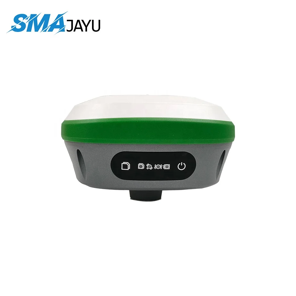
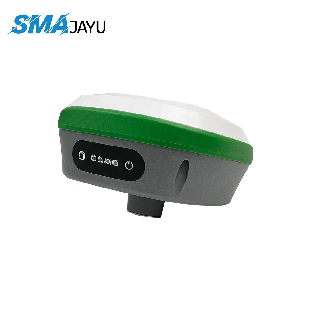
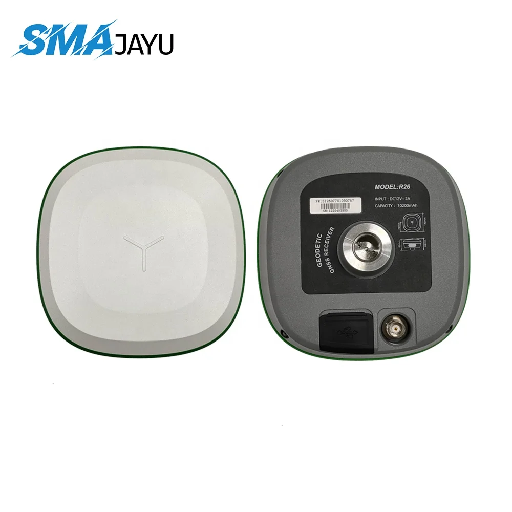
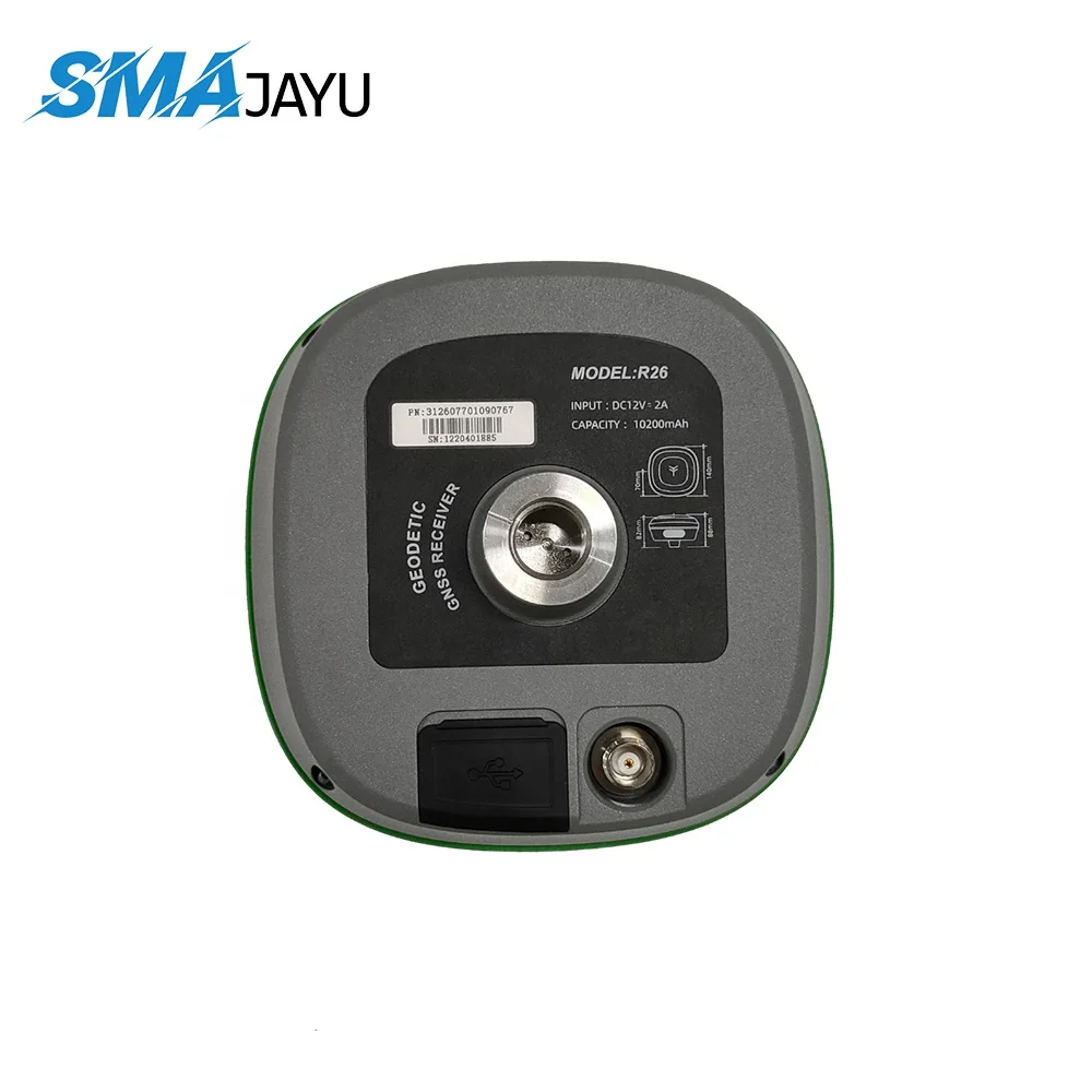
R26 gnss rtk base high precision positioning GNSS receiver RTK radio station
- Category: >>>
- Supplier: SZFP (Shenzhen) Technology Limited
Share on (1600767221808):
Product Overview
Description

Option
Option 1:Login CORS Account which is provided by local CORS station.
Option 2:R26、1-2km、RTK radio station.
Option 3:R26+D30+D10、10-20km、RTK radio station+external radio.
Option 4:R30+A10、50km、4G fixed network station if 4G available on farm.
Option 5:R30+A10+D30+D10、20km、Radio station or 50km network station.
Option 2:R26、1-2km、RTK radio station.
Option 3:R26+D30+D10、10-20km、RTK radio station+external radio.
Option 4:R30+A10、50km、4G fixed network station if 4G available on farm.
Option 5:R30+A10+D30+D10、20km、Radio station or 50km network station.
Product Description

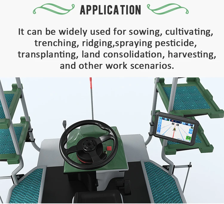
R23 integrated Beidou / GNSS inertial navigation RTK is an integrated multifunctional high-precision RTK receiver with built-in high-capacity battery, high-capacity storage, inertial navigation module, built-in Beidou / GNSS full frequency antenna, system wide multi frequency point.high-precision positioning and orientation board, Bluetooth and wireless communication module.
R23 inertial navigation RTK receiver can be used as both RTK mobile station and RTK reference station;It has the advantages of high precision, low power consumption, small volume, convenient and fast carrying and operation, and meets the positioning and orientation needs of various industries, such as mechanical control, surveying and mapping engineering, precision agriculture, geographic information, water survey, engineering survey, mine survey, aerial photography, UAV, etc.
R23 inertial navigation RTK receiver can be used as both RTK mobile station and RTK reference station;It has the advantages of high precision, low power consumption, small volume, convenient and fast carrying and operation, and meets the positioning and orientation needs of various industries, such as mechanical control, surveying and mapping engineering, precision agriculture, geographic information, water survey, engineering survey, mine survey, aerial photography, UAV, etc.
D10 protocol support transparent transmission, TRIMTALK, South protocol and compatible with PDL Radio, Watson Radio and Radio South. D10 radio feature greater receiver sensitivity and highperformance external radio antennas to help you achieve a greater range. It could use for the field of smart transportation, precision agriculture, surveying, geographic information and Drone RTK communication.
Specification
R26 | value | ||
Signal tracking | GPS | L1/L2 | |
BDS | B1/B2 | ||
GLONASS | L1/L2 | ||
QZSS | L1/L2/L5 | ||
Galileo | E1/E5b | ||
Precision index | Static accuracy | Plane accuracy;±(2.5 + 0.5×10 D)mm | |
Elevation accuracy;±(5 + 0.5×10 D)mm | |||
RTK Positioning Accuracy | Plane accuracy;±(10 + 1.0×10 D)mm | ||
Elevation accuracy;±(15 + 1.0×10 D)mm | |||
Single machine accuracy | 1.5m | ||
Initialize confidence | Greater than 99.99% | ||
Data output | Differential data | RTCM2.X、RTCM3.X、CMR、RTCA | |
Positioning data | NMEA-0183 | ||
Static data | Binary | ||
Electrical parameters | power waste | Mobile station ≤ 4.0w, reference station ≤ 10.5w | |
Endurance time | ≥ 13h (mobile station), ≥ 6.5h (Reference Station) | ||
Radio frequency | 410-470MHz/840MHz | ||
input voltage | DC 9-36V | ||
Battery capacity | 6800mAh | ||
Radio power | 0.5W / 1W / 5W | ||
storage capacity | 8g, direct high-speed download via USB (support automatic cyclic storage of data) | ||
Physical property | working temperature | -30℃~+70℃ | |
Storage temperature | -40℃~+80℃ | ||
Physical size | 136mm*136mm*147mm | ||
weight | 1.16Kg | ||
Degree of protection | IP67 | ||
key | 2/3Keys | ||
instructions | 6LED power indicator | ||
humidity | 100% non condensing | ||
data output | NMEA-0183 | ||
Data refresh rate | 1- 20Hz | ||
Network protocol | TCP、NTRIP | ||
Interface mode | 1Nine nine core aerial connector, one directional antenna TNC connector and one radio antenna TNC connector | ||
Baud rate | 9600~460800 | ||
Inertial navigation measurement | Tilt angle | 0-60° | |
Tilt accuracy | 62.5px (30 ° inclination angle) | ||
notes | [1] RTK initialization time may be affected by atmospheric conditions, signal multipath, obstacles and satellite geometric position, and the actual test data shall prevail. | ||
[2] D is the baseline length, in mm | |||
D10 | value |
Frequency Range | 410~470MHz |
Work Module | Half duplex |
Channel Gap | 25KHz |
Channel quantity | 10 channels |
Modulation | GMSK、4FSK |
Operating Voltage | 8-32VDC |
Indicator light | Power、 Receive、 Send |
Button | Channel Switch |
Power consumption (typical) | Transmit high power:3.3W Transmit low power:2.7W receive:0.5W |
Frequency stability | ≤±1.0ppm |
Dimension | 126×71×30mm |
Weight | 300g |
Protect | IP67,100% Non-condensing, 2M fall |
Storage Temperature | -40~+85 ℃ |
Operating Temperature | -40~+70 ℃ |
Antenna Port | TNC |
Antenna Port Impedance | 50ohm |
Data Port | Air plug connector-RS232 |
Serial baud rate | 9600bps,115200bps,38400bps |
Air baud rate | 9600bps、 19200bps |
Protocol | Transparent transmission、TRIMTALK、South protocol |
Company Information

FAQ
1. Who are we?
SMAJAYU is an America registered brand born for agriculture navigation system. And it is developed from SZFP TECH which is a 13 years R&D and marketing experienced professional enterprise in mobile pos terminal field. Its products already deployed in more 30 countries.
SMAJAYU GPS guidance system and auto steering system is designed for new agriculture and is completed system including software and hardware for precision and intelligent farming.
2. How can we guarantee quality?
IP67 level protection
Remote faulty diagnosis which can help farmer wherever you are!
Remote software upgrade supported.
2 years warranty
Always a pre-production and market testing before mass production;
Always final Inspection before shipment;
3.What can you buy from us?
EFT POS Terminal,Mobile POS,and PDA solution with agriculture system
4. Why should you buy from us not from other suppliers?
Smajayu Agriculture Navigation system is the first and the most used in China agriculture field.
Experienced team in Agriculture navigation system.
Great Quality recognized and praised by buyer.
5. What are the terms to buy ?
Accepted Delivery Terms: EXW,FCA,CPT,DDU,Express Delivery;
Accepted Payment Currency:USD,EUR,AUD,HKD,GBP,CNY;
Accepted Payment Type: T/T,PayPal,Western Union;
24 hours online service for help.
We Recommend


New Arrivals
New products from manufacturers at wholesale prices


