
2022 Year China New Dgps Hi Target V200 Rover Gnss Rtk for Land Survey
- Category: >>>
- Supplier: Nanjing Haoce Surveying And Mapping Technology Co. Ltd.
Share on (1600947219284):
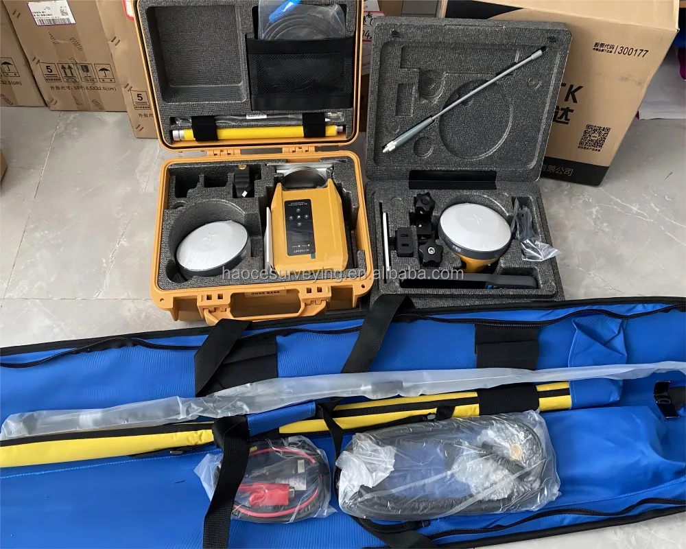
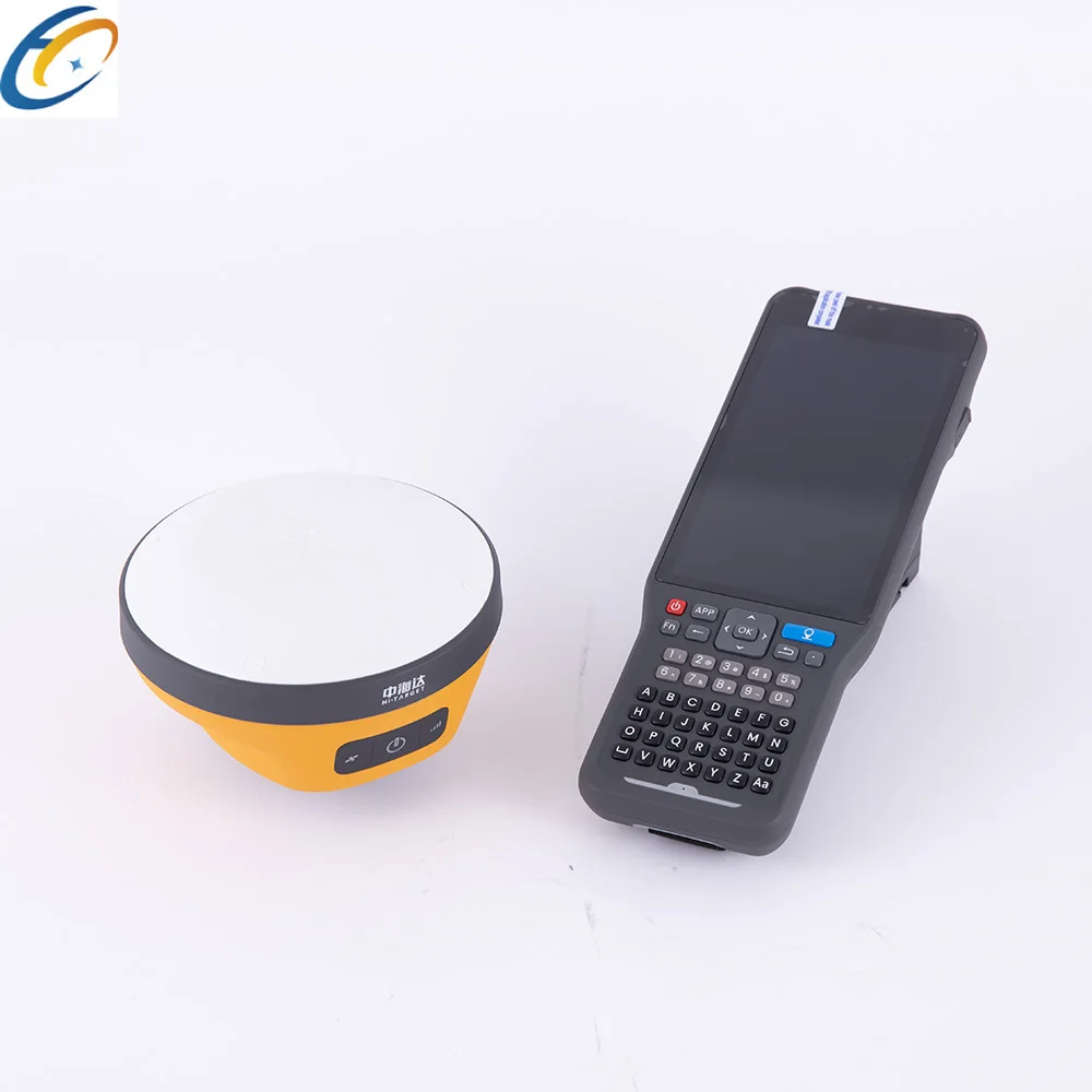
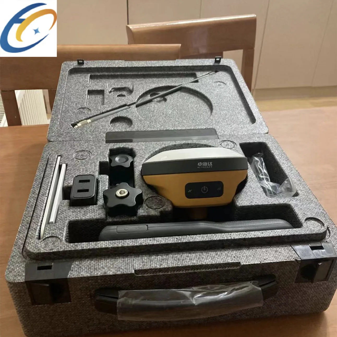
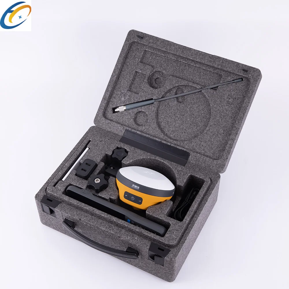
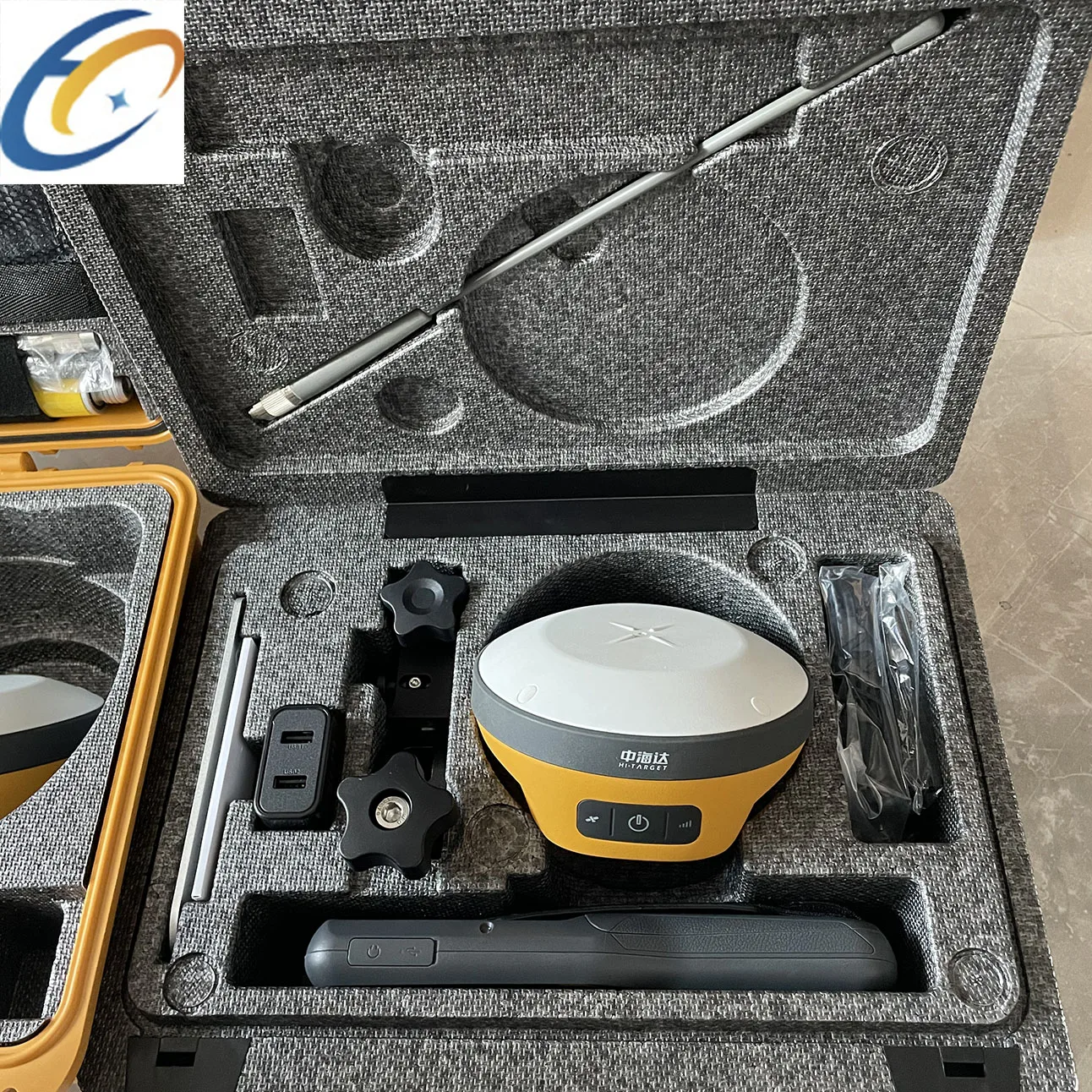
Product Overview
Description

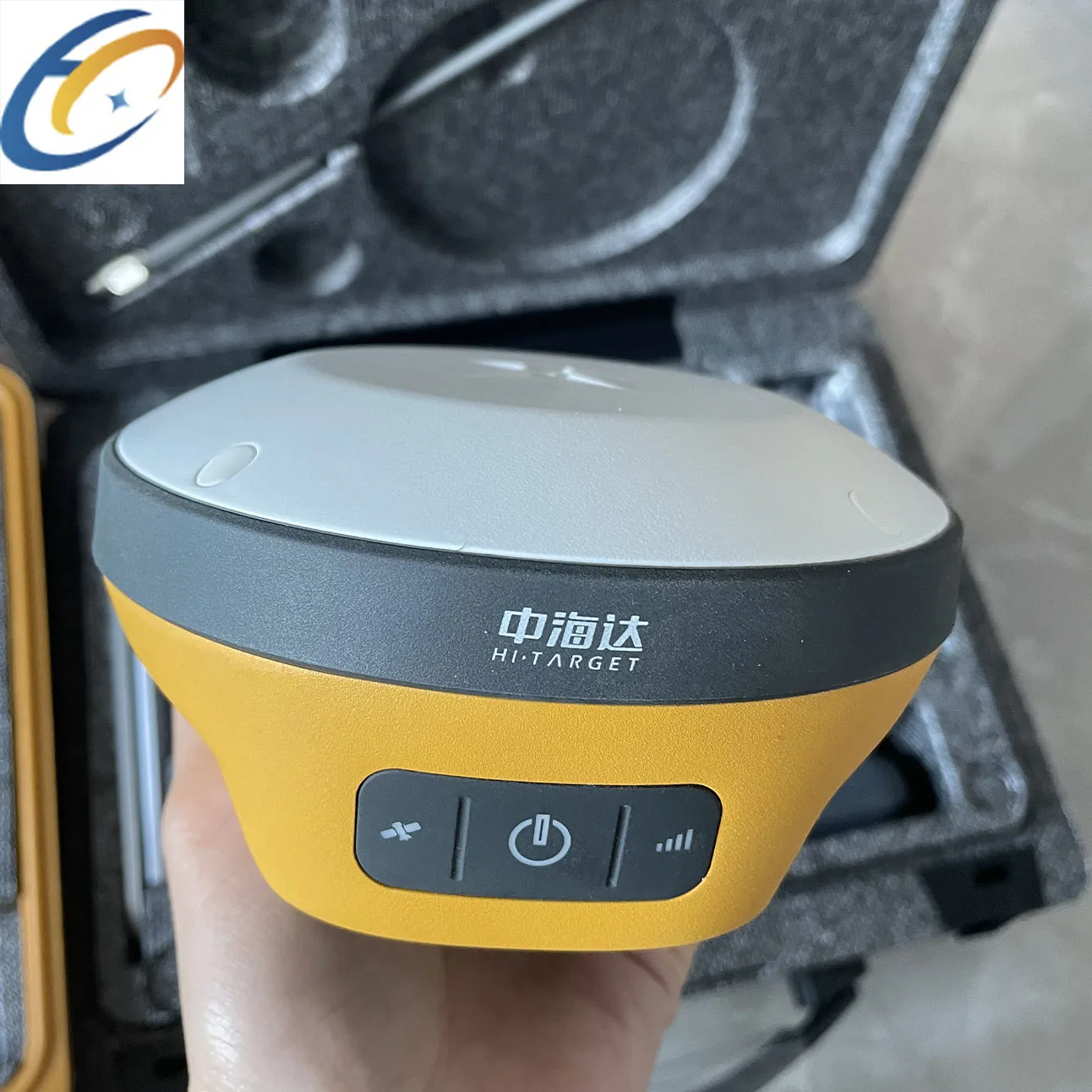
Key Features :
1. The new IMU can be measured by shaking it
2. Built-in integrated battery
3. Fast charging, can be fully charged in 1 hour
4.Small size, easy to carry
5,Higher Accuracy and Precision
6,Equipped with the High-Performance Patch Antenna,
7,enhances the low elevation angle tracking capabilities
2. Built-in integrated battery
3. Fast charging, can be fully charged in 1 hour
4.Small size, easy to carry
5,Higher Accuracy and Precision
6,Equipped with the High-Performance Patch Antenna,
7,enhances the low elevation angle tracking capabilities


Channels | 1408 | ||||||
Satelite Tracked | GPS:L1/ L2/ L5/L2C | ||||||
BeiDou:B1/ B2/ B3/B1C/B2a | |||||||
GLONASS: L1/L2/L3 | |||||||
Galileo:E1/ E5 AltBOC/E5a/E5b/E6 | |||||||
QZSS:L1/L2/L5/L6 | |||||||
SBAS: L1/ L5 | |||||||
IRNSS:L5 | |||||||
Static and Fast static Gnss Surveying | |||||||
Horizontal | ± (2.5+0.5× 10⁻⁶d) mm (D is the distance between measured points) | ||||||
Vertical | ± (5+0.5× 10⁻⁶d) mm (D is the distance between measured points) | ||||||
Post Processing Kinematic (PPK / Stop & Go ) GNSS Surveying | |||||||
Horizontal | 8mm+1ppm RMS | ||||||
Vertical | 15mm+1ppm RMS | ||||||
Initialization time | Typically 10 min for base while 5 min for rover | ||||||
Initialization reliability | typically > 99.9% | ||||||
Horizontal | ±(8+1×10¯6D)mm (D is the distance between measured points) | ||||||
Vertical | :±(15+1×10¯6D)mm D is the distance between the measured points | ||||||


About payment:
Generally, we accept Trade Assurance, Irrevocable LC at sight, Advance T/T, Escrow and West union.If you prefer other payment
terms, please let us know.
terms, please let us know.

WhatsApp/Wechat: +8618402557752
Our services:
1.Any inquiries will be replied within 12 hours.
2.All our products have one year warranty, And we sure the products will be free from maintenance within warranty period.
3.All products will have been strictly quality checked in factory before sending out.
4.we can providing instrument technology training


We Recommend


New Arrivals
New products from manufacturers at wholesale prices


