
Hi Target iBoat BSA Unmanned Boat Surface Vehicle Surveying BSA Boat Autopilot Water Surveying Equipment USV Unmanned Ship
- Category: >>>
- Supplier: Shangrao Haodi Imp & Exp Trading Co. Ltd.
Share on (1601280091401):
Product Overview
Description


| Technical parameters | |
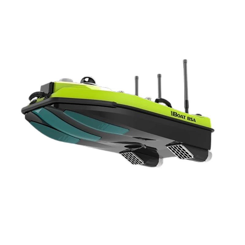
| Hull size | 980mm*560mm*345mm(length×width×height) |
| HullMaterial | carbon fiber,Kevlar bulletproof cloth high-strength composite material |
| Hull weight | 6kg,whole ship weight:25kg |
| Maximum load | 32kg |
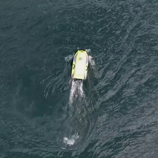
| Wind and wave resistanc level | Level 3 wind,level 2 wave |
| Ship type | M-type bottom design,low resistance,stablenavigation,draft:66mm |
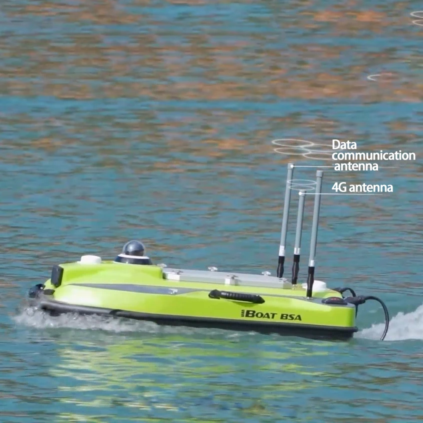
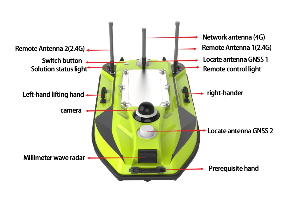
| Positioning Orientation | Dual GNSS positioning and directional antennas built into the hull |
| indeater light | Two indicators, remote control signal and GNSS positioning status indication; Explosion-proof fog light: left red and right green, can display RTK solution status and hull communication status |
| Video | 360° Hikvision PTZ camera |
| Measurement safety | Shoal hover protection, millimeter-wave obstacle avoidance automatic obstacle avoidance and video observation and navigation lights |
| Obstacle avoidance distance | 0.2~40m |
| Obstacle avoidance range | Pitch 14°, bearing 112°, 64 targets simultaneously detected and tracked |
| Waterproof and dustproof ductpreet | IP67 |
| Hull proectien | The ship body is equipped with anti-collision strips and double-layer water silo design to prevent the ship from sinking |
| Propeller steering | Dual thrusters, differential steering, reverse support |
| Thruster power | 800W |
| Propeller installation | Semi-recessed culvert design, equipped with waterproof grass mesh |
| Battery specification | Single battery 34Ah, rechargeable lithium battery, equipped with explosion-proof battery box |
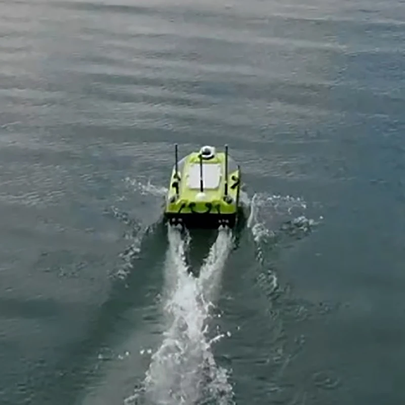
| Endurance | 7 hours @2m/s, 10 hours @1.5m/s The maximum ship speed is |
| Maximum ship speed | 7m/s, and the maximum flow rate can reach 3m/s |
| Satellite tracking | BDS B1I/B2I/B3I,GPS L1C/A/L2P(Y)/L2C/L5,Galileo E1/E5a/E5b,GLONASS L1/L2,QZSS L1/L2/L5,SBAS L1C/A |
| marderef darb | 1408channel |
| Single point positioning accuracy | Plane 1.5m,ekevation2.5m |
| DGNSS Accuracy | Plane 0.4m,ekevation 0.8m |
| RTK positioning accuracy | Plane±8mm 1ppm,elevation±15mm 1ppm |
| Orientation accuracy | 0.1°(1m baseline) |
| IMU accuracy | Zero drift 2.1°/h, loss of lock 30 seconds after the accuracy attenuation to less than 1m |
| IMU update rate | 200Hz |


We Recommend


New Arrivals
New products from manufacturers at wholesale prices


