

CHEAP HANDHELD MAGELLAN GPS EXPLORIST 110 310 510 610 710 GPS NAVIGATION
- Category: >>>
- Supplier: Shenzhen Pengjin Technology Co. Ltd.
Share on (1631417082):
Product Overview
Description
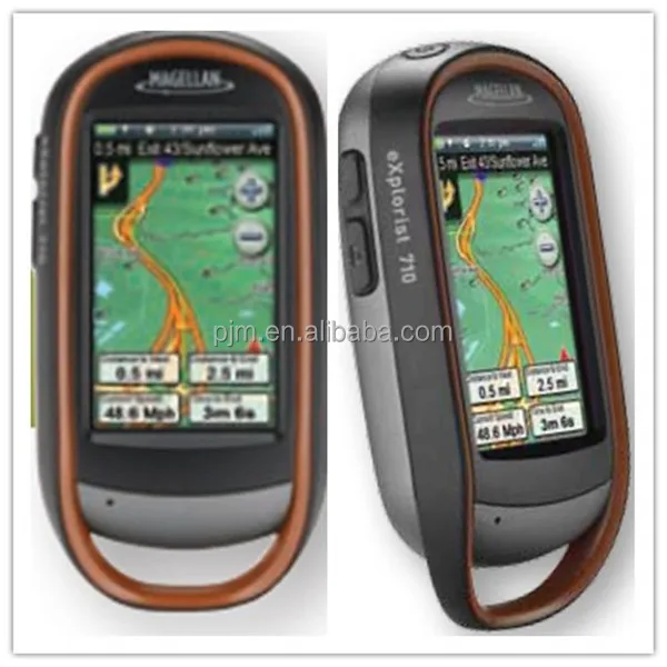
 CHEAP HANDHELD MAGELLAN GPS EXPLORIST 110 310 510 610 710 GPS NAVIGATION
Key Features for Handheld GPS
- 2.2" no-touch screen handheld gps for 110 310
- 3'' Colour Touch hand held for 510 610 710
- Amazing ease-of-use by one touch functions
- SD card expanison 2GB 4GB,
- Add detailed maps
- World Base Map - Built-in maps
- 3-meter accuracy
- Digital for Compass, Barometer, Blueteeth, Speaker, MIC, Camera for some model handheld gps.
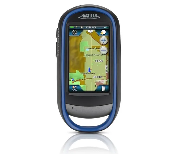
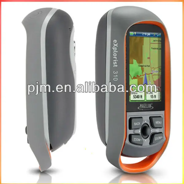
The Magellan handheld gps eXplorist 310 GPS receiver comes packed with tons of helpful features and is ready to use right out of the box.
The eXplorist 310 is pre-loaded with the World Edition map, which includes a complete road network in the United States, Canada, Western Europe, and Australia and major roads throughout the rest of the world. This unique preloaded map also includes water features, urban and rural land use, and city centers. Regional versions of Magellan’s Summit Series topographic maps are available for download to expand mapping coverage and level of detail.
A vibrant, transflective color screen allows for the best readability in direct sunlight. To zero in on the exact location of a geocache, favorite fishing spot, or the next summit, the SiRFstarIII GPS chipset provides accuracy of 10-15 feet (3-5 meters). To keep your outdoor adventure going all day long, the device is powered by two AA batteries for 18 hours of constant usage. The eXplorist 310 is rugged, waterproof, and submersible (IPX-7). All of this is packed into a small and attractive handheld form factor that can be hung around your neck with the optional Magellan lanyard or attached to your pack with the built-in carabineer hook.

The eXplorist 310 provides unmatched assistance with navigation, such as the combination of the world’s two most useful navigational tools – a compass and a map! Overlay a series of different transparent compass styles on top of a pre-loaded worldwide map that show roads, water features, parks, and city centers. Access the dashboard screen that shows a mini-compass for quick reference and customizable navigation data fields, such as latitude, longitude, heading, bearing, distance to end, trip odometer, and many more. Go back to the map screen and view your active track, which is a series of digital breadcrumbs to record all yours movements. Mark your starting point (car, trailhead, parking lot…) with a waypoint and easily navigate back to that location at the end of the day.
The eXplorist 310 supports paperless geocaching, which allows you to download more than 20 unique characteristics of each cache, including name, location, description, hider, size, difficulty, terrain, hint, spoilers, attributes, and last 20 user logs among a number of other details.
Reference your track summary to keep track of your distance travelled, elevation gained or lost, complete travel time, moving time and stopped time, and average time to find. Easily reset your track summary statistics to track the details of your next geocaching adventure.
No matter where you enjoy the outdoors, the eXplorist 310 GPS receiver will provide precise GPS signals thanks to the Satellite Based Augmentation Systems (SBAS) of WAAS, EGNOS, and MSAS; display coordinates in a myriad of different global systems, including UTM and WGS84; and accurately guide you to and from your next adventure, where ever in the world that may be!

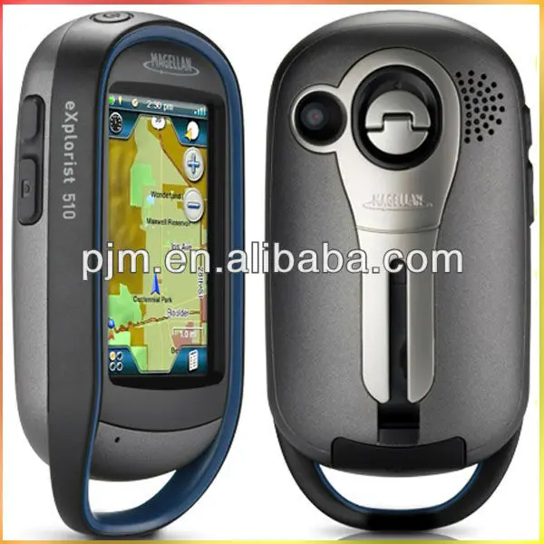
The Magellan handheld gps eXplorist 510 packs the most accurate maps into the palm of your hand. The World Edition map allows for 2D or 3D viewing angles. It includes a complete road network in United States, Canada, Western Europe, and Australia and major roads throughout the rest of the world and provides cartographic orientation in almost any location. This unique, preloaded map also includes water features, urban and rural land use, and a realistic shaded relief background.
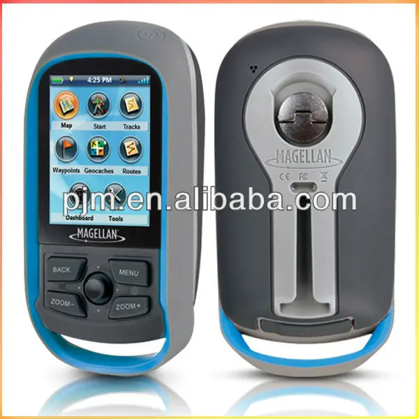
The best of both worlds, the eXplorist 510 combines the user friendliness of a touch screen with the reliability of two customizable hard buttons. Program the hard buttons to your two favorite or most used functions. Powered by two AA batteries, the eXplorist 510 will last up to 16 hours under normal conditions. To help conserve power, use the suspend mode to turn off the device but maintain GPS tracking. You can also adjust power management settings to your preference.
Magellan's award winning OneTouch™ favorites menu is now on our handheld devices. It provides instant access to bookmarks of favorite places. Set your home, base camp, and car. Easily re-assign a new location for each new.

Product Description

PHYSICAL
| Case | Rubber armored impact-resistant plastic, water-resistant seal, IPX-7 |
| Pre-Loaded Maps | Built-in basemap of Contiguous U.S., Alaska, Canada and Worldwide Geographic Boundaries |
| Size | 4.65" x 2.16" x 1.22" |
| Weight | 6.6 oz (187.1 g) - w/ battery |
| Screen Size | 2.2" (5.59cm) diagonal, QVGA (240 x 320) resolution, LED backlit |
| SD RAM | SD Card |
| Memory available for map storage | Secure Digital (SD) Card |
| Antenna Type | Built-in multidirectional patch |
| Keypad | Nine direct-access keys |
| Operating Range | 14 to 140°F (-10 to 60°C) |
PERFORMANCE
| GPS | SiRF Star III 20 channels, WAAS/EGNOS |
| Acquisition Time | Hot: 20 seconds, Cold: 60 seconds, Initial: 2 minutes |
| Update Rate | Once per second |
| GPS Accuracy | 3 to 5 meters (10 - 16 feet) - WAAS/EGNOS, < 7 meters (15 feet) - GPS only |
| Languages | English, French, German, Dutch, Italian, Spanish, Danish, Norwegian, Swedish, Finnish, Portuguese. |
| Coordinate Systems | Latitude/Longitude, UTM, OSGB, Irish, Swiss, Swedish, Finnish, German, French, USNG, MGRS, Indian, Dutch. |
POWER
| Source | Two AA Batteries (not included) |
| Battery Life | 10 hours |
Packaging & Shipping
size; 15cm * 15cm * 7cm
weight: 0.325 kg
Our Services
Delivery time: 3-5 working days
Warranty: one year
Load with world map,
Language supporting: english/CA/MX/BOSNA/CESKY/DEUTSCH/EESTI/english GB/espanol/suomi/francais/slovenski/svenska/polski/nederlands/latvijas/lietuvos/italiano/hrvatski/
Company Information
WHO WE ARE ?
Shenzhen Pengjin Technology Co.,Ltd, which is the owner of PJK brand land surveying instrument, the PJK brand covers total station, theodolite, level,RTK GPS, GIS, handheld GPS, Rebound tester, laser vertical collimator, laser rangefinder, laser swinger, laser line marking, laser telescope rangefinder,etc. Now we are looking for the international general agencies.
Recently we have many products which are on hot sale like RIDGID line detectors as well as the instruments of HiTarget, North, Kelida, SD, Ruide, GNSS, FOIF and so on. What's more, we have Trimble, Ashtech, NIKON and surveying instrument which are on sale.


We Recommend


New Arrivals
New products from manufacturers at wholesale prices


