

Sok kia GRX3 GNSS Receiver RTK GPS Price for Sale
- Category: >>>
- Supplier: Shenzhen Pengjin Technology Co. Ltd.
Share on (50040386846):
Product Overview
Description
Product Description
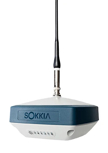
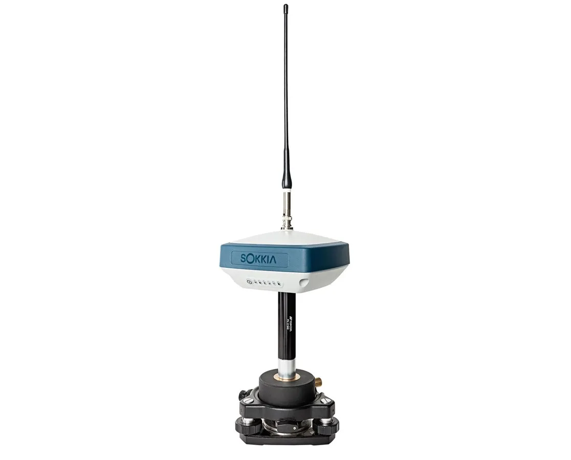
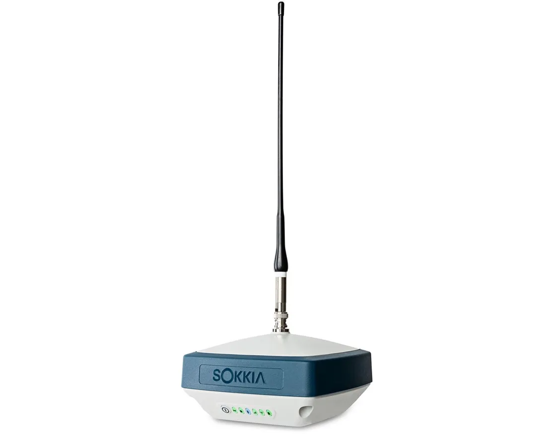
SOKKIA GPS GRX3 RECEIVER RTK GNSS

The Sokkia GRX3 GNSS Receiver is a powerful satellite system packed with the top-class GNSS technology which is built for static and kinematic land surveying applications. It features the innovative nine-axis inertial measurement unit (IMU) and the
ultra-compact eCompass that balances if mis-leveled up to 15 degrees.
ultra-compact eCompass that balances if mis-leveled up to 15 degrees.
Features for the Sokkia GRX3 GNSS Receiver
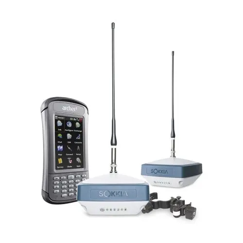
* Choice of 5 kits
* Top-class GNSS technology
* Built for static and kinematic land surveying applications
* 9-axis inertial measurement unit (IMU)
* Ultra-compact eCompass
* Leading Fence Antenna
* 226 tracking channels with Universal Tracking Technology
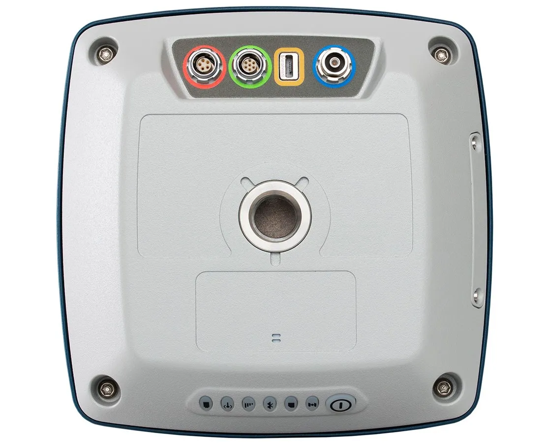
* Built-in Bluetooth connectivity
* Multi-channel Sitecomm Technology
* Connects to Sokkia data collectors
* Used together with the Sokkia Receiver Utility (SRU), MAGNET Field, and the Sokkia GeoPro software
* Adjustable Phase Locked Loop (PLL), Delay Locked Loop (DLL)
* Supports Quartz Locked Loop (QLL) technology
* IP67 dustproof and water resistant
* Vibration and shock resistant
* Built-in 8GB memory storage
* 8GB internal memory
* Access data by USB read only
* Top-class GNSS technology
* Built for static and kinematic land surveying applications
* 9-axis inertial measurement unit (IMU)
* Ultra-compact eCompass
* Leading Fence Antenna
* 226 tracking channels with Universal Tracking Technology
* Built-in Bluetooth connectivity
* Multi-channel Sitecomm Technology
* Connects to Sokkia data collectors
* Used together with the Sokkia Receiver Utility (SRU), MAGNET Field, and the Sokkia GeoPro software
* Adjustable Phase Locked Loop (PLL), Delay Locked Loop (DLL)
* Supports Quartz Locked Loop (QLL) technology
* IP67 dustproof and water resistant
* Vibration and shock resistant
* Built-in 8GB memory storage
* 8GB internal memory
* Access data by USB read only
Tracking Features
Satellites | GPS, GLONASS, Galileo, BeiDou, IRNSS, SBAS, QZSS, L-band |
Frequency | L1 C/A, L1C, L1P(Y), L2P(Y), L2C, L5 (GPS); L1 C/A, L1P, L2C/A, L2P, L3C (GLONASS); E1, E5a, E5b, E5AltBOC (Galileo); B1, B2 (BeiDou); SPS-L5 (IRNSS); WAAS/EGNOS/MSAS (SBAS); L1 C/A, L1C, L2C, L5 (QZSS); 1525-1560 MHz |
Channels | 226 |
RTK | VRS, MAC, FKP |
Antenna | Internal & External |

Accuracy | ||
RTK | H: 5 mm + 0.5 ppm V: 10 mm + 0.8 ppm | |
Static | H: 3mm + 0.8 ppm; V: 5mm + 1.0 ppm | |
DGPS | H: <0.25 m V: <0.50 m | |
Applications | ||
Control Surveying | YES | |
Construction Survey | YES | |
Topographic Survey | YES | |
Static Survey | YES | |
Kinematic Survey | YES | |
Functions | ||
Raw Data Recording | YES | |
Rover Configuration | YES | |
Base Configuration | YES | |
Base Configuration | YES | |
We Recommend


New Arrivals
New products from manufacturers at wholesale prices


