


LAND SURVEY GPS MAGELLAN 610
- Category: >>>
- Supplier: Shenzhen Pengjin Technology Co. Ltd.
Share on (60244489475):
Product Overview
Description
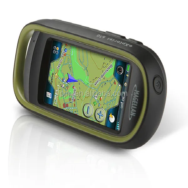
LAND SURVEY GPS MAGELLAN 610
THE FRIST NAME IN GPS
The inventor of the first handheld GPS device, Magellan allows people to travel, work and explore the world around them.Founded in 1985, Magellan is one of the world’s leading navigation brands with over 200 key patents in GPS technology and is the inventer of the award-wining RoadMate and eXplorist Series.
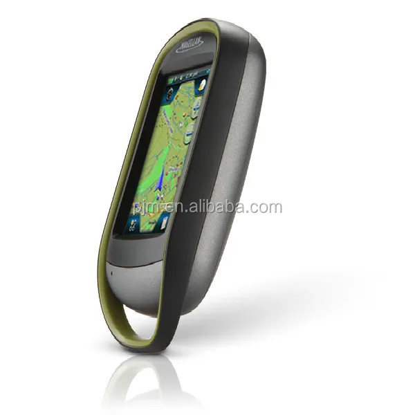
The eXplorist Series of rugged, waterproof, handheld GPS receivers is perfect for any outdoor adventure.Whether you’re hinking.geocaching,hunting.fishing or any other outdoor activity, the eXplorist Series provides the innovative features you need right at your fingertips.

Feature
Core Outdoor Navigation
Rugged and waterproof, the eXplorist combines high sensitivity GPS reception with aesthetic mapping and accurate navigation. Find your way using more than 30 navigational data fields. Create waypoints, record tracks, and route from point to point.
Experience Recording
Integrated 3.2 mega-pixel camera, microphone, and speaker enables outdoor enthusiasts to record geo-referenced images and voice notes. Relive your outdoor adventures on the device, on your computer, or share with others on various online communities.
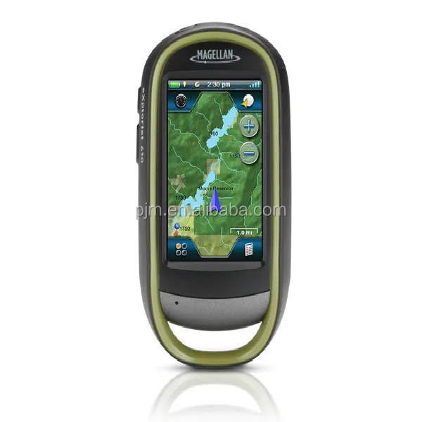
Superior Maps with 3D Perspective View
The eXplorist series packs some of the most accurate maps into the palm of your hand. The World Edition map allows for 2D or 3D viewing angles and covers the globe with details roads and land use areas. Summit Series is a new breed of topographic outdoor maps covering various regions with high level of detail. City Series will add turn-by-turn routing to your handheld GPS receiver.
3.0" Touch Screen and Button Controls
The best of both worlds, the eXplorist combines the user friendliness of a touch screen with the reliability of two customizable hard buttons. Program the hard buttons to your two favorite or most used functions and ensure quick reaction while wearing gloves or in just in a rush.
Paperless Geocaching
Download and view more than 20 unique characteristics of each cache and view, search, filter on the device. Details include name, location, description, hider, size, difficulty, terrain, hint, and recent logs created by other geocachers.
16 Hours of Battery Life
Powered by two AA batteries, the eXplorist will last up to 16 hours under normal conditions. To help conserve power, use the suspend mode to turn off the device but maintain GPS tracking. You can also adjust power management settings to your preference.
OneTouch™ Menu
Magellan’s award winning OneTouch™ favorites menu is now on our handheld devices. It provides instant access to bookmarks of your favorite places. Set your home, camp, and car. Easily re-assign a new location for each new adventure. 12 customizable icons to create personalized searches, save unique locations, or assign quick access to your favorite screens
3-axis Electronic Compass & Barometric Altimeter
Always know exactly where you are going, which direction is north, and your accurate altitude about sea level with built-in sensors. Know the direction to the geocache while standing still. Measure barometric pressure over time to track changing weather conditions. Use a number of different digital compasses to always understand your cardinal directions.
World Edition Pre-loaded Map
The World Edition includes a complete road network in United States, Canada, Western Europe, and Australia and major roads throughout the rest of the world that provides cartographic orientation in almost any location. This unique preloaded map also includes water features, urban and rural land use, and a realistic shaded relief background.
Summit Series Canada
Summit Series Canada is highly detailed topographic map based on 1:50,000 scale source maps. The map includes contour lines, land use areas, trails, waterways, and points of interest. Locate the nearest trailhead. Search nearest bike shops, fuel stations, or potable water source. Navigate safely in 3D perspective view while knowing the boundaries between private and public lands.
VantagePoint
eXplorist users can use Magellan’s free VantagePoint PC application to view all your maps, waypoints, geocaches, trails and routes in one, easy-to-use application. Analyze your maps in 3D - turn, tilt, and "fly through" the terrain with the touch of the mouse. Create custom routes and mark waypoints with images, sounds and description messages.
Navionics® Map Compatibility
Navionics is a world of products that enhance your enjoyment on and off your boat. Simply purchase a Navionics Gold Chart, HotMaps® Premium, or FishN' Chip Region (sold separately) and plug the SD Card into the eXplorist 510, 610 or 710.


Trophy
It’s amazing where a great guide will take you
Get your trophy every time with the eXplorist Series outdoor GPS device,premium content, maps and accessories designed for the hunter.
Geotag photos or videos of buck rubs with the built-in camera.Record geotagged voice notes with the built-in microphone.See high-resolution imagery of the terrain with DigitalGlobe downloads.
Silent alarms keep you on course, notify you of arrival and keep you in the right areas without
disturbing your prey.The eXplorist also includes premium maps for the most accurate navigation on your hunt so you can focus on finding your prey. The eXplorist also insludes Hunt and Fish Calendars and Sun Moon Calendars.
THE PERFECT CATCH
For great fish stories
The eXplorist premium handheld GPS unints are Navionics compatible.That means the best marine maps available. Navioncs offers the ultimate in high-resolution fishing bathymetry.Find ish-holding structure, seasonal patterns and shallow-water cruising lanes with new high-definition ,1ft contouring on inshore coastal waters,bays and rivers,plus accurate detail in skinny backwater. An incredible resource packed with fish-finding details such as wrecks, sea bed composotion, tides,currents, local fishing areas, vegetation,offshore bathymetry and nav aids.
Geotag photos or videos of your favorite fishing spot and record geotagged voice notes with the built-in microphone. With geotagged photos, videos and voice notes, you can navigate back to the spot where you recorded them. You can keep the best sports secret or share online.Silent alarms keep you on course,notify you of arrival and keep you in the right areas without disturbing the fish .The eXplorist also includes premium maps for the most accurate navigation to your trip so you can focus on finding your fish and not on finding your way. The eXplorist also includes Hunt and Fish Calendars and Sun and Moon Calendars.
OWN THE TRAIL
Experience the unforgettable
These handheld GPS units include the premium topo map,Magellan Summit Series that contain high-resolution,digital terrain information(1:24000 scale)and contour line depicting approximate elevation above sea level.
The eXplorist Series comes power-packed with an electronic compass and barometric altimeter so you can know you derection,even while standing still.Track altitude and weather information with the barometer.
| Performance Specification | ||
| Device | Dimension | (65.3 mm x 128 mm x 36.8 mm)2.57" x 5.04" x 1.45" |
| Weight | 195 g(6.87 oz) | |
| Battery Type | 2×AA | |
| Battery Life | 16 Hour | |
| Camera | 3.2 Mega Pixel | |
| Microphone | ||
| Waterproof | IPX-7 | |
| Speaker | ||
| CPU | 400MHz | |
| MicroSD Expandable Memory | ||
| Temperature Range | -10°C ~ +60°C( 14°F to 140°F) | |
| Suspend Mode | ||
| Available User Storage | 500MB/Not Applicable | |
| Internal Memory | 4GB | |
| Screen | Display Resolution | QVGA 240×400 |
| Screen Size | 3.0" | |
| Display Type | Color,Transflective | |
| GPS and Sensors | GPS Accuracy Up to 3-5 meters | |
| High-Sensitivity GPS SiRFstarIII™ | ||
| Multidirectional Patch Antenna | ||
| 3-Axis Electronic Compass | ||
| Barometric Altimeter | ||
| WAAS/EGNOS/MSAS | ||
| Interface and Communications | USB Mass Storage Communication Protocol | |
| USB Port | ||
| NMEA Output | ||
| PC Compatible | ||
| Mapping and navigation | Preloaded Maps + World Edition+ Summit Series USA | |
| Uploadable Maps | ||
| Points of Interest | ||
| Turn-by-Turn Routing | ||
| Vertical Profile | ||
| Area Calculation | ||
| Hunt & Fish Calendar | ||
| Sun & Moon Information | ||
| Coordinates Systems & Datums | ||
| User Grid | ||
| OneTouch Favorites Menu | ||
| Audible Proximity Alarms | ||
| Silent Proximity Alarms | ||
| Visit magellangps.com for a full list of compatible maps | ||
| User-generated content | Accepts GPX Files | |
| 2,000Waypoints | ||
| 200 Routes | ||
| 10000Geocaching | ||
| 500 Legs Per Route | ||
| Paperless Geocaching | ||
| Picture Viewer | ||
| 200 Tracks | ||
| 10,000 Points Per Track | ||
| User Data Online Sharing | ||
Company Information
We Recommend


New Arrivals
New products from manufacturers at wholesale prices


