
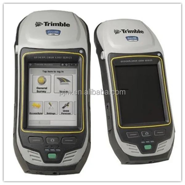
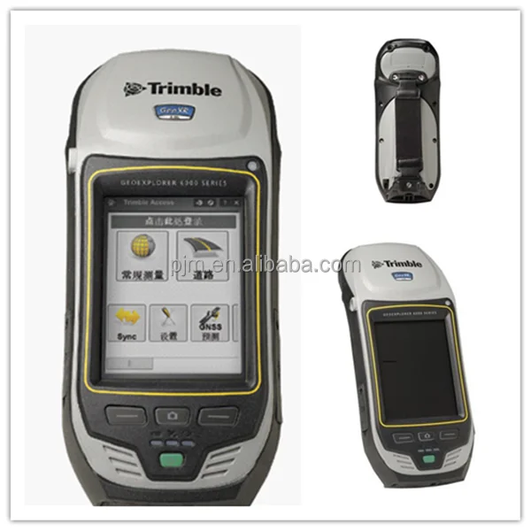
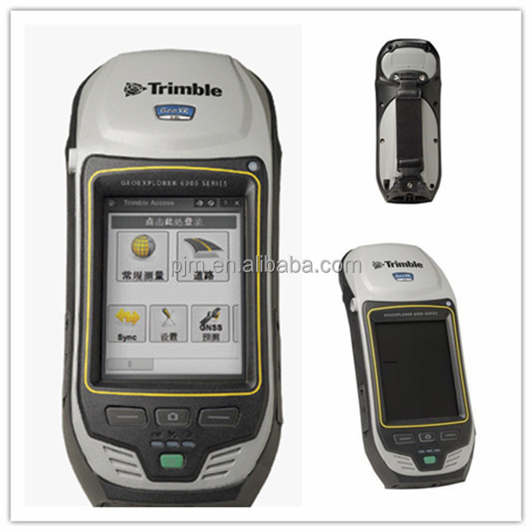
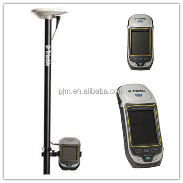
TRIMBLE GEO XR 6000 dgps system with an external antenna
- Category: >>>
- Supplier: Shenzhen Pengjin Technology Co. Ltd.
Share on (60263948403):
Product Overview
Description
TRIMBLE GEO XR 6000 dgps system with an external antenna
Product Description
The rugged Trimble® GeoXR™ Network Rover is a purposebuilt complete solution designed to make both highaccuracy surveying and handheld point measurement easier, more efficient, and more flexible.
Trimble Productivity, Handheld Convenience
The Trimble GeoXR Network Rover adds a new aspect to GNSS surveying productivity by combining the functionality for high-accuracy field work with the flexibility and convenience of handheld positioning in one device.
The Trimble GeoXR can be used mounted on a survey rod with an external antenna for survey-grade accuracy and when connected to Trimble VRS™ technology, it serves as an advanced and highly productive network rover. Then snapped off the rod and seamlessly switched to the integrated antenna, it becomes a solution for handheld point measurement with easy access to features such as the integrated camera.
The Trimble GeoExplorer GeoXR handheld, integrated with Trimble Access™ software, establishes a new standard in advanced network rover solutions.

Optimized for Trimble Access
Trimble Access field software features the power, functionality, and modularity surveyors need today. It is designed to support everyday work – topographic surveys, staking, control, and more – through a familiar easy-to-use interface.
The Trimble GeoXR handheld includes a sunlight-optimized display designed specifically for outdoor operation. It maintains exceptional clarity in all outdoor conditions, including direct sunlight. Text is crisp and easy to read. Background maps and photos are rich and vibrant. At 4.2 in (10.7 cm), the display provides a spacious touch panel that is easy to control. Surveyors can work directly from the active map and integrate photos into their workflow using the large color touch screen.
The integrated cellular modem of the Trimble GeoXR allows continuous network and Internet access for webbased services, Trimble VRS corrections, and live, secure synchronization of field and office files through Trimble AccessSync.
In addition, wireless connectivity options including cellular and Wi-Fi technology ensure that field workers can remain in contact with the office and each other, even from remote locations.
Centimeter Accuracy in Your Hand
On the rod or in your hand, the Trimble GeoXR handheld delivers the accuracy and speed required to ensure that the work of recording survey points or staking-out is fast and reliable.
The Trimble GeoXR handheld is equipped with a 220 channel GNSS receiver capable of tracking GPS, and GLONASS satellites together with an integrated dualfrequency (L1/L2) GNSS antenna. In addition to being a complete network rover solution, when outside the network, the system can be used to collect GNSS data for postprocessing in Trimble Business Center software.
High Quality photo capture
A photograph is often the best way to capture information about an asset, event, or site. The Trimble GeoXR handheld includes a 5 megapixel autofocus camera with geo-tagging capability. The camera is controlled by the Trimble Access software, so photo capture and linking of images to survey data is seamless and simple to integrate with existing workflows.
Easily record the qualitative information that survey data alone can miss, such as site conditions or work progress. The benefits of including images as part of your workflow are almost limitless—from easy data handover to in-field quality assurance.
Designed for High Efficiency Work
The Trimble GeoXR was designed with a single goal in mind—delivering a high-accuracy network rover that works faster, longer, and in more places than any other. The Lithium-Ion battery provides up to 9.5 hours of GNSS operation on a single charge, and can be swapped on-the-go without shutting down the device— enabling near-continuous operation and minimizing field worker downtime.
The fully ruggedized IP65 construction is designed to withstand the harshest environments. Wherever field workers go, they can take the Trimble GeoXR handheld with the confidence that the equipment can handle the toughest conditions.
These smart design features combine with unprecedented accuracy, flexibility, and productivity to deliver the ultimate high performance handheld field solution. The Trimble GeoXR, together with Trimble VRS technology, Trimble Access software and services, and Trimble Business Center is your optimal total Network Rover solution.

KEY FEATURES:
1. Advanced Network Rover solution
2. Centimeter accuracy in a handheld form factor
3. Optimized for Trimble Access field software
4. Sunlight readable color display with unmatched clarity in bright sunlight
5. Capture high quality photographs and link directly to measured points
SPECIFICATION:
| System Configuration | ||
| System Summary | Dual-frequency GNSS receiver and antenna with Trimble R-Track™ technology | |
| Sunlight readable 4.2" polarized display | ||
| Integrated 3.5G cellular modem | ||
| Integrated Wi-Fi and Bluetooth® wireless technology | ||
| 5 megapixel autofocus camera | ||
| Windows Mobile® 6.5 (Professional edition) | ||
| Rugged and water-resistant design | ||
| Shipment and Standard Accessories | Trimble GeoXR handheld with Microsoft Windows Mobile 6.5 | |
| Rechargeable battery (x2) | International AC charger (x2) | |
| Range pole bracket | USB Data Cable (mini USB) | |
| Hand strap | Stylus pen (x2) and stylus tether | |
| Screen Protectors (x15) | Device label pack | |
| Antenna port dust cover | Transport case | |
| Quick Start Guide | External GNSS antenna with 1.5 m antenna cable | |
| Optional Accessories | 12 V vehicle charging cable | Soft pouch |
| Replacement door kit (SD, USB, SIM) | GNSS Antenna Cable (TNC to SMB), 1.5 m and 5.0 m | |
| Performance Specifications | ||
| Measurements | Trimble R-Track technology | |
| Advanced Trimble Maxwell™ 6 Custom Survey GNSS chip with 220 channels | ||
| High precision multiple correlator for GNSS pseudorange measurements | ||
| Unfiltered, unsmoothed pseudorange measurements data for low noise, low multipath error, low time domain correlation and high dynamic response | ||
| Very low noise GNSS carrier phase measurements with <1 mm precision in a 1 Hz bandwidth | ||
| Signal-to-Noise ratios reported in dB-Hz | ||
| Proven Trimble low elevation tracking technology | ||
| Satellite signals tracked simultaneously: | GPS: L1C/A, L2C, L2E (Trimble method for tracking L2P) | |
| GLONASS: L1C/A, L1P, L2C/A (GLONASS M only), L2P | ||
| SBAS(WAAS/EGNOS/MSAS): L1C/A | ||
| 1 Hz (positioning), 5 Hz (stakeout) | ||
| 1 Hz data storage | ||
| CMR+, CMRx, RTCM 2.1, RTCM 2.3, RTCM 3.0, RTCM 3.1 Input via cellular modem | ||
| Code differential GNSS positioning | Horizontal | 0.25 m + 1 ppm RMS |
| Vertical | 0.50 m + 1 ppm RMS | |
| SBAS differential positioning accuracy | typically <5 m 3DRMS | |
| Static and FastStatic GNSS | Horizontal | 3 mm + 0.5 ppm RMS |
| Vertical | 3.5 mm + 0.5 ppm RMS | |
| Real-Time Kinematic surveying | Single Baseline <30 km | |
| Horizontal (external GNSS antenna) | 10 mm + 1 ppm RMS | |
| Vertical (external GNSS antenna) | 15 mm + 1 ppm RMS | |
| Horizontal (internal GNSS antenna) | RMS | |
| Vertical (internal GNSS antenna) | 40 mm + 1.5 ppm RMS | |
| Network RTK | ||
| Horizontal (external GNSS antenna) | 10 mm + 0.5 ppm RMS | |
| Vertical (external GNSS antenna) | 15 mm + 0.5 ppm RMS | |
| Horizontal (internal GNSS antenna) | 25 mm + 1 ppm RMS | |
| Vertical (internal GNSS antenna) | 40 mm + 1 ppm RMS | |
| Initialization time | typically <8 seconds | |
| Initialization reliability | typically >99 9% | |
| Electrical | ||
| Processor | TI OMAP 3503 | |
| RAM | 256 MB | |
| FLASH | 2 GB | |
| External storage | SD/SDHC up to 32 GB | |
| Battery Type | Rechargeable, removable Li-Ion | |
| Battery Capacity | 11.1 V, 2.5 AH | |
| Charge time | 4 hours (typical) | |
| Battery run-time per battery (internal / external GNSS antenna) | GNSS only | 9.5 / 8.0 hours |
| GNSS & VRS over Wi-Fi | 8.5 / 7.5 hours | |
| GNSS & VRS over Cellular modem | 6.5 / 6.0 hours | |
| Standby time | 50 days | |
| Buttons & Controls | Power key, left & right application keys, camera key | |
| Connectors & Inputs | Internal microphone and speaker, mini USB connector, DE-9 serial via optional USB to serial converter, external power connector, SIM socket, SDHC card socket | |
| Camera | Still mode | Autofocus 5 MP |
| Still image format | Up to VGA resolution | |
| Video mode | Up to VGA resolution | |
| Video file format | WMV with audio | |
| Cellular & Wireless | UMTS/HSDPA | 850/900/2100 MHz |
| Wi-Fi | 802.11 b/g | |
| GPRS/EDGE | 850/900/1800/1900 MHz | |
| Bluetooth | Version 2.1 + EDR | |
| Display | Type | Transflective LED-backlit LCD |
| Size | 4.2 in (diagonal) | |
| Resolution | 480x640 | |
| Luminance | 280 cd/m2 | |
Packaging & Shipping

Our Services
1 Reply to your inquiry in 24 working hours
2 Experienced staffs answer all your questions in professional and fluent English.
3 Exclusive and unique solution can be provide to our customer by your our well-trained and professional engineers and staffs
Company Information
 Shenzhen Pengjin Technology Co.,Ltd, which is the owner of PJK brand land surveying instrument, the PJK brand covers total station, theodolite, level,RTK GPS, GIS, handheld GPS, Rebound tester, laser vertical collimator, laser rangefinder, laser swinger, laser line marking, laser telescope rangefinder,etc. Now we are looking for the international general agencies.
FAQ
Payment terms :
We accept T.T in advance, Wester Union, Paypal and Escrow .
If you want other payment terms, Pls let us know before the order.
Delivery time: ready stock for sample, 1-2 week for large quantity
Warranty: ONE year
We Recommend


New Arrivals
New products from manufacturers at wholesale prices


