
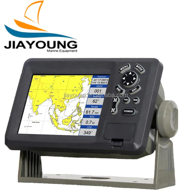
8 Inches Boat GPS Chartplotter With CE
- Category: >>>
- Supplier: Chongqing Jiayoung Marine Co. Ltd.
Share on (60717668810):
Product Overview
Description
8 Inches Boat GPS Chartplotter With CE
Product Description
High resolution TFT day-view LCD display
SD-cards slot for C-Map MAX and user data
C-Map MAX and K-Chart Selectable
Tide table
Versatile display mode include
Plotter Screen
Nav.Data
Satellite Information
AIS Display
Compass Screen
GOTO track navigation
Map orientation select
Proximity waypoints alarms
Perspective View
Palette
Normal
Daylight – exposed to sunlight
Night – in dark environment
NOAA- paper chart colors
| PLOTTER CHARACTERISTICS | |
| Waypoints/icons | 15,000 waypoints with name, symbol, 10 proximity waypoint |
| Routes | waypoint up to 200 points each, plus MOB and Track Navigation or Goto Track modes |
| Tracks | 30,000 point automatic track log; 15 saved track (up to 2000 track points each) let you retrace your path in both directions |
| Alarms | XTE, Anchor drag, arrival, speed, voltage, proximity waypoint and time, AIS alarm. |
| Pallete | Normal
Daylight exposed to sunlight Night in dark environment NOAA paper chart colors |
| Tides | Tide data |
| Projection | Mercator projection |
| Position format | Lat/Lon |
| Basemap | Built-in K-Chart |
| External Map | SD Cards slot for C-Map MAX |
| User data storage | Internal backup of user settings, or external SD-card |
| Plot Interval | 1s to 99h or 0.01 nm to 9.99nm |
| Plotting scales | 0.01nm to 1,000nm |
| Nav Data | Inputs: $–DBT, $–DPT, $–GGA, $–GLL,$–GSA, $–GSV, $–HDG,$–HDM,$–HDT,$–MTW, $–RMB,$–RMC, $–VTG, $–ZDA, $–VWR,$–VWT,$–MWD, $–VPW Outputs: $–AAM, $–APB, $–BOD,$–BWC,$–GGA, $–GLL, $–RMB,$–RMC,$–VTG, $–XTE, $–ZDA Outputs for autopilot: $–AAM, $–APB, $–BOD,$–VTG |
| Perspective View | On/off |
| POWER SUPPLY | 10.5 to 35VDC, current drain <350mA at 12V |
| PHYSICAL | |
| Size | 290mm(H)X195.5mm(W)X99.5mm(D) |
| Weight | 2.43kg |
| Display | 8.0-inches ColorTFT day-view LCD 800 X 600 pixels |
| Waterproofing | Display unit: IPX5 Antenna unit: IPX6 |
| Temperature range | Display unit: -15℃ to +55℃ Antenna unit: -25℃ to +70℃ |
| GPS RECEIVER CHARACTERISTICS | |
| Receiver | 50 parallel channel GPS receiver continuously Tracks and uses up to 50 satellites to compute and update your position |
| Acquisition times | Cold start: 27 seconds average Warm start: 27 seconds average Hot start: 1 seconds average |
| Update rate | 1/second,continuous |
| Accuracy | Position: 2.5 meters(95%) without S/A Velocity: 0.1 Meter/sec without S/A Time: ±100ns synchronized to GPS time |
| Dynamics | Altitude: 50,000m Max Velocity: 500 m/s Acceleration: 4g Max |
| Datum | WGS 84 & Others |
| Interfaces | NMEA 0183 input and output,RS232 and RS422 output |
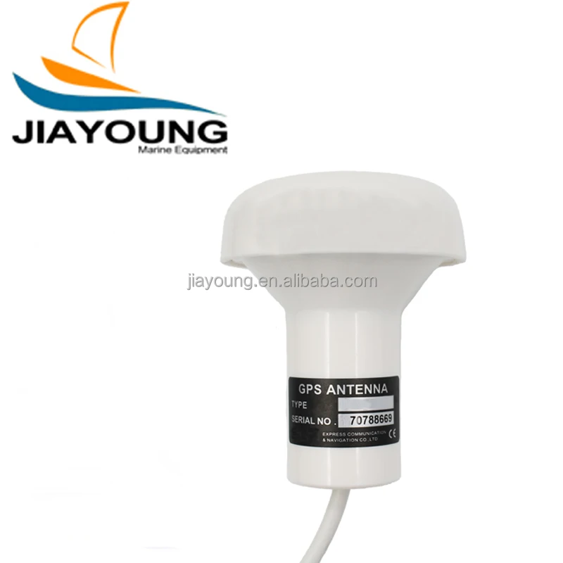
| Antenna | KA07 |
| AIS INTERFACE | |
| Data input | NMEA 0183 , RS232 or RS422 |
| Baud rate | 38,400 |
| EQUIPMENT LIST | |
| Display unit
Antenna unit with 10m cable Operation manual Installation materials and standard spare parts | |
Related Products

Contact us
We Recommend


New Arrivals
New products from manufacturers at wholesale prices


