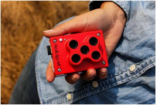
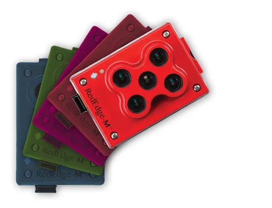

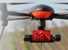
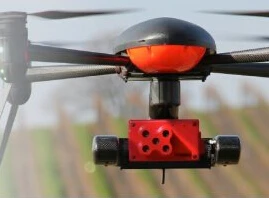
MICASENSE ALTUM тепловой многоспектральный датчик изображений высокого разрешения
- Category: Other Test Instruments >>>
- Supplier: Shenzhen Pengjin Technology Co. Ltd.
Share on (60815005492):
Product Overview
Description
MICASENSE ALTUM THERMAL MULTI-SPECTRAL HI-RESOLUTION IMAGERY SENSOR
 | MicaSense Altum: Thermal,multispectral, and high resolution imagery in one sensor.
|

At MicaSense (REDEDGE M / REDEDGE MX ), we believe in delivering more than pretty pictures.
We believe in providing scientific solutions that address real problems.


Agricultural companies, service providers, researchers and academics need a reliable, accurate, high-precision sensor.
They don't need to compromise.
1 Chlorophyll Map: The red edge spectral band is the star here, working in conjunction with the other bands to provide a more accurate measure of not just plant vigor but plant health.
2 NDVI Layer: This commonly known index compares the reflectance of the red band with that of the near-infrared band. However, this index alone provides limited information.
3 Digital Surface Model: A DSM is an astonishingly advantageous tool in any agronomist’s arsenal, primarily because of its use in evaluating surface properties and water flow.
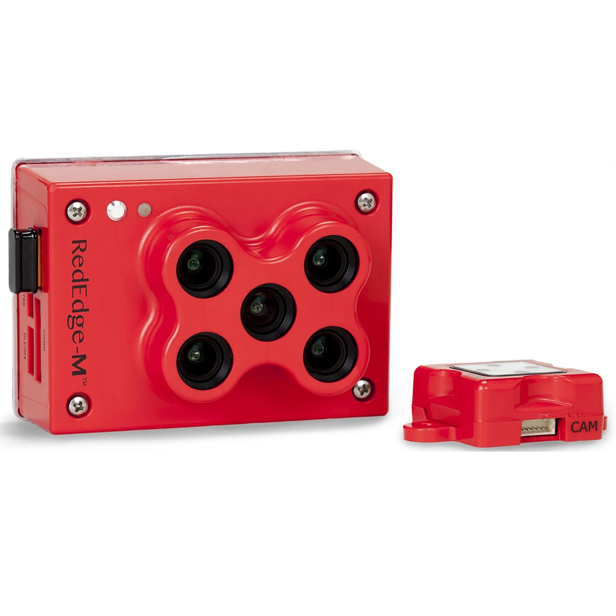
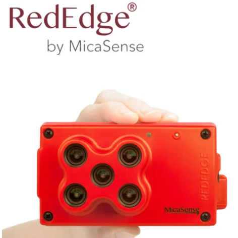
4 RGB Image: RedEdge-M features global shutters for distortion-free images, including narrowband red, green, and blue bands for RGB color images that when processed are aligned to all visible and non-visible bands and vegetation indices.
Specifications
Weight: | 170 grams (6.0 oz) |
(includes DLS and cables) | |
Dimensions: | 9.4 cm x 6.3 cm x 4.6 cm |
(3.7 in x 2.5 in x 1.8 in) | |
External Power: | 4.2 V DC - 15.6 V DC |
4 W nominal, 8 W peak | |
Spectral Bands: | Blue, green, red, red edge, near-IR |
(global shutter, narrowband) | |
RGB Color Output: | Global shutter, aligned with all bands |
Ground Sample Distance (GSD): | 8 cm per pixel (per band) at 120 m |
(~400 ft) AGL | |
Capture Rate: | 1 capture per second (all bands), 12-bit |
RAW | |
Interfaces: | Serial, 10/100/1000 ethernet, removeable |
Wi-Fi, external,trigger, GPS, SDHC | |
Field of View: | 47.2° HFOV |
Custom Bands: | 400nm - 900nm (QE of 10% at 900nm) |
Triggering Options: | Timer mode, overlap mode, external trigger mode (PWM, GPIO, serial, and Ethernet options), |
manual capture mode |
RedEdge M: Professional Multispectral Sensor Kit A multispectral powerhouse:
- One flight, multiple outputs
- Easy and flexible integration options
- Calibrated for precise, repeatable measurements
- Capable of generating RGB color images aligned with 5 specific spectral bands
- RedEdge-M is built to last with quality materials
- Kit includes a Downwelling Light Sensor (DLS), GPS/Mag module, calibrated reflectance panel, and hard carrying case

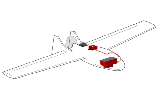
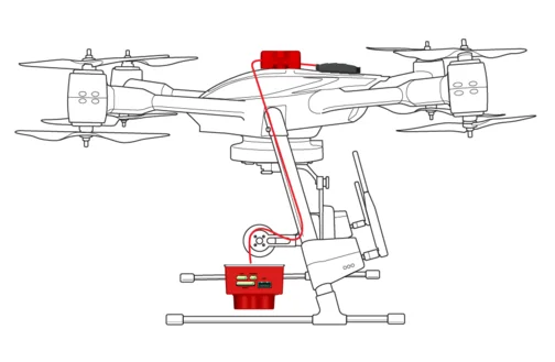
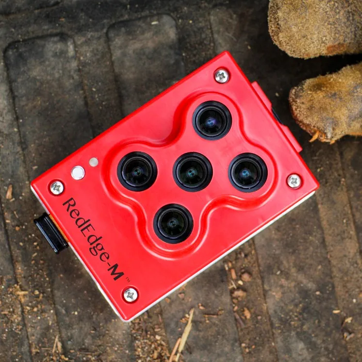
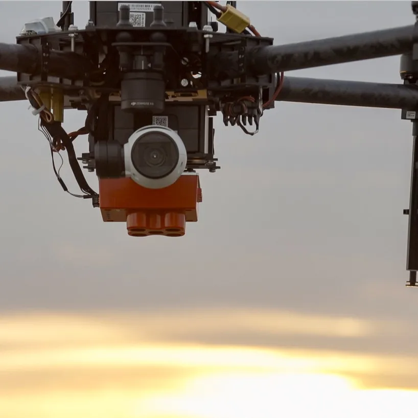
RedEdge-M is action-ready, integrating seamlessly no matter the platform.
It has a compact design and is lightweight to work with as many drone models as possible.

FLY
The RedEdge-M’s low weight, low power requirement, and ability to capture RGB and narrowband spectral bands simultaneously means you can gather the data you need in fewer flights. Have multiple UAVs? RedEdge-M quickly integrates with many different drone platforms.
PROCESS
With RedEdge-M, you own your data. You’re not limited to a particular processing platform. You can choose whichever platform is best for you, your customer, or your project.
ANALYZE
RedEdge-M has five bands—blue, green, red, red edge, and near-infrared—that our research showed were optimal for sensing crop health. It simply shows you more. And with MicaSense Atlas, you can see many different analytical layers in one easy to use interface, and compare these outputs across time.
ANYWHERE
We know you need tools you can rely on. That’s why we built the sensors we wanted in the field—predictable, tough, and reliable—so you can gather the data you need when you need it.

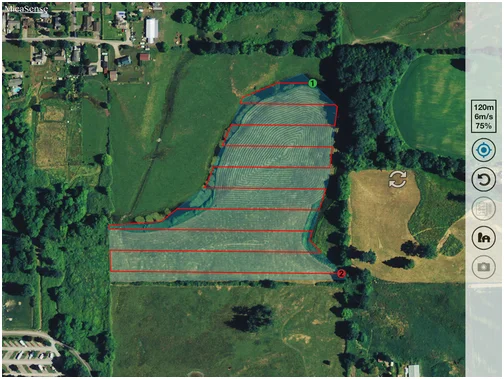
Accurate Data Begins with a Quality Flight Plan
With Atlas Flight, turn your Atlas fields into flight plans, and capture data optimized for Pix4D and Atlas.
ustomize your RedEdge-M me projects or specialized applications require different filters than the stock options. Or maybe you need even more spectral resolution than just five bands. We can help. Contact our sales team to request more information on custom sensors.

We Recommend

Flange Connection Liquid Closed-loop Sampling System Device
US $46.00-$216.00

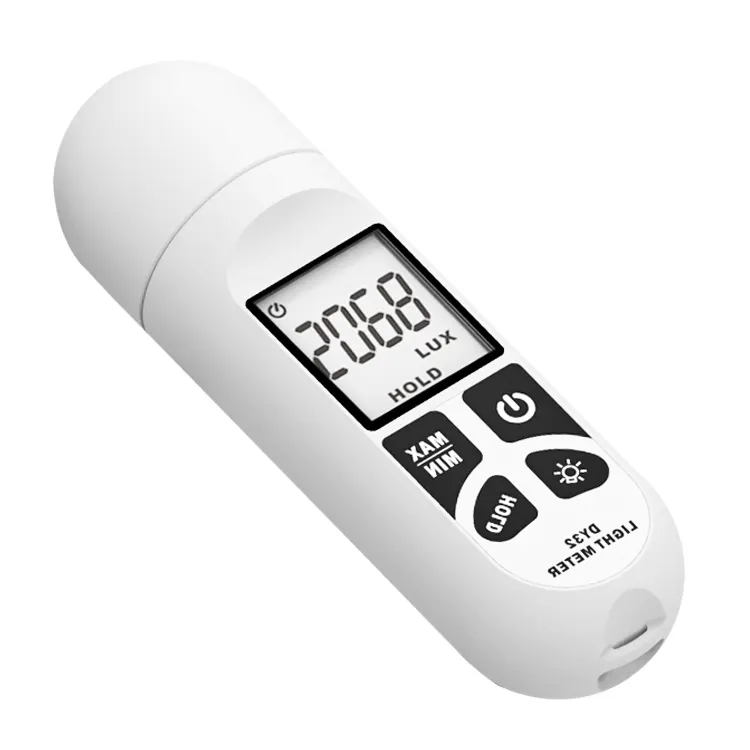
Ce Rohs DY32 Digital Lux Light Meter Lumen Meter Quantum Meter
US $9.95-$13.99

DO-957 Water Testing Meter low cost dissolved oxygen sensor
US $58.00-$66.00

KH300T Hand-held Digital Paperless Temperature Recorder
US $400.00-$1200
New Arrivals
New products from manufacturers at wholesale prices


