
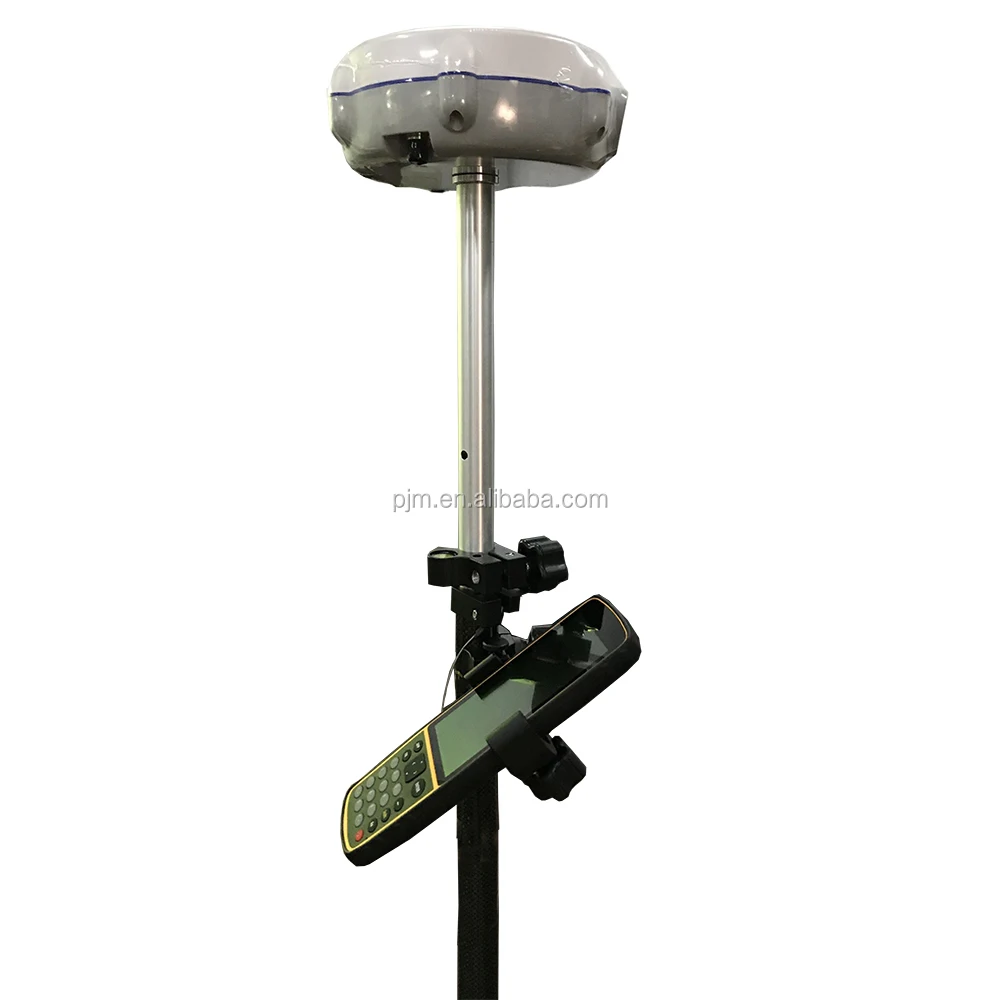
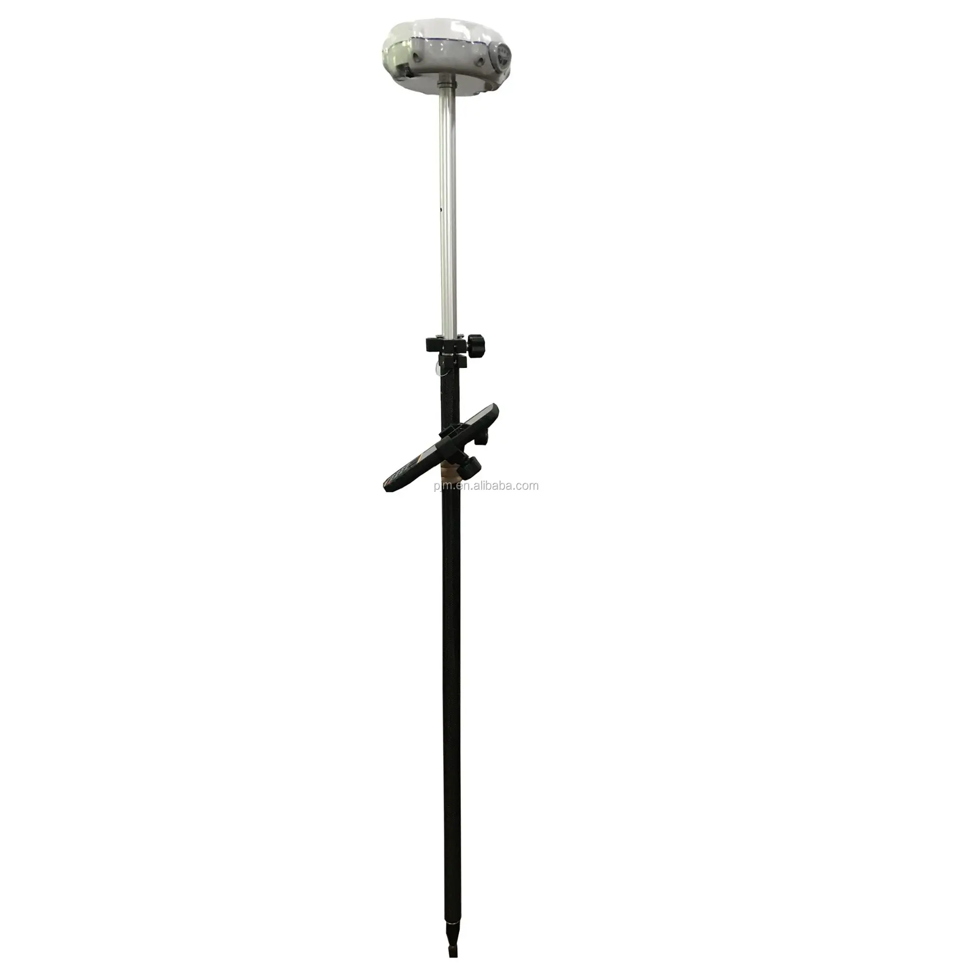
CHC LAND SURVEYING EQUIPMENT M6 M5 GNSS GPS RTK DE DOBLE FRECUENCIA
- Category: >>>
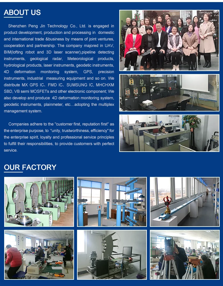
- Supplier: Shenzhen Pengjin Technology Co. Ltd.
Share on (60842796110):
Product Overview
Description
Product Description
CHC LAND SURVEYING EQUIPMENT M6 M5+ GNSS GPS RTK DE DOBLE FRECUENCIA
KEY FEATURES
-Future proof 384channel core GNSS with the ability to track GPS, GLONASS and BeiDou
-High performance RTK GPS positioning covering wide range of applications
-LandStar 7 software scale to your survey need
-Integrated Bluetooth, GPRS and radio modem
-Innovative and rugged design built for harsh environment


The M5 GNSS receiver from Sinov leverages the latest GNSS technology by integrating 384 channels with the ability to track GPS, GLONASS and Beidou and field software dedicated to topographic and construction surveying. The M5 series is one of the most
costeffective GNSS receiver selected by large number of surveyors for its outstanding performances and reliability.
Outstanding RTK Performances
The M5 offers greater performances with proven and innovative GNSS functionality. The future proof multiconstellation tracking feature increases availability in obstructed sky conditions such as construction sites in urban areas while securing RTK GPS accuracy.
A Selection of Field Surveying Software
LandStar 7 combines advanced functionality and an intuitive user interface. LandStar 7 is a complete data collection system for real time RTK GPS.
Compact and rugged
The M5 innovative design integrates a builtin GNSS core, multi constellation antenna, Bluetooth® communication and optional UHF datalink and GSM/GPRS modules in one single receiver.
Exceptional Performances to Price Ratio
Sinov M5 GNSS receiver brings extremely affordable highend GNSS RTK solution to surveyors without the conventional cost associated.
| M5 Technical Specifications | ||
| GNSS Characteristic | 384channel signal tracking | GPS: L1, L2, L5 |
| GLONASS: L1, L2 | ||
| BeiDou: B1, B2, B3 | ||
| Advanced multipath mitigation technology | ||
| Low noise carrier phase measurement | ||
Performance specifications | Real Time Kinematics (RTK) | Horizontal: 10 mm + 1 ppm RMS |
| Vertical: 15 mm + 1 ppm RMS | ||
| Initialization time: < 10 s | ||
| Initialization reliability: > 99.9% | ||
| Post Processing Static | Horizontal: 8 mm + 1 ppm RMS | |
| Vertical: 10 mm + 1 ppm RMS | ||
| Communi cations | 1* RS232 serial port | |
| 1* high-speed USB | ||
| Integrated Bluetooth® class 2 | ||
| Integrated GSM/GPRS modem | ||
| Optional GSM/GPRS modem | ||
| Optional radio modem | Internal Rx : 450-470 MHz | |
| External Tx DL6 : 1W - 28W adjustable | ||
| Protocols | RTCM2.x, RTCM3.x, CMR | |
| NMEA0183 output | ||
| RINEX and HCN outputs for GNSS raw data | ||
| Data Storage | 4 GB internal memory | |
| GPS device mounts as a USB external hard drive | ||
| Hardware | Physical | Size (LxWxH): 190 x 200 x 84 mm (7.5 x 7.9 x 3.3 in) |
| Weight: 1.4 kg with battery (49 oz) | ||
| Operating Temperature: -30 °C to +65 °C (-22 °F to 149 °F) | ||
| Storage Temperature: -40 °C to +75°C (-40 °F to 167 °F) | ||
| Humidity: 100% condensation | ||
| Dust proof: IP67 | ||
Waterproof: protected from temporary immersion to depth of 1 meter, floats. | ||
| Shock: survives a 2 meters drop onto concrete | ||
| Electrical | Power consumption: 2.8 W | |
| Li-ion battery capacity: 2200 mAh | ||
| Battery life: typical 4.5 hours in RTK mode | ||
| External power input: 9-18VDC | ||
| Software | CHC’s Landstar field data collection software | |
| Carlson’s SurvCE field data collection software | ||

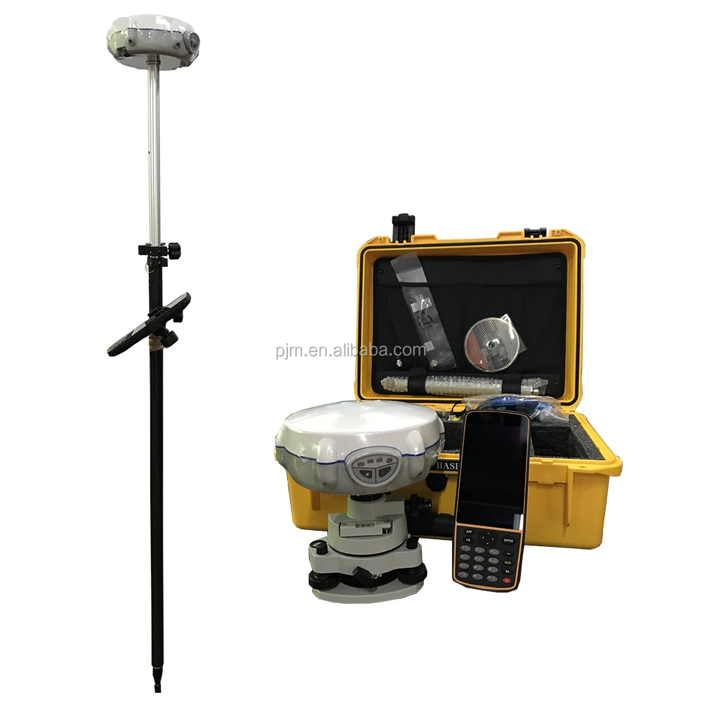
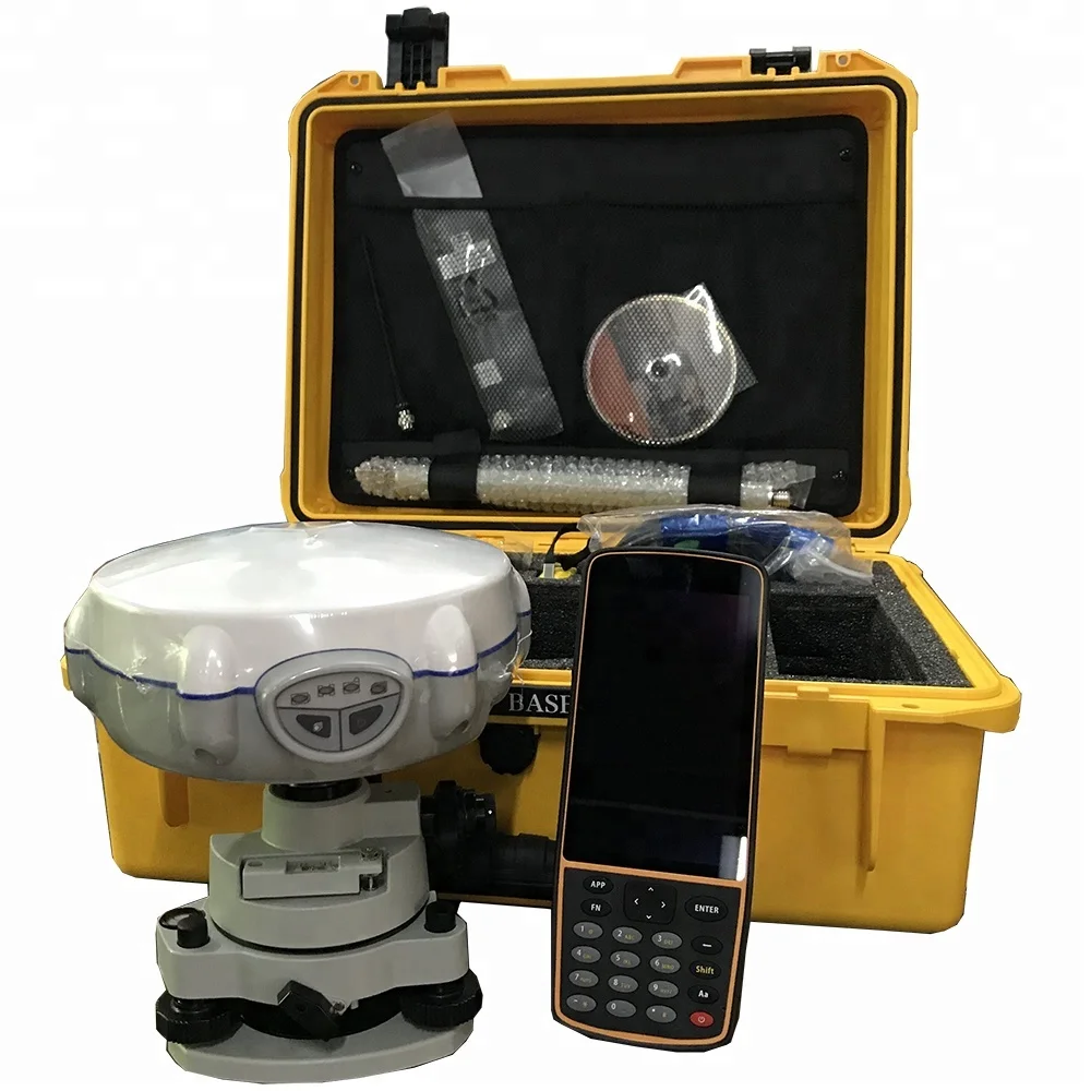
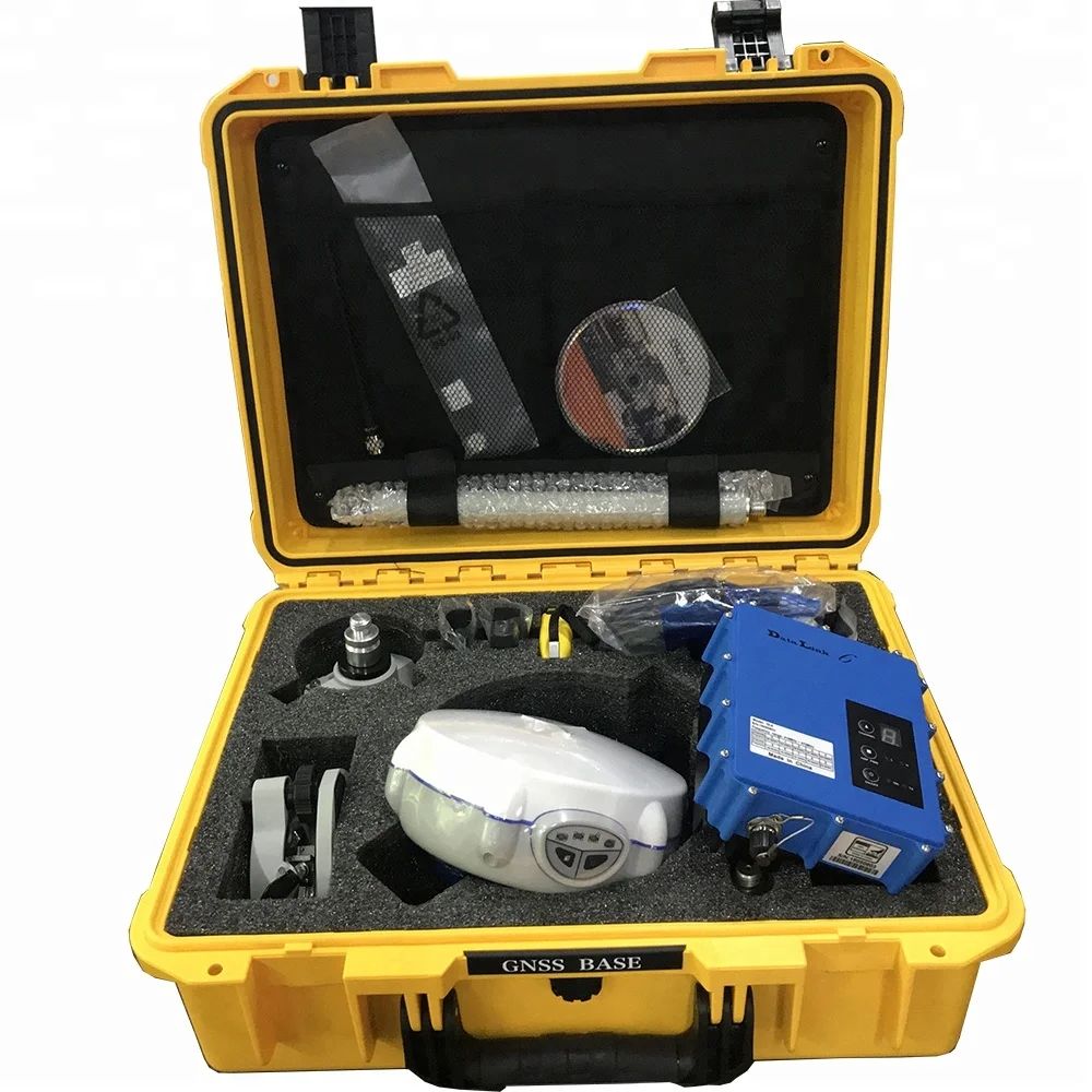
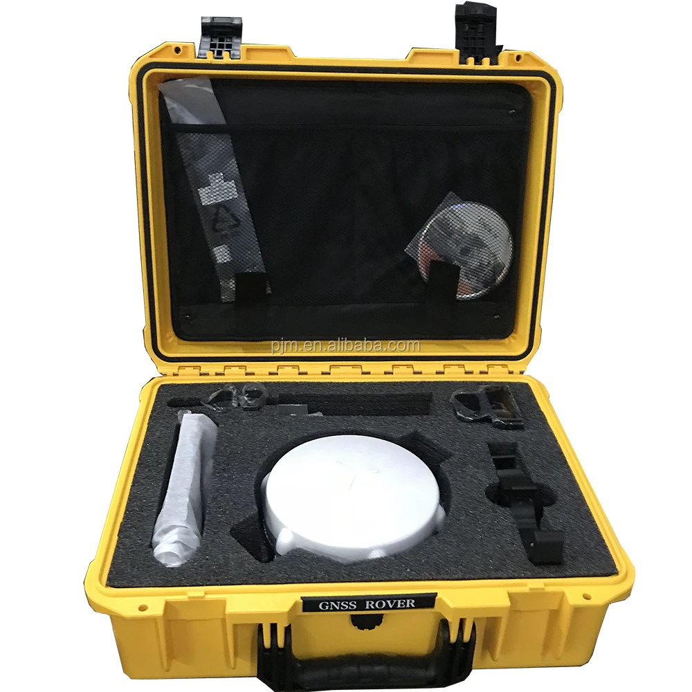
standard packing list for CHC M5 GPS RTK SURVEY EQUIPMENT
M5 GNSS RTK | 384 Channel
Part Number Description Pcs Unit Price
X900+ Kit
8008 000 021 W/ Internal Rx: 450-470 MHz Base Kit 1
1192 719 727 M5 GNSS Receiver 1
2004 020 012 UHF Whip Antenna 1
0101 020 039 External GPRS cable 1
2004 060 031 Transport Hard Case 1
2004 030 052 GPS to PC Data Cable 1
2004 050 030 C300 Battery Charger w/Power Adapter with cord 1
2004 050 017 Lithium Battery 2
2004 030 031 RS232 to USB converter 1
2004 030 037 H.I. Tape 1
2004 040 008 Extension Pole(30cm) 1
2004 330 056 Tribrach w/ Optical Plummet 1
2004 030 012 Tribrach Adaptor 1
8008 000 022 W/ Internal Rx: 450-470 MHz Rover Kit 1
1192 719 727 M5 GNSS Receiver 1
2004 020 012 UHF Whip Antenna 1
0101 020 039 External GPRS cable 1
2004 060 032 Transport Hard Case 1
2004 030 052 GPS to PC Data Cable 1
2004 030 031 RS232 to USB converter 1
2004 050 030 C300 Battery Charger w/Power Adapter with cord 1
2004 050 017 Lithium Battery 2
2004 040 013 2M Range Pole w/ Bag 1
8008 000 011 DL6 Datalink Kit 1
2003 020 006 DL6 Datalink (410-470 MHz) 1
2004 030 064 GPS to Datalink Cable (Power Cable) 1
2004 020 007 Datalink Antenna 1
2004 030 040 3 Meter Cable for Datalink Antenna 1
2004 030 006 Datalink Data Setup Cable 1
2004 040 004 Datalink Antenna Mounting Pole Kit 1
2004 040 009 Pole Mounting 1
8008 000 003 HCE300 GPS/GIS Handheld Controller Kit 1
2003 030 022 HCE300 Android Data Controller 1
2004 050 027 Li-Ion Battery 1
2004 030 065 Data Cable (USB) for HCE300 1
2004 050 028 Power Adapter 1
2104 010 015 Controller Bracket for Range Pole 1
2004 090 055 Strap 1
0103 020 320 Stylus 1
Data Collection Software
1906 210 639 Landstar 7 Data Collection Software (Android) 1
Hot Sale

Company Information
We Recommend


New Arrivals
New products from manufacturers at wholesale prices


