
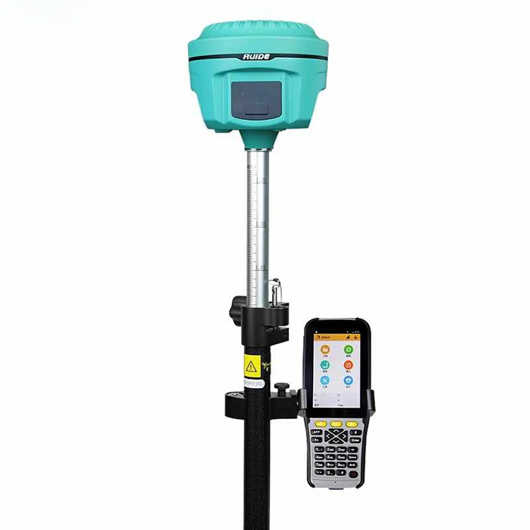

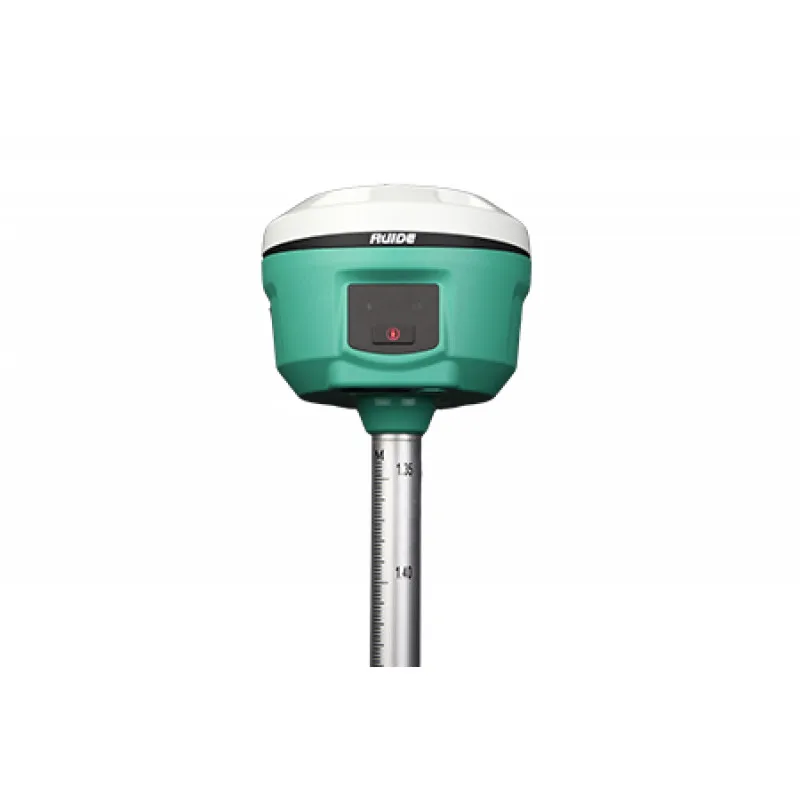
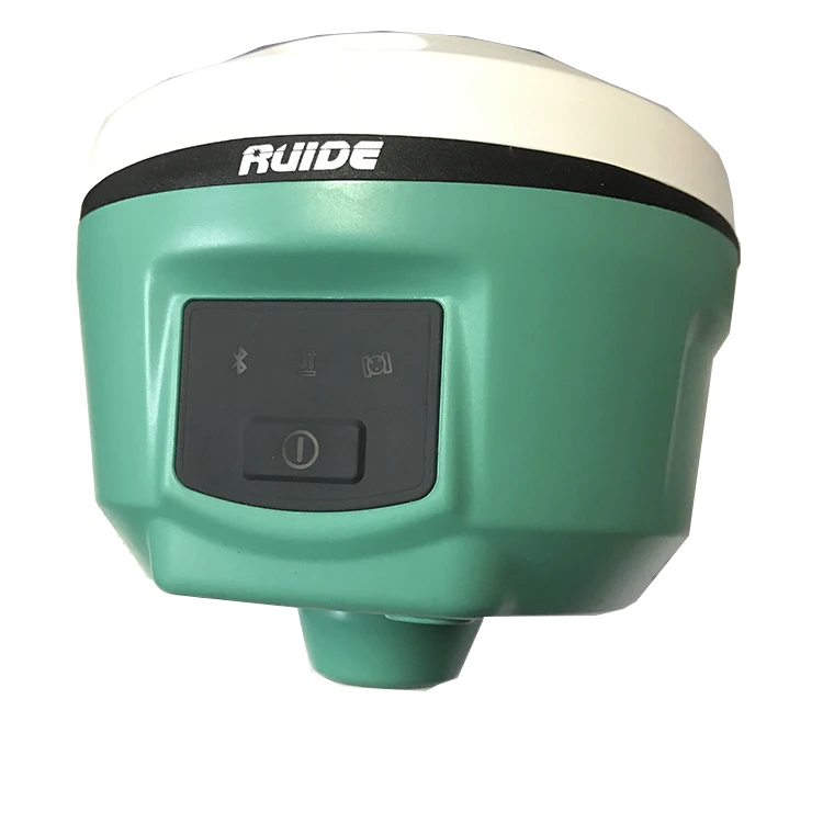
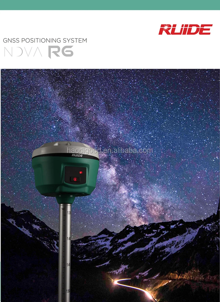
Professional Ruide R6 336 Channels Total Station GNSS GPS RTK
- Category: >>>
- Supplier: Shangrao Haodi Imp & Exp Trading Co. Ltd.
Share on (62152913504):
Product Overview
Description

Original Ruide Software Can Be Updated At Any Time


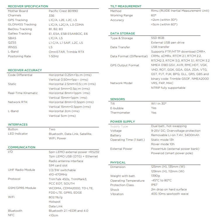
| Surveying performance | |
| Channel | 336channels |
| Signal Tracking | BDS B1, B2, B3 |
| GPS L1C/A, L1P, L2C/A, L2P, L3 | |
| GLONASS L1C/A, L1P, L2C/A, L2P, L3 | |
| SBAS L1C/A, L5 (only for the statellites supporting L5) | |
| Galileo GIOVE-A, GIOVE-B, E1, E5A, E5B | |
| QZSS, WAAS, MSAS, EGNOS, GAGAN, SBAS | |
| GNSS Features | Positioning output rate : 1Hz~50Hz |
| Initialization time : <10s | |
| Initialization reliability : >99.99% | |
| Positioning Precision | |
| Code Differential GNSS Positioning | Horizontal: ±0.25 m + 1 ppm |
| Vertical: ±0.50 m + 1ppm | |
| SBAS positioning accuracy : typically< 5m 3DRMS | |
| Static GNSS Surveying | Horizontal: ±2.5 mm + 0.5 ppm |
| Vertical: ±5 mm + 0.5 ppm | |
| Real-Time Kinematic Surveying | Horizontal: ±8 mm + 1 ppm |
| (Baseline<30s) | Vertical: ±15 mm + 1 ppm |
| Network RTK | Horizontal: ±8mm + 0.5ppm |
| Vertical: ±15mm + 0.5ppm | |
| RTK intialization time: 2~8s | |
| Phycical | |
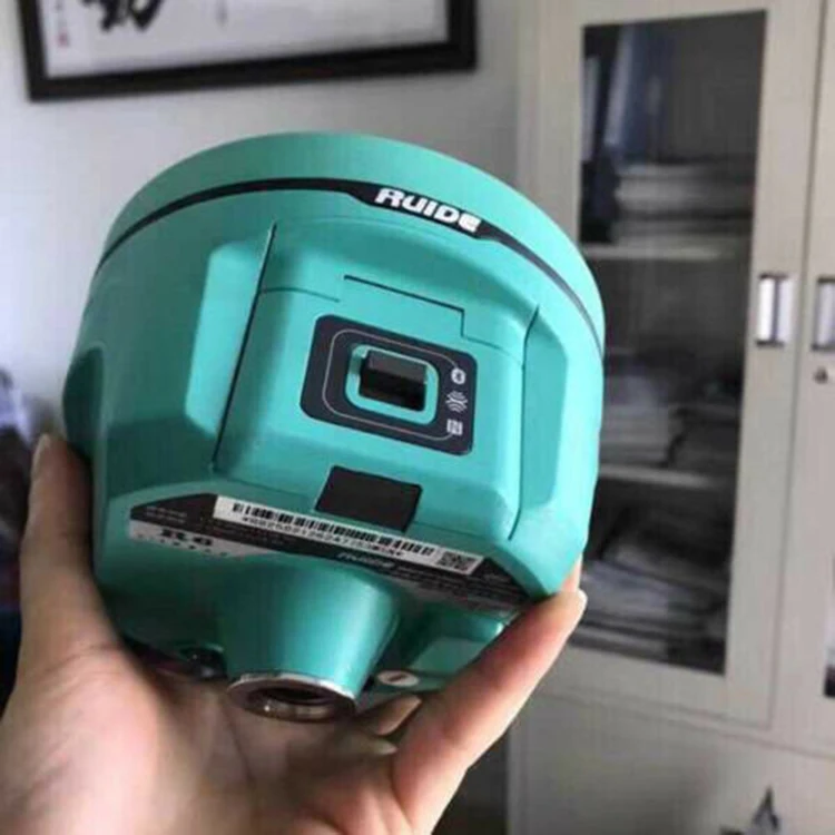
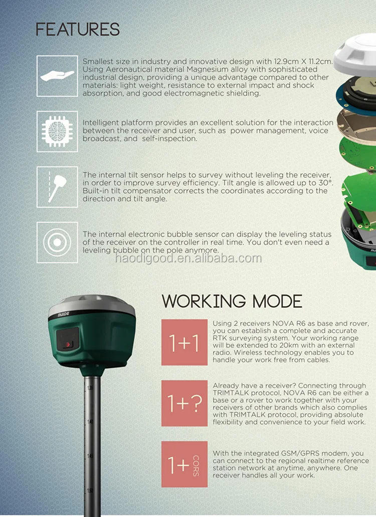
| Dimension | 12.9cmx11.2cm |
| Weight | 970g(including installed battery) |
| Material | Magnesium aluminum alloy shell |
| Environmental | |
| Operating | -45°C ~ +60°C |
| Storage | -55°C ~ +85°C |
| Humidity | Non-condensing |
| Waterproof/Dustproof | IP67standard,protected from long time immersion to depth of 1m |
| IP67 standard,fully protected against blowing dust | |
| Shock and vibration | OFF Status:Withstand 2 meters pole drop onto the cement ground naturally |
| ON Status:Withstand 40G 10 milliseconds sawtooth wave impact test | |
| Electrical | |
| Power Consumption | 2W |
| Battery | Rechargeable, removable Lithium-ion battery |
| Battery life | Single battery: 7h(static mode) |
| 5h(internal UHF base mode) | |
| 6h(rover mode) | |
| Communications and Data Storage | |
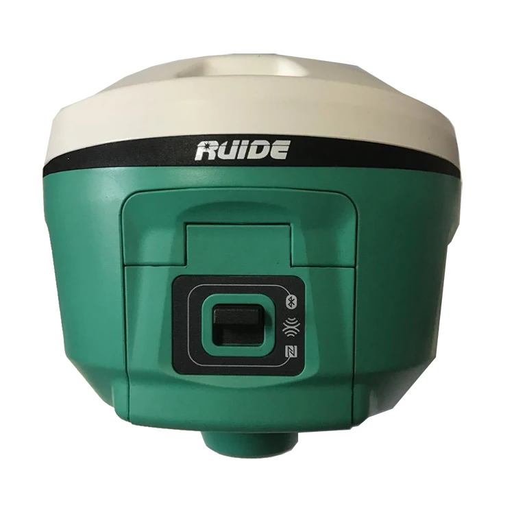
| I/O Port | 5PIN LEMO external power port + RS232 |
| 7PIN LEMO RS232 + USB | |
| 1 network/radio data link antenna port | |
| SIM card slot | |
| Wireless Modem | Integrated internal radio receiver and transmitter 0.5W/1W |
| External radio transmitter 5W/25W | |
| Working frequency | 410-470MHZ |
| Communication protocol | TrimMark3,PCC EOT,SOUTH |
| Cellular Mobile Network | WCDMA 3.5G module,GPRS/EDGE |
| compatible,CDMA2000/EVDO 3G optional | |
| Double Module | BLE 4.0 standard,supports |
| connection with Android and IOS | |
| 2.1+EDR standard | |
| Data Storage/Transmission | 4GB internal storage,more than 3 year's |
| raw observation data (about 1.4M/day) ,based on | |
| recording from 14 satellites plug and play mode of USB data transmission. | |
| Data Format | Differential:CMR+,CMR×,RTCM2.1,RTCM2.3,RTCM3.0,RTCM3.1,RTCM3.2 |
| GPS OUTPUT:NMEA0183,PJK plane coordinates,binary code | |
| Network module support:VRS,FKP,MAC,supporting NTRIP protocol | |
| Inertial Sensing System | |
| Tilt Survey | Built-in tilt compensator ,correcting coordinates automatically according to the tilt direction and angle of the centering rod |
| Electronic Bubble | Controller software display electronic bubble,checking leveling status of the centering rod real time |
| User Interaction | |
| Buttons | One-button operation,visual operation |


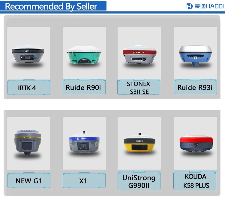


We Recommend


New Arrivals
New products from manufacturers at wholesale prices


