


High accuracy UFO U3 gnss receive gps for land survey with Electric bubble and Tilt survey
- Category: >>>
- Supplier: Shanghai Hexin Survey Instrument Company Ltd.
Share on (62373833575):
Product Overview
Description
High accuracy UFO U3 gnss receive gps for land survey with Electric bubble and Tilt survey
Product Description
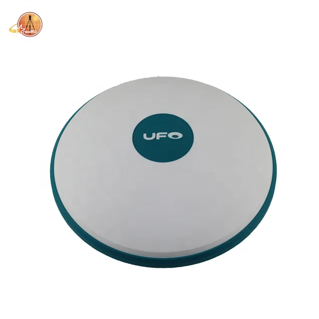
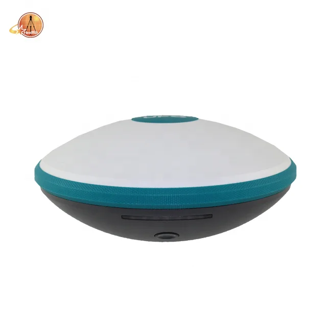
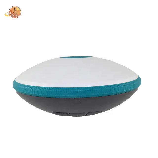
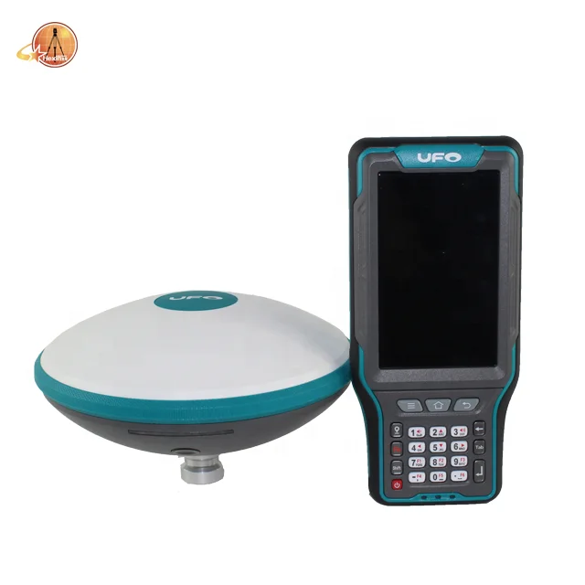
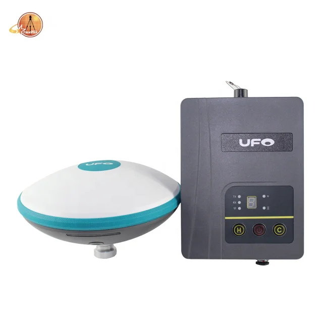
UFO U3 GNSS Receiver
The shape design of U3 is in-spired by flying saucer, which means future technology, and supports satellite station differ-ential and satellite chain life, quick connection, intelligent voice, tilt survey, etc. The body is made of magnesium alloy, which is rugged and has better EMC characteristics, it creates a high-grade aesthetic feeling, simple yet sophisticated.
| New Generation GNSS Receiver Leader U3 | |
 | •The body is made of magnesium
alloy, which is rugged and has better
EMC characteristic.The weight of the
whole receiver is only 1.2kg. |
•The shape of the U3 is inspired by
the flying saucer, bringing the high
performance and minimal structure
of outer space. | •Integrated design, wireless binding,
a backpack can hold the whole rover. |
Product feature
Design
The shape of the U3 is inspired by the flying saucer, bringing
Interface
|
 |
Button
Material
Protection
IP67, 2m drop-resistant design make the device worry-free. |
Intelligent voice
support TTS intelligent voice
supports user customiza-tion.
Electronic bubble
display the horizontal situation
for the surveyor to collect
the detailed points in the field.
WebUI
through a smartphone or other
hardware products with WiFi function
to perform settings, status check,
survey data download and firmware
upgrade, etc. Operating U3 can be
as simple as surfing the Internet. |
 | aRTK In the RTK operation, when the differential link of the radio or |
| Satellite station differential Using a global framework reference station for differential data solving and broadcasting via satellite, users can achieve single-receiver centimeter positioning on a global scale, even if you are in the ocean, desert, gobi and other extreme environ-ments, it can provide you with accurate coordinate data under the global framework. | Tilt survey
Portable |

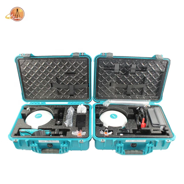
•The following figure, Base station standard configuration.

•The following figure, Rover station standard configuration.

Specification type
Product Specification
Model
| GNSS | |
| Channel | 394 |
| Satellite Tracked | GPS:L1CA,L1P,LIC,L2P,L2C,L5 GLOASS:G1,G2,P1,P2 BeiDou:B1/B2/B3 Galileo: E1BC/E5a/E5b QZSS:L1CA,L2C,L5,L1C |
| Update Rate | 5Hz |
| Static Accuracy | Horizontal: ±(2.5+0.5×10⁻⁶D)mm |
| Vertical: ±(5+0.5×10⁻⁶D)mm | |
| RTK Accuracy | Horizontal: ±(8+1×10⁻⁶D)mm |
| Vertical: ±(15+1×10⁻⁶D)mm | |
| Power Supply | |
| Battery | Built-in battery, 7.2V 6800mAh |
| Working time | No less than 10 hours |
| Input Voltage | 9~28V DC |
| Communication | |
| Memory | 8GB |
| Bluetooth | V2.1+EDR / V4.1 Dual Mode, Class2 |
| WIFI | 802.11 b/g/n |
| Internal UHF | Transmit power 1w Frequency 410-470MHz Radio Protocol SATEL PCC-EOT, TrimTalk 450S South 9600, South 19200 TrimMark III (19200), TrimTalk1 GEOTALK, GEOMARK |
| Network | Support 4G |
| Electric Bubble | Enable |
| Physical | |
| Dimensions | L180mm*76mm |
| Weight | 1.2kg |
| Interface | |
| TNC | Internal radio UHF antenna interface |
| Type-C | Direct charge and support external power supply, USB3.2 directly connected to the computer, USB mode, etc. |
| 5-pin Interface | Serial port and external power supply |
| SIM card slot | NANO SIM |
| Power Button | Short press, long press, hold,multiple applications |
| Power Indicator | Display the battery power of receiver |
| Strip-type Indicator | Display the working status of receiver |
| Voice | TTS voice broadcast |
| Environment | |
| Operating Temperature | -30℃ ~ +65℃ |
| Storage Temperature | -40℃ ~ +80℃ |
| Water/Dust Proof | IP67 (Customizable IP68) |
| Shock& Vibration | Survive a 2 m (6.6 ft) pole drop,1.2 m (3.9 ft) free fall |
| Humidity | 100%, condensing |
Packaging & Shipping
Terms of payment
Our terms of payment are as follows:T/T, Western Union, Paypal , etc.

Company Information
With 8 years' experience in geodetic surveying and cadastration surveying, we are a professional and leading enterprise in the surveying industry in Mainland China. We specialize in the R&D and manufacturing and sales of all kinds of surveying products, including total station, electronic theodolite, electronic distance meter, automatic level, laser level, reflector prism, surveying accessory, GPS receiver, mapping software, etc. The marketing model advocated by us is not a simple sense of "selling products", instead, pre-sales service, services during operation and after-sales service are integrated in entire operating activities. It makes the customers feel that they purchased not only a commodity, but also a professional service.
We welcome new and old customers from all walks of life to contact us for future business relationships and achieving mutual success!
FAQ
Q:How to turn off voice broadcast of receiver?
A:a. Enter the WEBUI, find the voice switch in the settings page and turn it off.
b. Controller Software→Device→Device Setting, turn off the “enable voice”, and click “OK”.
Q:Can the base station and rover station be interchangeable?
A:The difference between the rover station and the base station is that the accessories are different, the function and hardware configuration are the same. You can use the controller to choose the working mode of the device and set it as the base station or rover station.
Q:What is CORS?
A:CORS is called a continuous operating reference station system. It can be understood as a base station that is erected at a fixed known point and works continuously for 24 hours, and sends its own data to a specific serverthrough the network. The use of CORS operation eliminates the need for a base station, and CORS is equivalent to a base station in a normalnetwork operation.
We Recommend


New Arrivals
New products from manufacturers at wholesale prices


