
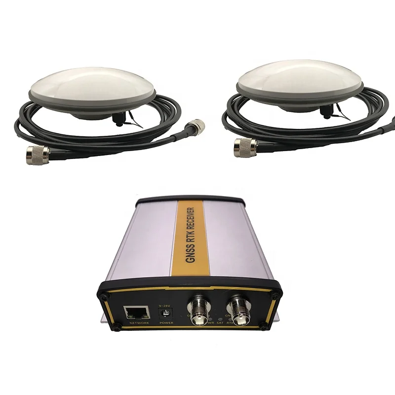
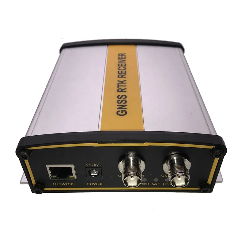
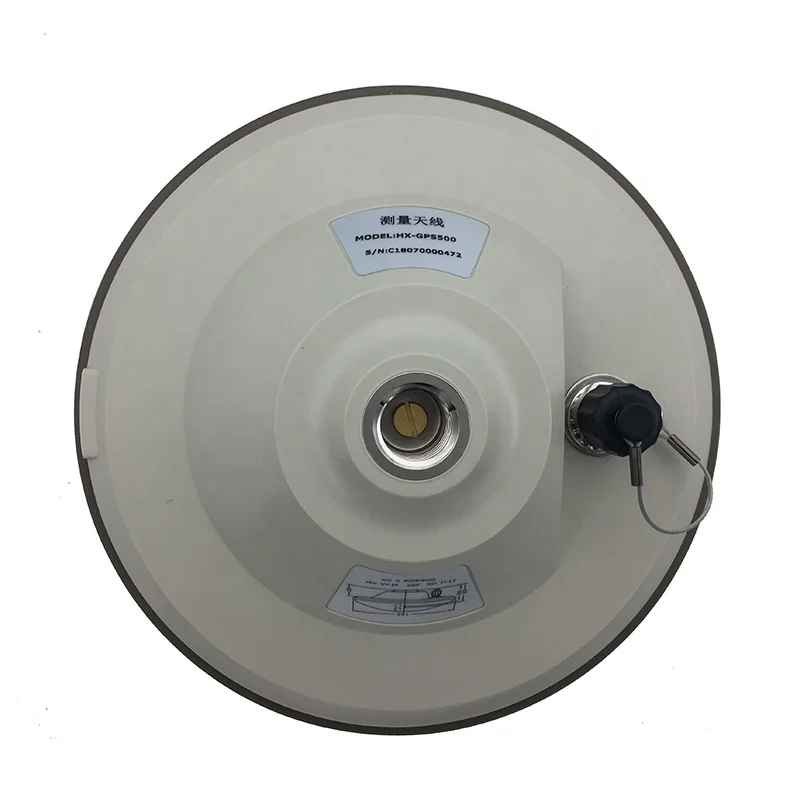
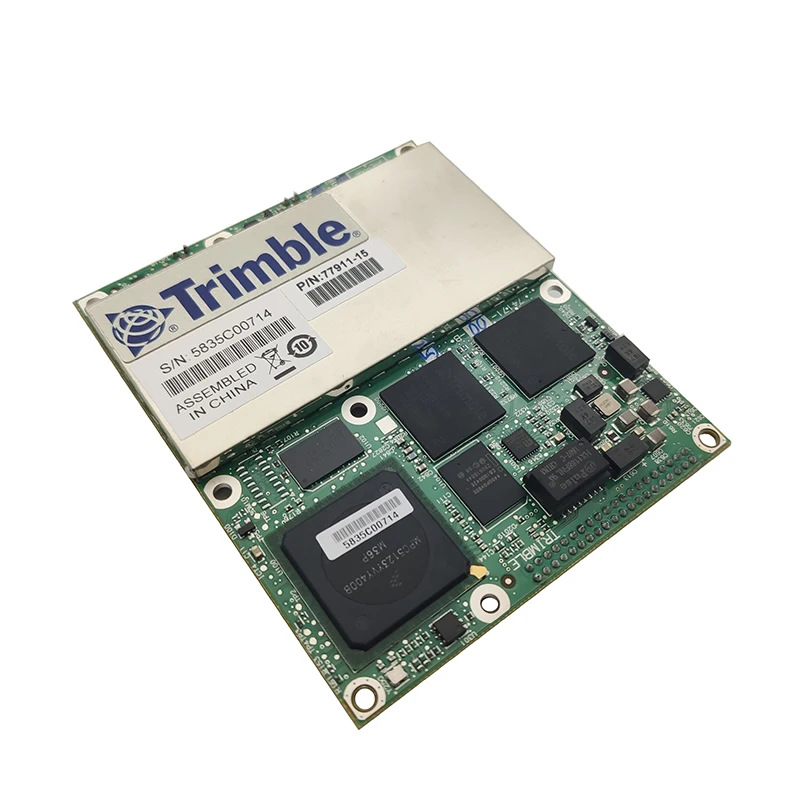
Trimble BD982 GNSS receiver RTK with 2pcs Harxon GPS500 antenna High precision measuring survey GPS l1 l2/GLONASS/Galileo/Beidou
- Category: Other Test Instruments >>>
- Supplier: Shenzhen Yimadangxian Electronic Technology Co. Ltd.
Share on (62551310445):
Product Overview
Description
Package list:


TNC-TNC cable is 5m by default, please contact us if you need other lengths.
The BD982 GNSS system is a single-board solution for precise positioning and heading. The product supportst the latest GNSS signals and provides a multistar base-line RTK for remote base stations between two connected antennas. With the BD982, OEMs and system integrators can ensure that their investments are robust both now and in the future. BD982 GNSS supports GPSL1 / L2 / L5 and GLONASS L1 / L2 signals. In addition. In support of this initiative, the new BD982 tracks experimental satellites GIOVE-A and GIOVE-B for signal evaluation.
By using OMNISTAR's VBS, XP, G2, and HP service options, the BD982 can deliver varying levels of GNSS performance down to the sub-meter scale. Even base stations can do the same.
The main performance characteristics:
Dual antenna input for precise heading calculation;
Support multi-star GNSS
Support OmniSTAR VBS / XP / G2 / HP;
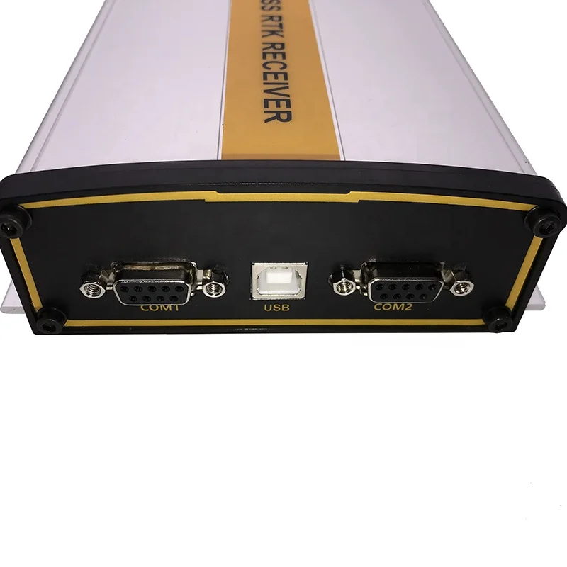
Flexible RS232, USB, Ethernet or CAN
interface;
Centimeter level positioning accuracy
The main performance characteristics:
Product Description BD982 GNSS receiver module
.
Technical specifications:
• Positioning antenna based on Maxwell 6 chip with 220 channels:
- GPS: Concurrent L1 C / A, L2E, L2C, L5
- GLONASS: Concurrent L1 C / A, L1 P, L2 C / A, L2 P
- SBAS: Concurrent L1 C / A, L5
- GIOVE-A: Concurrent L1 BOC, E5A, E5B, E5AltBOC1
LED Driver Support............................................ .. .... .......... .3
(Display power, satellite tracking and differential data)
Positioning specifications:
Mode precision 4 delay 5 highest frequency
- GIOVE-B: Concurrent L1 CBOC, E5A, E5B, E5AltBOC1
- GALILEO: closed 2
• Vector antennas based on a second Maxwell 6 chip with 220 channels:
Single Baseline RTK
(<30km)
8 mm + 1 ppm Level <20 ms 50 Hz
15 mm + 1 ppm vertical
- GPS: Concurrent L1 C / A, L2E, L2C
- GLONASS: Concurrent L1 C / A, L1 P, L2 C / A, L2 P
• Advanced Maxwell custom GNSS technology
• High-precision multi-correlated GNSS pseudorange measurements.
• Unfiltered with low noise, low mulit-error, low time-domain correlation, and high dynamic response
Smooth pseudo-range measurement data.
• Low-noise GNSS carrier phase measurement at 1 Hz bandwidth with accuracy of <1 mm.
• Signal-to-noise ratio reported in dB-Hz.
• Proven Trimble low elevation tracking technology.
• Initialization time 3 usually <10 seconds
• Initialization Reliability 3 Typically> 99.9%
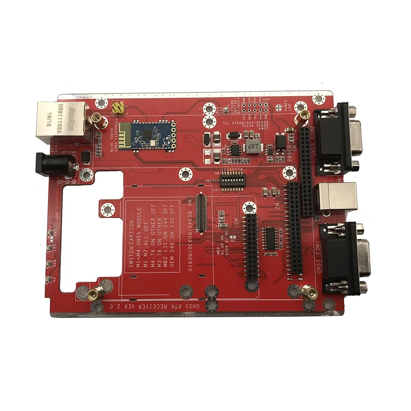
• 1 USB port
• 1 CAN port
• 1 LAN Ethernet port:
- Supports connection to 10BaseT / 100BaseT adaptive networks.
- All functions can be executed in parallel through a single IP address, including the WEB GUI and the original
data flow.
- Support for the following network protocols:
HTTP (WEB Graphical User Interface)
NTP server
NMEA, GSOF, CMR over TCP / IP or UDP
NTripCaster, NTripServer, NTripClient
mDNS / uPnP service lookup
Dynamic DNS
eMail notification
Web links to Google Earth
Connect to external modem via PPP protocol
• 4 RS232 interfaces:
- Baud rate up to 460,800
• 1 Hz, 2 Hz, 5 Hz, 10 Hz, 20 & 50 Hz Positioning Output (depending on installation options).
• Original measurement & position output up to 50 Hz:
Reference output.......................... CMR, CMR +, RTCM 2.1, 2.2, 2.3, 3.0, 3.1
Navigation output ... ... .... ... .... ASCII: NMEA-0183 GSV, AVR, RMC, HDT,
VGK, VHD, ROT, GGK, GGA, GSA, ZDA, VTG, GST, PJT,
PJK, BPQ, GLL, GRS, GBS and Binary: Trimble GSOF
• controlling software:
- HTML web browser, IE7.0 or higher
- Firefox 3.5 or higher
- Safari 4.0
- Opera 9
- Google Chrome
• 1 pulse output per second.
• Support event tag input.
© 2012 Tianbao Navigation Co., Ltd. All rights reserved. Trimble and the Globe & Triangle logo are trademarks of Trimble Incorporated in the U.S. Patent and Trademark Office and other countries.
Trademark. Maxwell is a trademark of Tianbao Navigation Co., Ltd. All other trademarks are the property of their respective owners. (02/12)
DGPS 0.25 m + 1 ppm Level <20 ms 50 Hz
0.50 m + 1 ppm vertical
SBAS6 <5 m 3DRMS <20 ms 50 Hz
Heading specifications:
Baseline accuracy 4 The highest frequency
2 m <0.09o 50 Hz
10 m <0.05o 50 Hz
Physical and Electrical Characteristics:
Size, ..., ..., ..., ..., ..., ..., ..., .... 100 mm X 84.9 mm X 11.6 mm
Power Consumption, ..., ..., ..., ..., ..., ..., ..., ..., ..., ..., ..., ..., 3.3V DC +5% / - 3%
Usually 2.1W (L1 / L2 GPS)
Usually 2.3W (L1 / L2 GPS and G1 / G2 GLONASS)
Weight, ..., ..., ..., ..., ..., ..., ..., ..., ..., ... 92 grams
Connector
I / O, ..., ..., ..., ..., ..., ..., ..., ..., ... ..... .40 pin plug
Antenna,...,................. 2 x MMCX socket
Environmental Features 7:
temperature
Operating -40 ° C to +75 ° C
Storage -55 ° C to +85 ° C
Vibration MIL810F, custom
Work: Random 6.2 gRMS
Survival: Random 8 gRMS
Mechanical impact MIL810D
Work: ± 40 g
Survival: ± 75 g
Ordering Information:
The BD982 GNSS offers a variety of configurations up from the L1 DGPS
The evaluation kit includes the interface board and power supply
1 Support for Galileo GIOVE-A and GIOVE-B test satellites is to use non-restricted information in the public domain and is intended for signal evaluation.
2 Native hardware follows the Galileo OS SIS ICD, Issue 1, Rev. 1, Sep 2010. However, at the time of writing this article, the EU has not yet announced the application for a permit. Therefore, to comply with ICD copyright / intellectual property rights,
All Galileo firmware / hardware features have been disabled. Depending on the circumstances of the permit, future upgrades may support all of Galileo's satellite systems
Function (L1 CBOC, E5A, E5B, E5AltBOC), and this upgrade will be subject to additional fees.
3 May be affected by atmospheric conditions, signal multipath and satellite geometry. Initial reliability is continuously monitored to ensure the best possible quality.
4 1 sigma level
5 at maximum output rate. .
6 Depends on the performance of the SBAS system.
7 Depends on the proper mounting / packaging design.
We Recommend

Flange Connection Liquid Closed-loop Sampling System Device
US $46.00-$216.00

Ce Rohs DY32 Digital Lux Light Meter Lumen Meter Quantum Meter
US $9.95-$13.99

DO-957 Water Testing Meter low cost dissolved oxygen sensor
US $58.00-$66.00

KH300T Hand-held Digital Paperless Temperature Recorder
US $400.00-$1200
New Arrivals
New products from manufacturers at wholesale prices


