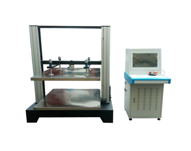
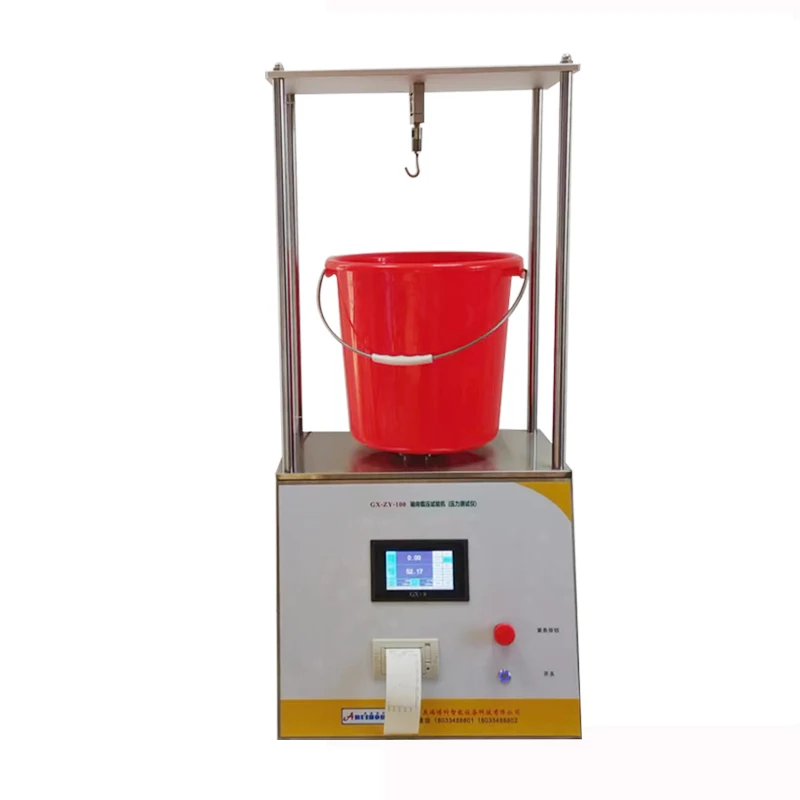
Модель: DL313C-13-7T Машина Для Испытания На Прочность на сжатие поддонов оборудование для испытания фанеры и
16 000,00 $ - 18 000,00 $
Сохранить в закладки 1600520001477:
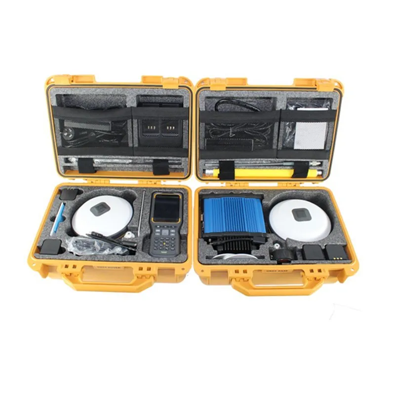
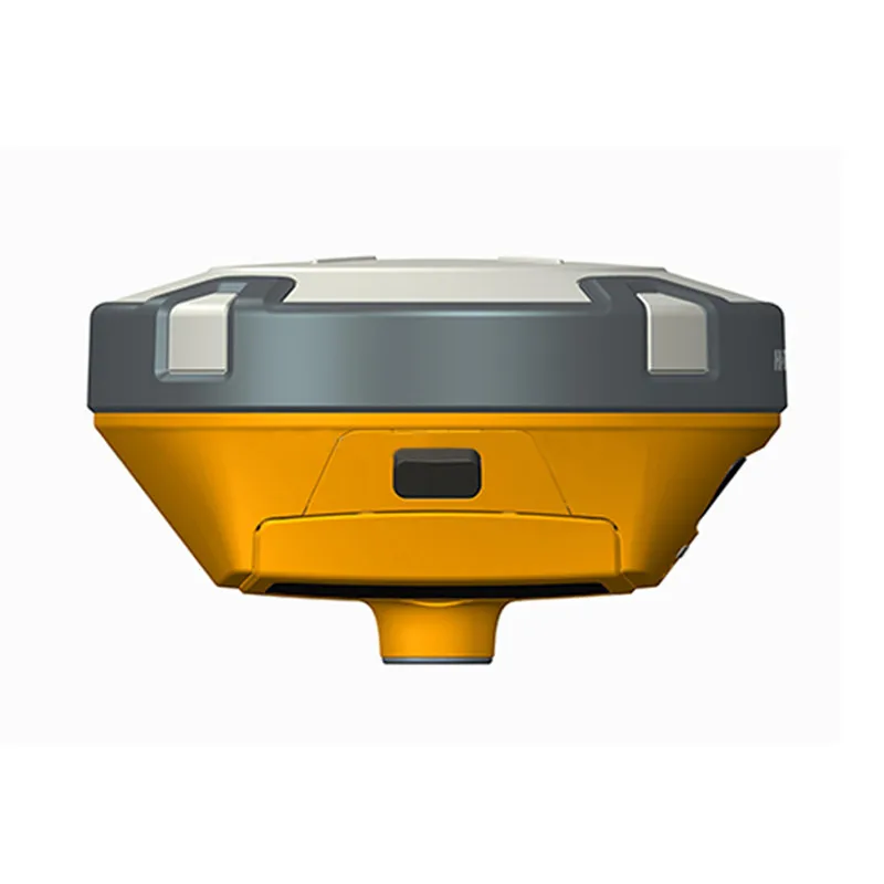
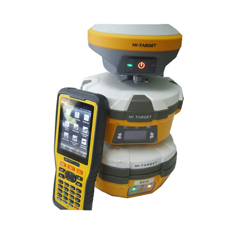
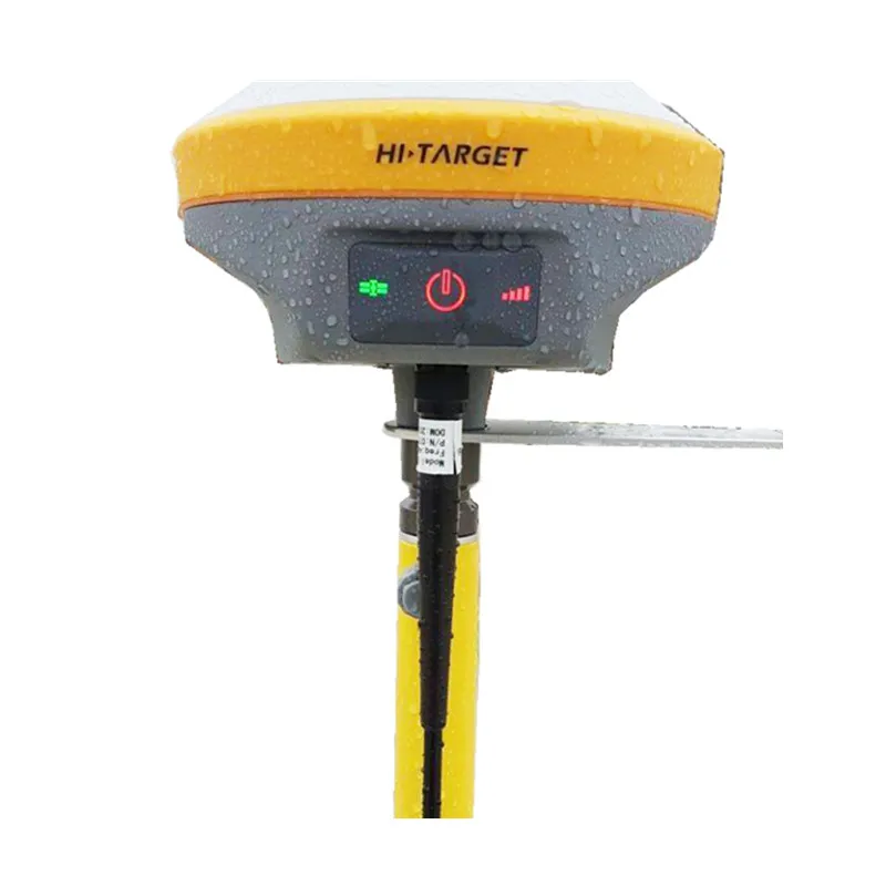
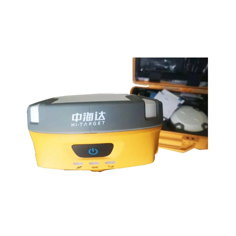
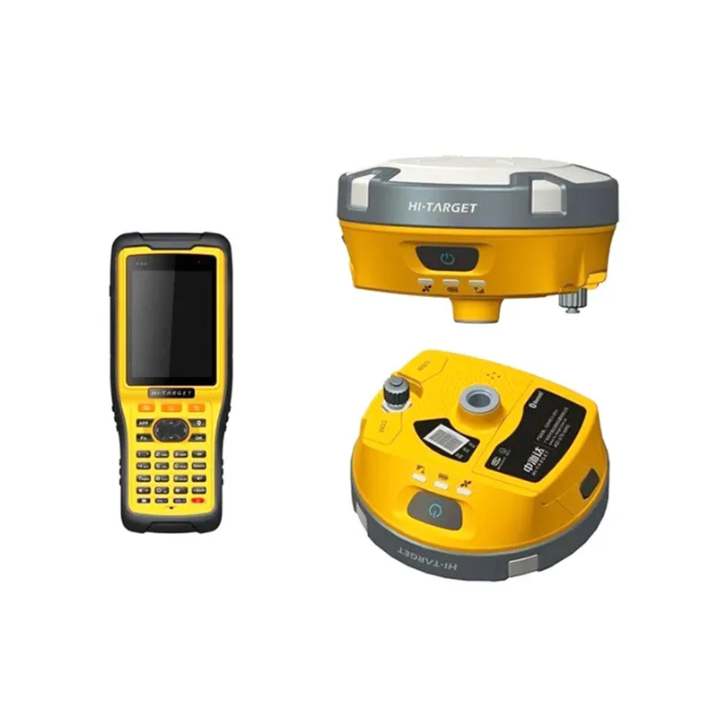
Low cost rtk gps gnss Hi Target V90 for land survey


| Satellites Signals Tracked Simultaneously | |
| Channel | 220 |
| GPS | Simultaneous L1C/A, L2C,L2E, L5 |
| Glonass | Simultaneous L1C/A,L1P,L2C/A(Glonass M only), L2p |
| SBAS | Simultaneous L1C/A, L5 |
| Galileo | Simultaneous L1,BOC,E5A,E5B, E5AltBOC1 |
| BDS | B1, B2 |
| QZSS | L1C/A, L1SAIF, L2C, L5 |
| Static and Fast static Gnss Surveying | |
| Horizontal | 2.5mm+0.5ppm RMS |
| Vertical | 5mm+0.5ppm RMS |
| Post Processing Kinematic Gnss Surveying | |
| Horizontal | 1cm+1ppm RMS |
| Vertical | 2.5cm+1ppm RMS |
| initialization time | Typically 10 minutes for base while 5 minutes for rover |
| initialization reliablity | Typically>99.9% |
| Real time Kinematic (PPK/Stop & Go)GNSS Surveying | |
| Single Baseline | |
| Horizontal | 8mm+1ppm RMS |
| Vertical | 15mm+1ppm RMS |
| Network RTK | |
| Horizontal | 8mm+0.5ppm RMS |
| Vertical | 15mm+0.5ppm RMS |
| initialization time | Typically<8 seconds |
| initialization reliablity | Typically>99.9% |
| Code differential Gnss postioning | |
| Horizontal | 25cm+1ppm RMS |
| Vertical | 50cm+1ppm RMS |
| SBAS3 | 0.50m Horizontal, 0.85m Vertical |
| Network Communication | |
| Full integrated, fully sealed internal WCDMA, compatible with GPRS, GSM WIFI frequency is 2.4G, supports the standard protocol 802.11b/g/n Network RTK(via CORS) range 20-50km | |


With a hi-tech, fully integrated design, the conveniently sized V90 is one of the most flexible choices for any measuring task. Built-in Linux operating system, pre-loaded multiple smart applications such as tilt surveying, electronic bubble calibration, NFC , V90 GNSS system provides surveyor industry-leading GNSS solutions.
iHand30 Controller:
Default Configuration
The iHand30 is designed for intelligent RTK with NFC sensor, a durable keyboard,ultra-long battery life and sensitive touchscreen,preinstalled free and intelligent Hi-Survey software. Hi-Survey software is the first high-precision survey software of Hi-Target running on the And roid platform,supports tilt survey and electronic bubble, can perfectly cooperate with V90.


Q1. Are you a factory or a trading company?
A: We are an industrial and trade integrated enterprise.
Q2.What kind of products do you offer?
A:We supply pll kinds of surveying products, including total station, electronic theodolite, electronic distance meter, automatic level, laser level, reflector prism, surveying accessory, GPS receiver, mapping software, etc.
Q3.How can I get the quotation or send my inquiry to?
A: Send your inquiry to us by the inquiry from on the right-side or the bottom of this page.
Q4. How to ensure product quality?
A: We have a professional test team and test platform. We will perform functional tests before delivery and provide a 90-180 day warranty.
Q5.How is the price?
A:As we believe the quality is the most important,we will provide the best quality products we can with reasonable price.
Q6.Could I get samples?
A: Yes,we have materials in stock to help you to get the samples as soon as we can.
Q7. Delivery time?
A: Usually, if you need more than one sample, it takes about 4~7 working days. For batch orders, the delivery time is usually about 20~35 days according to the quantity and requirements of your order.

Новинки товаров от производителей по оптовым ценам