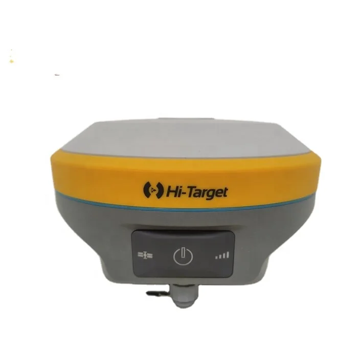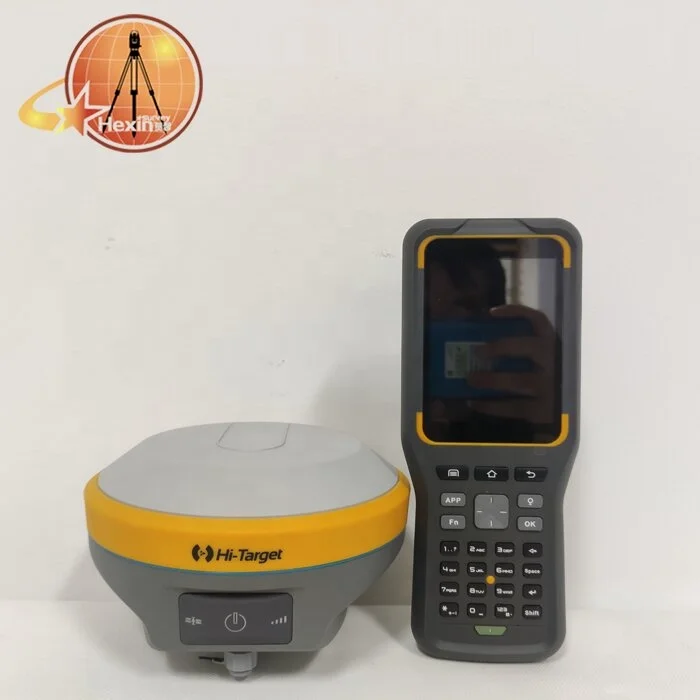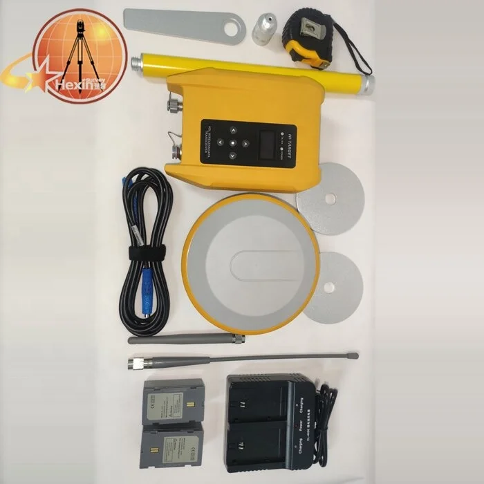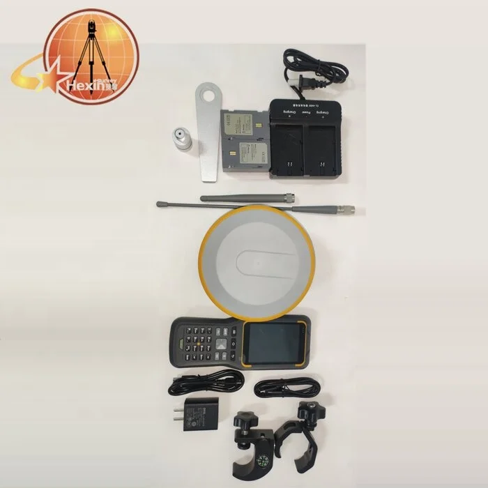
Высокопроизводительный инструмент наблюдения RTK GPS Hi target V90plus rover GNSS uav 800 каналов поддержка WebUI

Сохранить в закладки 1600789798879:


Цена:3 000,00 $ - 3 200,00 $*

Количество:

  • В избранное

Описание и отзывы

Характеристики


Product Description


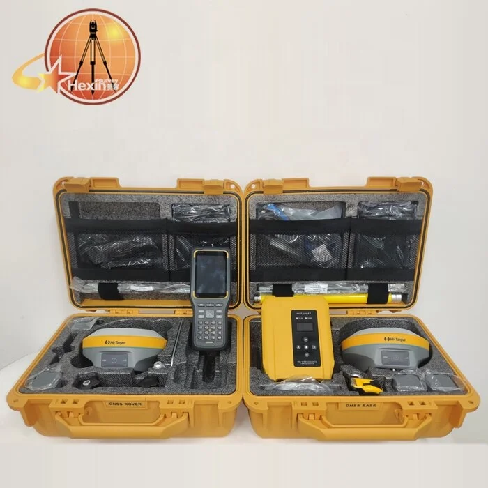
High performance RTK GPS Hi-target V90plus rover GNSS uav survey instrument 800 Channels support WebUI


Hi-target V90 PLUS GNSS RTK SYSTEM
With a hi-tech, fully integrated design, the conveniently sized V90 Plus is one of the most flexible choices for any measuring task. Built-in Linux3.2.0 operating system, pre-loaded multiple smart applications such as tilt surveying, electronic bubble calibration, NFC and voice DIY. The V90 Plus GNSS system provides surveyor industry-leading GNSS operation.


Multi-constellation Tracking
*800 tracking channels
*NGS approved full-wave GNSS antenna
*Supports GPS, GLONASS, GALILEO, BDS, SBAS

*Supports a wide range of satellite signals
*A large receiving area designed for multipath mitigation
*Air dielectric is light and stable


Smart Application
*Offers tilt survey with a maximum tilt angle of 30 degrees
*Supports electronic bubble
*Intelligent voice assistance guides field operations. Voice can be DIY
*Standard Rinex data and HI-TARGET raw data recorded simultaneously


Optional Transceiver UHF Radio
*The transceiver UHF radio enables switchable working modes between base and rover
*Three types of internal UHF radio provide different frequencies based on users requirements. The SATEL internal UHF radio is compatible with other radios


Multi-network Connection
*Supports GPRS, GSM and WCDMA
*Supports WIFI

Powerful Battery
*Powered by high-capacity (5000mAh) Li-ion battery to ensure full day operation
Rugged Design
*IP67 dustproof and waterproof
*Able to survive a 2-meter natural fall onto concrete


iHand30 Professional Field Controller
The iHand30 is a rugged field controller that is designed for data collection and GNSS device control. Based on the Android operating system, it is compatible with Hi-Target professional software and third-party Android software. Combining the physical keyboard with a touchscreen, it can boost efficient field work and provide express solutions for users.

KEY FEATURES
*Ergonomically designed, lighter and easy to hold.
*Industrial-grade protection that can withstand tough environments.
*Convenient wireless data transmission via Blue tooth, Wi-Fi and 4G.
*Quick charge, with large capacity lithium battery to ensure all day work.


Hardware Configuration
OS:Android 6.0
Processer:MTK6737, 1.5GHz, 4 core
Storage:RAM 2GB 16GB(up to 32GB extension Micro-SD)
Display:3.7’’, 640 x 480, sunlight readable 
Camera:8MP, tag available
Sensors:G-sensor, E-compass, barometer, light-field sensor, gyro


Communication
Cellular mode:Dual SIM card, dual stand-by Cellular network:4G (TDD-LTE, FDD-LTE, WCDMA, GPRS)
Wi-Fi:IEEE 802.11b/g/n,2.4GHz/5GHz Blue tooth:V2.0/4.0
USB:Type-C, supports OTG NFC


Physical
Weight:440g(within battery)
Size:208mm*83mm*24mm
Operating temperature:-20℃ ~ +60℃
Storage temperature:-30℃ ~ +70℃
Free fall:1.2m
Water/dustproof:IP67
GNSS Features
GNSS:GPS, GLONASS, AGPS, 20 channelsUpdate rate:1Hz
Power Supply
Battery:Removable 3.7V lithium battery, 5200mAh
Duration:15 hours


iHand55 Professional Field Controller
The iHand55 Handheld Controller is a professional field controller with a big vision.More features of the latest Hi-Survey Road Software contribute to achieving high intelligence. Keeping robust and reliable in fieldwork under any conditions,iHand55 is a perfect choice for your survey work.

KEY FEATURES
*5.5” sunlight readable display capacitive touch screen for fingers or
stylus.
*Alphanumeric full keyboard designed, convenient for different measurement application scenarios.
*Quick charge with internal lithium battery to improve efficiency under long time job.
*Android 10.0 operating system equipped to maintain the productivity of numerous survey projects and data.


Hardware Configuration
OS :Android 10
Processer:CPU: 8 core; 2.0 GHZ
Storage:2 GB RAM+16 GB ROM; T-Flash memory card, up to 128GB
Display:5.5” bright Outdoor Color capacitive touch screen (with touch pen, can be operated with gloves)
Input Configuration:Physical full keyboard, number / letter 
separate,
professional custom smart input method
GNSS Features
GNSS:GNSSantenna, GPS, GLONASS, BDS, AGPS, 20 channels


Communication Interface
Cellular mobile: 4GDual SIM
WiFi:IEEE 802.11 b/g/n, Wapi, AP 
Blue tooth:Built-in Blue tooth (2.1+4.0) NFC
USB:USB, TypeC interface, OTG
Power Supply
Battery:7500 mAh internal 
Duration:14 hours


Application
Camera:Built-in 13 million pixel camera 
Flash:Highlight Flash LED flash(support flashlight function)
Sensor:gravity sensor, compass, light sensor, gyroscope


Physical Features
Weight:480g(within battery)
Size:236 mm*85 mm*25 mm
Operating temperature:-20℃ ~ +60℃
Storage temperature:-30℃ ~ +70℃ 
Free fall:1.2 m
Shock and vibration:MIL-STD-810H


Two hand thin Professional Field Controllers are optional


Hi-Survey Road
Survey Data Collection Software
The Hi-Survey Road is an android software that is designed for all types of land survey and road engineering projects in the field. It is compatible with Hi-Target professional controllers, android phones,tablets and other third-party android devices. It is a sleek and easy-to-use software that supports the operating of big data with build-in tools. With customized industrial
application solutions, more possibilities are created for users.


*Various algorithms to achieve high accuracy in corresponding measuring circumstances with a better reliability.(Tilt survey,quasi-dynamic technology, detail survey,timing static survey, etc.)
*Express interacting functions to greatly improve the work efficiency.(Cross-projects points selection,QR code scanning,multi-format support, etc.)
*Integrated professional measurement functions for engineering
applications.(Road functions, DTM surface operations,Google online base map, 3rd party rangefinders, etc.)


Specification


PERFORMANCE SPECIFICATIONS


SATELLITE SIGNALS TRACKED SIMULTANEOUSLY
Channels:800
GPS:Simultaneous L1C/A, L2C, L2E, L5
GLONASS:Simultaneous L1C/A, L1P, L2C/A (GLONASS Monly), L2P 
Galileo:Simultaneous E1 BOC, E5A, E5B, E5AltBOC1 
BDS:B1, B2                            SBAS:L1 C/A, L5
POSITIONING PERFORMANCE
Hot Start:Typically< 10s
Cold Start:Typically< 15s
High-Precision Static
Horizontal:2.5 mm + 0.1 ppm RMS
Vertical:3.5 mm + 0.4 ppm RMS
Static and Fast Static
Horizontal:2.5 mm + 0.5 ppm RMS
Vertical:5mm + 0.5 ppm RMS
Post Processing Kinematic (PPK /
Stop & Go) GNSS Surveying
Horizontal:8mm+1ppm RMS 
Vertical:15mm+1ppm RMS
Initialization time:Typically 10 minutes for base while 5 minutes for rover 
Initialization reliability:Typically > 99.9%
Real Time Kinematic(RTK) Surveying Network Communication Single Baseline

Horizontal:8mm+1ppm RMS 
Vertical:15mm+1ppm RMS

Network RTK
Horizontal:8mm+0.5ppm RMS 
Vertical:15mm+0.5ppm RMS
Initialization time:Typically 2-10s
Initialization reliability:Typically >99.9%
Code Differential GNSS Positioning
Horizontal:25cm+1ppm RMS 
Vertical:50cm+1ppmRMS
SBAS 3:0.50m Horizontal, 0.85m Vertical
COMMUNICATION
Network Communication
Fully integrated, fully sealed internal WCDMA, compatible with GPRS, GSM Wifi frequency is 2.4G, supports the standard protocol 802.11b/g/n Network RTK (via CORS) range20-50km

Hi-Target Advanced Internal UHF Radio
Frequency:403-473MHz 
Transmitting power:1W, 2W, 4W adjustable 
Transmitting linkrate:9.6Kbps,19.2Kbps 
Support multiple protocols 
Working range:3-5km typically, 8-10km optimal

SATEL Internal UHF Radio (Optional)
Frequency:403~473MHz 
Transmitting power:0.1W ~1W adjustable 
Transmitting speed:9.6Kbps,19.2Kbps 
Supports multiple communication protocol 
Working range:3~5km typically, 8~10km optimal

HI-TARGET External UHF Radio
Frequency:460MHz with 116 channels
Transmitting power:5W, 10W, 20W, 30W adjustable 
Transmitting speed:Up to 19.2Kbps 
Working range:8~10km typically, 15~20km optimal

Advanced External UHF Radio (Optional)
Frequency:410~470MHz 
Transmitting power:5W/25W 
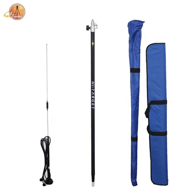
Compatible with third party radio 
Working Range:8~10km typically, 15~20km optimal


HARDWARE 
Physical
Dimensions (W x H):153mm x 83mm 
(6.02inch x 3.27inch) 
Weight:950g (2.09lb) without internal battery 
Operation temperature:-40℃~+75 ℃(-40 ℉ ~+167℉)
Storage temperature: -55℃~+85 ℃(-67 ℉ ~+185 ℉)
Humidity:100%,condensing 
Water/dustproof:IP67 dustproof, protected from temporary immersion to depth of 1m (3.28ft) 
Shock and vibration:Designed to survive a 2m(6.56ft) natural fall onto concrete


Electrical
Power 6V to 28V DC external power input Power consumption ≤ 3.5W Automatic switching between internal power and external power Rechargeable, removable 7.4V, 5000mAh Lithium-ion battery in internal battery compartment

Internal Battery Life
Static more than 12 hours
RTK Rover (UHF/GPRS/3G) 10 hours 
RTK base more than 8 hours

I/O Interface
Blue tooth, NFC,standard USB2.0port ,TNC antenna connector RS232 serial port,DC power input (5-pin),
MicroSD card port
Support
Tilt Survey System Electronic Bubble&WebUI

SYSTEM CONFIGURATION
Data storage:16GB Internal storage+ Internal Micro SD Card memory (Support up to 32GB extension) 
Record GNS and Rinex format simultaneously


Terms of payment
Our usual terms of payment are as follows:T/T, Western Union, Paypal , etc.If there are other payment methods you prefer, we can discuss them in detail.


Packing & Delivery


To better ensure the safety of your goods, professional, environmentally friendly, convenient and efficient packaging services will be provided.


Related Product


Company Profile


With 10 years' experience in geodetic surveying and cadastration surveying, we are a professional and leading enterprise in the
surveying industry in Mainland China. We specialize in the R&D and manufacturing and sales of all kinds of surveying products,including total station, electronic theodolite, electronic distance meter, automatic level, laser level,reflector prism, surveying accessory, GPS receiver, mapping software, etc.
The marketing model advocated by us is not a simple sense of
"selling products", instead, pre-sales service, services during operation and after-sales service are integrated in entire operating activities. It makes the customers feel that they purchased not only a commodity, but also a professional service.
We welcome new and old customers from all walks of life to contact us for future business relationships and achieving mutual success!


Packaging & Shipping


FAQ


1:How to turn off voice broadcast of receiver?
a. Enter the WEBUI, find the voice switch in the settings page and turn it off.
b. Controller Software→Device→Device Setting, turn off the “enable voice”, and click “OK”.

2:Can the base station and rover station be interchangeable?
The difference between the rover station and the base station is that the accessories are different, the function and hardware configuration are the same. You can use the controller to choose the working mode of the device and set it as the base station or rover station.
3:What is CORS?
CORS is called a continuous operating reference station system. It can be understood as a base station that is erected at a fixed known point and works continuously for 24 hours, and sends its own data to a specific server through the network.
The use of CORS operation eliminates the need for a base station, and CORS is equivalent to a base station in a normalnetwork operation.
4: What services can we provide?
Accepted Delivery Terms: FOB,CIF,EXW
Accepted Payment Currency:USD
Accepted Payment Type: T/T,PayPal,Western Union


If you have any questions,please click on the text or the picture below to contact us.


Похожие товары

Новые поступления

Новинки товаров от производителей по оптовым ценам