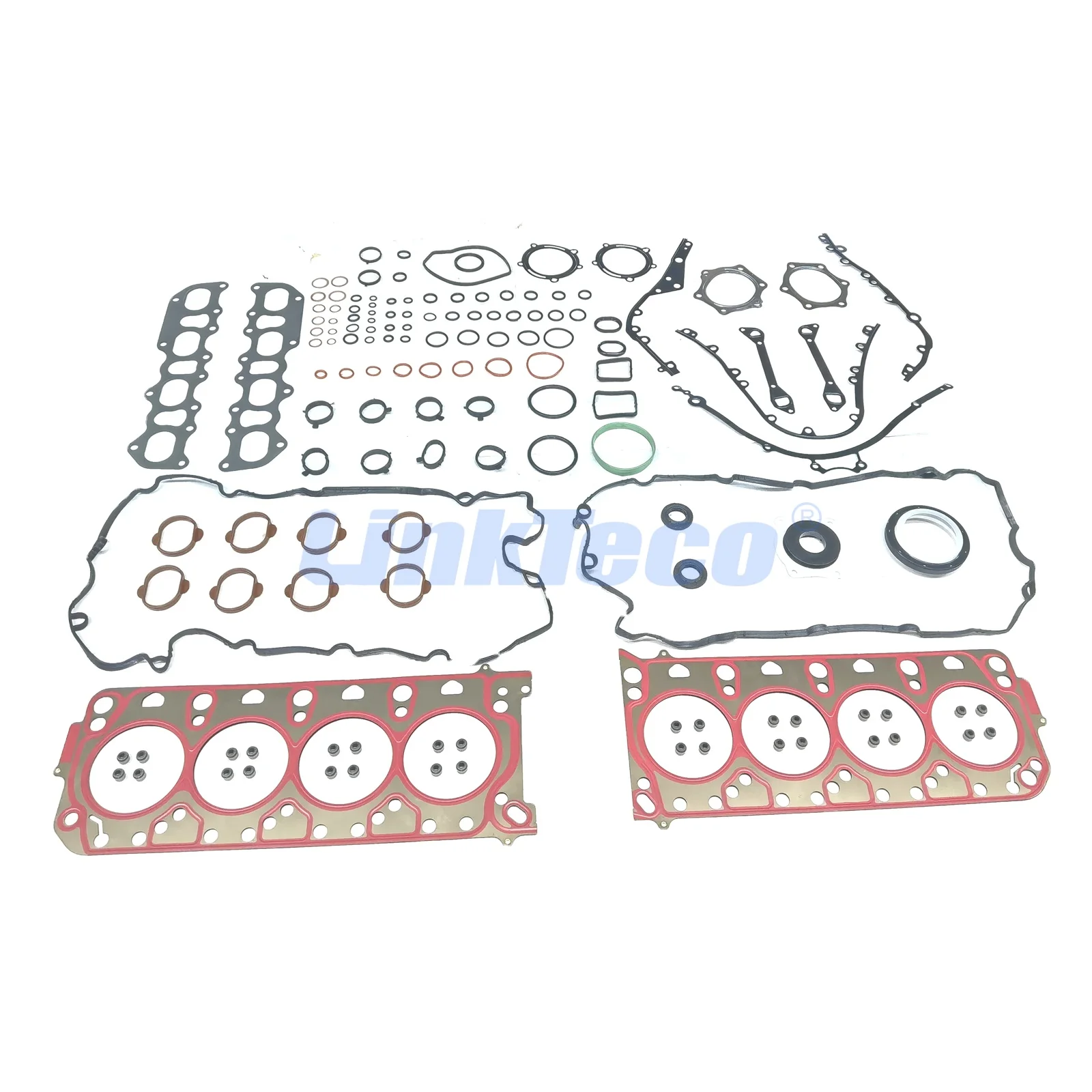
Новый двухслойный атласный тюрбан из полиэстера, жаккардовая ткань durag, пользовательская головная шапочка для волос, Оптовая продажа
1,60 $ - 2,20 $


Сохранить в закладки 1601010113622:
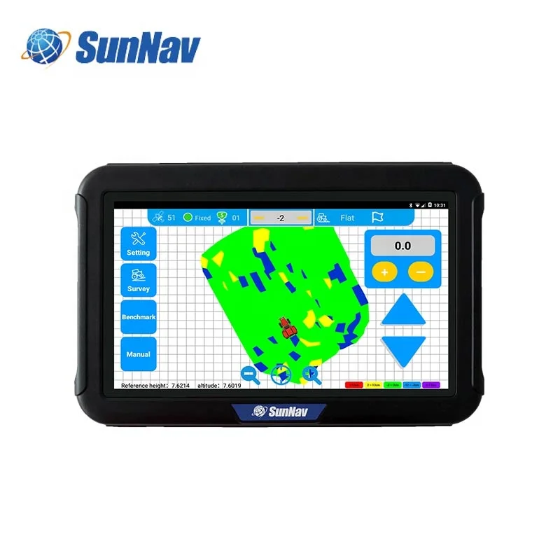
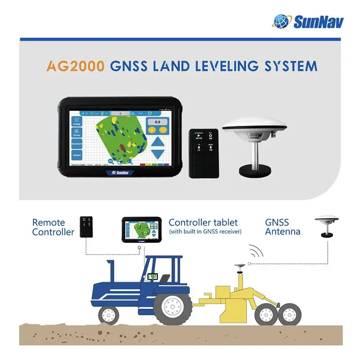
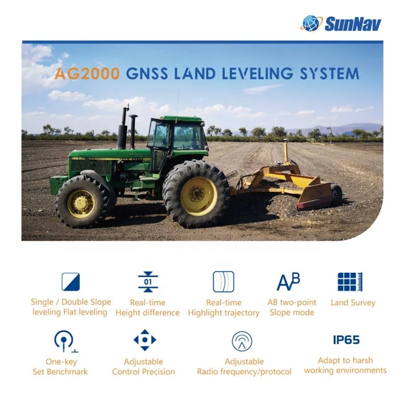
SunNav AG2000M GPS Land Leveling System

 | The high-precision and high-performance GNSS Land Leveling system is independently developed by SunNav.Widely used in precision agriculture for wasteland restoration,land remediation and leveling, slope land conversion, paddy field leveling,dry land leveling and other large areas land leveling. It can also be used for water conservancy,airport construction and large-scale stadium construction. |
Features:
| 1. Display real-time height difference information during leveling 2. Support single slope leveling, double slope leveling and flat leveling, easy to operate 3. Functions: land survey function, length and area measurement 4. Support one-key set benchmark, fast and efficient 5. Adjustable control precision, adjustable solenoid valve response sensitivity 6. Adjustable radio frequency/protocol, avoid radio signal interference, compatible with multiple brands of base stations 7. Adapt to harsh working environments, and easily cope with various working conditions 8. Compact fanless design, reasonable internal structure design, good heat dissipation |  |


| AG2000M | AG2000MS | |
| console tablet System | System:Android 6.0/9.0 | |
| Processor: 4 cores | ||
| Main frequency:1.2GHz | ||
| Onboard:2G RAM | ||
| Storage:16G ROM | ||
| Network | 2.4GHz | |
| WiFi | ||
| IEEE 802.11 b/g/n BT 4.0 | ||
| BLE 4G/LTE | ||
| Built-in speaker | ||
| Electrical Parameters | Power consumption: ≤12.0W | |
| Power supply voltage: DC 12V | ||
| I/O INTERFACE | RS-232*2 | |
| RS-485*1 | ||
| USB2.0*1 | ||
| DCIN*1 | ||
| Audio output*1 | ||
| DI*2,DO*2 | ||
| 12VDCOUT*1 | ||
| GNSS | 1408 channels | |
| BDS:B1I/B2I | ||
| GPS:L1/L2 | ||
| GLONASS:L1/L2 | ||
| Galileo:E1/E5b | ||
| QZSS:L1/L2 | ||
| Cold start time:60s | ||
| RTK initialization time:10s | ||
| Initial reliability:0.999 | ||
| Accuracy | leveling working accuracy:±2cm | |
| Single point positioning(RMS):H 1.5m, V 2.5m | ||
| DGPS accuracy(RMS):H 0.4m,V 0.8m | ||
| RTK(RMS):H 1cm+1ppm,V 1.5cm+1ppm | ||
| Data Transfer | Data Format:NMEA-0183 | |
| Refresh rate:1-10Hz optional | ||
| Differential format:RTCM3.2 | ||
| Baud rate:9600/38400/115200 | ||
| Radio protocol:TRIMATLK\\TRANSEOT | ||
| Frequency Range:410MHz-470MHz | ||
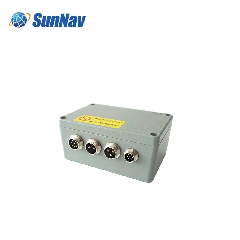
| Parameter Characteristics | Size:180mm*120mm*60mm | |
| Weight:1.2kg | ||
| Operating temperature:-20°C~+60°C | ||
| Indicator light: 3 | ||
| console tablet Physical Properties | Operating temperature: -20°C~+60°C | |
| Storage temperature: -30°C~+70°C | ||
| Physical size: (W*H*D): 281*181*42mm | ||
| Resolution: 1024*600P Support 5-finger touch | ||
| Screen size:10.1 inch | ||
| Tablet weight: 1.5kg | ||
| Tablet protection level: IP65 | ||
| Plate Shock and Vibration:MIL-STD-810 | ||
| Standard industrial grade waterproof connector(4 kinds of PIN definition) | ||
| SMA female*1 (4G) | ||
| TNC female*1 (GNSS) | TNC female*2 (GNSS) | |
| Physical Interface | GNSS Antenna interface:TNC connector*1 | TNC connector*2 |
| UHF Antenna interface:TNC connector*1 | ||
| Display interface: M16 aviation plug 8 cores*1 | ||
| Control line interface: M16 aviation plug 3 cores * 1 | M16 aviation plug 3 cores*2 | |
| Power interface: M16 aviation plug 2 cores | ||
| Handle interface: M12 aviation plug 7 cores | ||


 |
 |  |
 |  |


Новинки товаров от производителей по оптовым ценам