
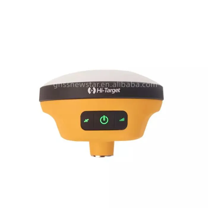
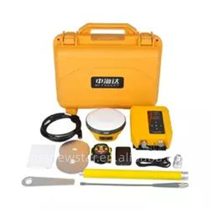
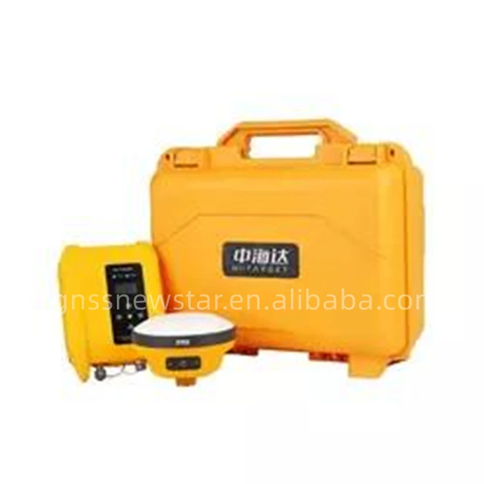
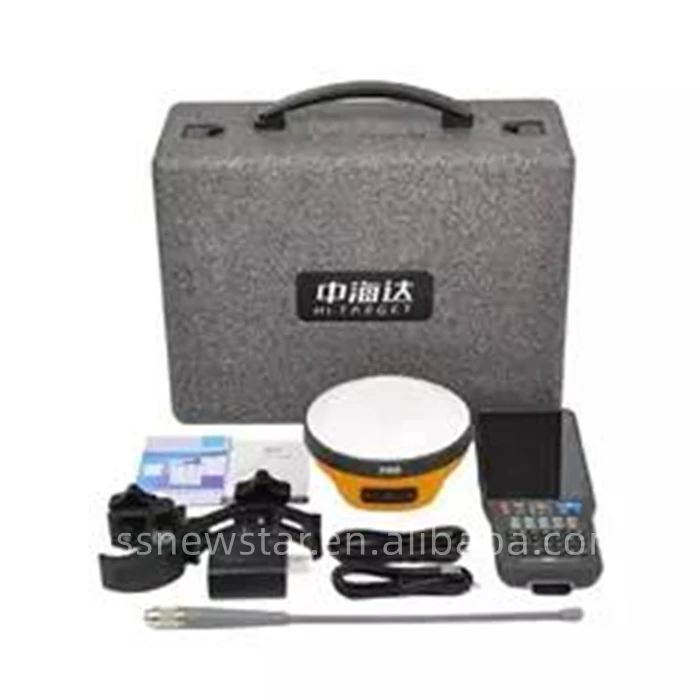
Hi TARGET GNSS RTK V200 for Land survey Surveying Instrument GPS RTK BASE AND ROVER GNSS NEW STAR
- Category: Other Measuring & Analysing Instruments >>>
- Supplier: Tianjin New Starr Technology Trade Co. Ltd.
Share on (1600625680480):
Product Overview
Description
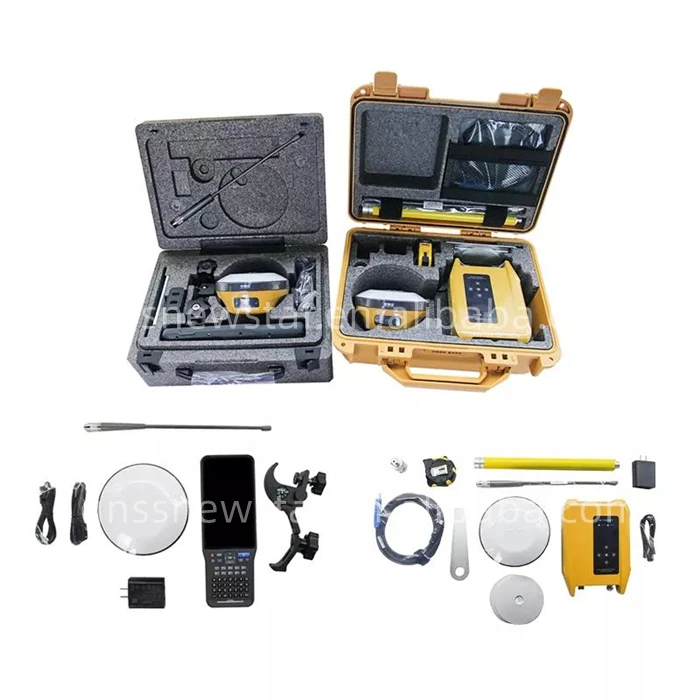
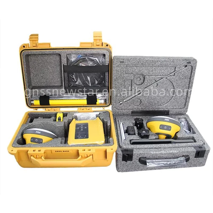
Product Description
Recommend Products

Specification
item | value |
Warranty | 1 |
Place of Origin | China |
Tianjin | |
Brand Name | Hi TARGET |
Model Number | V200 |
Specification | ||||||
800 Channels Land Survey Equipment Base and Rover Full Set High Target V200 | ||||||
GNSS configuration | Number of channels: 800 | |||||
BDS:B1 / B2 / B3 / B1C / B2a | ||||||
GPS: L1 / L2 / L5 / L2C | ||||||
GLONASS: L1 / L2 / L3 | ||||||
GALILIEO: E1 / E5 AltBOC / E5a / E5b / E6 | ||||||
SBAS: L1 / L5 | ||||||
QZSS: L1 / L2 / L5 / L6 | ||||||
IRNSS: L5 | ||||||
Output format | ASCII: NMEA-0183, binary code | |||||
Positioning output frequency | 1Hz~20Hz | |||||
Static data format | GNS, Rinex dual format static data | |||||
Difference format | CMR, RTCM2.X, RTCM3.0, RTCM3.2 | |||||
Network mode | VRS, FKP, MAC; support NTRIP protocol | |||||
operating system | Linux operating system | |||||
System Configuration | Start Time | 3 seconds | ||||
data storage | Built-in 8GB ROM, supports automatic storage of static data | |||||
High-precision static GNSS Surveying | Horizontal:2.5mm + 0.1ppm RMS Vertical:3.5mm + 0.4ppm RMS | |||||
Positioning Performance | Horizontal:2.5mm + 0.5ppm RMS Vertical:5mm + 0.5ppm RMS | |||||
Static and Fast Static | ||||||
Horizontal:8mm + 1ppm RMS | ||||||
Post Processing Kinematic (PPK / Stop & Go) | Vertical:15mm + 1ppm RMS | |||||
Initialization time:Typically 10 min for base and 5 min for rover | ||||||
Initialization reliability:Typically>99.9% | ||||||
Horizontal:±0.25m+1ppm RMS | ||||||
Code Differential GNSS Positioning | Vertical:±0.5m+1ppm RMS SBAS:0.5m (H), 0.85m (V) | |||||
Horizontal:8mm+1ppm RMS Vertical:15mm+1ppm RMS | ||||||
Real Time Kinematic (RTK) | Initialization time:Typically <10 seconds | |||||
Initialization time:Typically 99.9% | ||||||
Time to first Fix | Cold start:< 45 s Hot start:< 30 s Signal re-acquisition:< 2 s | |||||
Initialization reliability | >99.99% | |||||
Horizontal:RTK+10mm / minute RMS Vertical:RTK+20mm / minute RMS | ||||||
Hi-Fix② | ||||||
Additional horizontal pole-tilt uncertainty typically less than 8 mm +0.7 mm / °tilt (2.5cm accuracy in the inclination of 60°) | ||||||
Tilt Survey Performance | ||||||
Communication unit | Communication | Bluetooth:4.2 / 2.1+EDR, 2.4GHz | ||||
Wi-Fi:frequency 2.4GHz, Supports 802.11 b / g / n | ||||||
Frequency:410-470MHz Channel:116 (16 scalable) | ||||||
Internal UHF Radio | Transmitting power:0.5W / 1W / 2W adjustable | |||||
Supports multi-communication protocols:HI-TARGET, TRIMTALK450S, TRIMMARK III, TRANSEOT, SATEL-3AS, etc. | ||||||
Internal 7.4V / 6800mAh lithium-ion rechargeable battery | ||||||
Physical | Internal battery | RTK Rover (Network) for 12 hours. Static:up to 15 hours | ||||
Power consumption:4.2W | ||||||
External power | Dimensions (W×H):132mm×67mm | |||||
Charging:using standard smartphone chargers or external power banks. | ||||||
Weight:≤0.8kg (includes battery) | ||||||
Data storage:8GB ROM internal storage | ||||||
LED Lamp | Satellite, Signal, Power | |||||
Control Panel | Physical button | 1 | ||||
I / O Interface | 1 × USB port, Type C | OTG function, NFC IGRS, WebUI interaction, U disk firmware upgrade | ||||
1 × SMA antenna connector | ||||||
Output rate | 1Hz-20Hz. | |||||
Data Formats | Static data format | GNS, Rinex | ||||
Network model | VRS, FKP, MAC; supports NTRIP protocol | |||||
CMR& RTCM | CMR, RTCM 2.x, RTCM 3.0, RTCM 3.2 | |||||
Navigation outputs ASCII | NMEA-0183 | |||||
Water / Dustproof | IP67 | |||||
Environment | Shock and vibration | Designed to survive a 2m natural fall onto concrete | ||||
Humidity | 100%, condensing | |||||
Operation temperature | -30℃~+70℃ | |||||
Storage temperature | -40℃~+80℃ | |||||
Company Profile

Our Advantages

FAQ
1. who are we?
We are based in Tianjin, China, start from 2019,sell to Africa(20.00%),Central America(16.00%),Southern Europe(15.00%),Eastern Europe(8.00%),Southeast Asia(7.00%),Mid East(6.00%),Northern Europe(5.00%),South America(5.00%),Western Europe(5.00%),Oceania(5.00%),North America(5.00%),South Asia(2.00%),Eastern Asia(1.00%). There are total about 5-10 people in our office.
2. how can we guarantee quality?
Always a pre-production sample before mass production;
Always final Inspection before shipment;
3.what can you buy from us?
GPS,RTK,UAV,TOTALSTATION,GNSS RECEIVERS
4. why should you buy from us not from other suppliers?
Tianjin New Starr Technology Trade Co., Ltd. is an electronic product R&D and production-oriented trading company, specializing in the research and manufacture of high-precision GNSS motherboards and industrial
5. what services can we provide?
Accepted Delivery Terms: FOB,CFR;
Accepted Payment Currency:USD,CNY;
Accepted Payment Type: T/T,Credit Card,PayPal,Western Union;
Language Spoken:English,Chinese,Spanish
We Recommend


New Arrivals
New products from manufacturers at wholesale prices


