
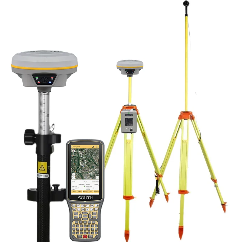
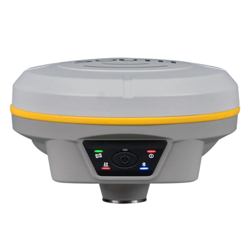
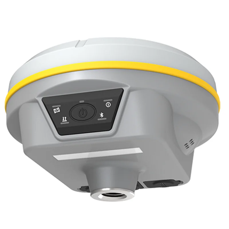
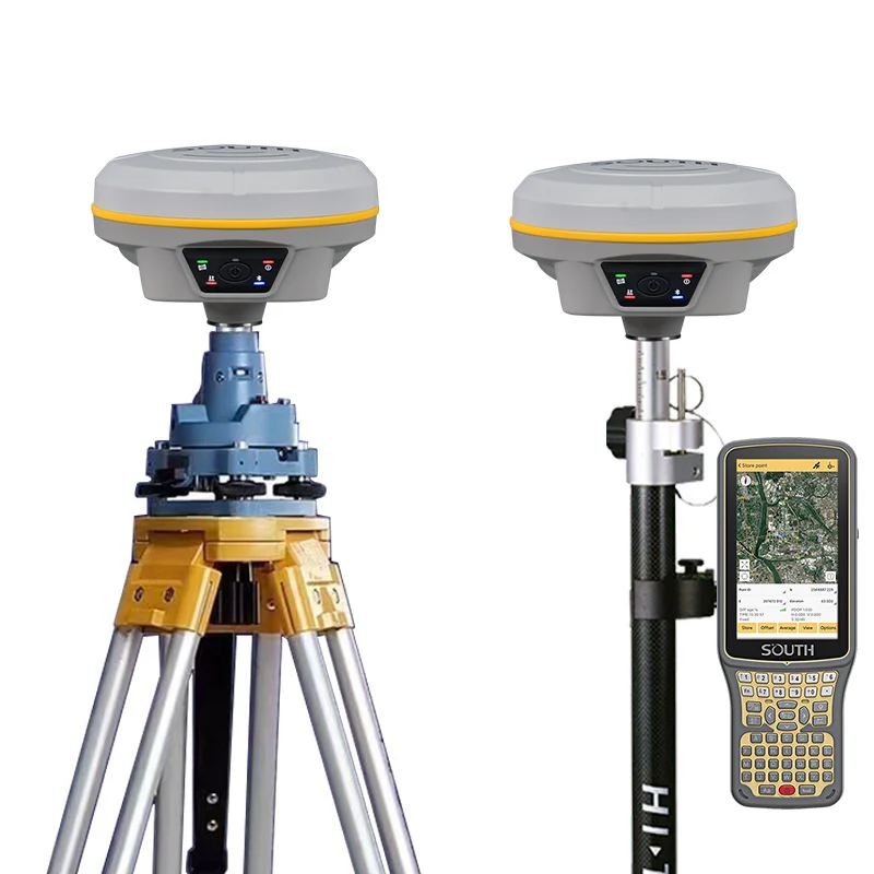
Professional high precision land surveying equipment Gps surveying instrument 2023 New cheap rtk GALAXY G3 gnss
- Category: Other Measuring & Analysing Instruments >>>
- Supplier: Chengdu Mingjun Trading Co. Ltd.
Share on (1600735829286):
Product Overview
Description
Specification
GNSS Features | Channels | 1598 |
GPS | L1, L1C, L2C, L2P, L5 | |
GLONASS | L1C/A,L1P,L2C/A,L2P,L3* | |
BDS | BDS-2: B1I, B2I, B3I BDS-3: B1I, B3I, B1C, B2a, B2b* | |
GALILEOS | E1, E5A, E5B, E6C, AltBOC* | |
SBAS(WAAS/MSAS/EGNOS/GAGAN) | L1* | |
IRNSS | L5* | |
QZSS | L1, L2C, L5* | |
MSS L-Band | BDS-PPP | |
Positioning output rate | 1Hz~20Hz | |
Initialization time | < 10s | |
Initialization reliability | > 99.99% | |
Positioning Precision | Code differential GNSS positioning | Horizontal: 0.25 m + 1 ppm RMS Vertical: 0.50 m + 1 ppm RMS |
Static(long observations) | Horizontal: 2.5 mm + 1 ppm RMS Vertical: 3 mm + 0.4 ppm RMS | |
Static | Horizontal: 2.5 mm + 0.5 ppm RMS Vertical: 3.5 mm + 0.5 ppm RMS | |
Rapid static | Horizontal: 2.5 mm + 0.5 ppm RMS Vertical: 5 mm + 0.5 ppm RMS | |
PPK | Horizontal: 3 mm + 1 ppm RMS Vertical: 5 mm + 1 ppm RMS | |
RTK(UHF) | Horizontal: 8 mm + 1 ppm RMS Vertical: 15 mm + 1 ppm RMS | |
RTK(NTRIP) | Horizontal: 8 mm + 0.5 ppm RMS Vertical: 15 mm + 0.5 ppm RMS | |
RTK initialization time | 2 ~ 8s | |
SBAS positioning | Typically < 5m 3DRMS | |
BANDA-L | Horizontal: 5-10cm (5-30min) Vertical: 10-30cm (5-30min) | |
IMU | Less than 10mm + 0.7 mm/° tilt to 30° | |
IMU tilt angle | 0° ~ 60° | |
Hardware Performance | Dimension | 130mm(W) ×130mm(L) × 80mm(H) |
Weight | 790g (battery included) | |
Material | Magnesium aluminum alloy shell | |
Operating temperature | -45℃ ~ +75℃ | |
Storage temperature | -55℃ ~ +85℃ | |
Humidity | 100% Non-condensing | |
Waterproof/Dustproof | IP68 standard, protected from long time immersion to depth of 1m IP68 standard, fully protected against blowing dust | |
Shock/Vibration | Withstand 2 meters pole drop onto the cement ground naturally MIL-STD 810G | |
Power supply | 6-28V DC, overvoltage protection | |
Battery | Inbuilt 7.2V 6800mAh rechargeable, Li-ion battery | |
Battery life | 15h (Rover Bluetooth mode) | |
Communications | I/O Port | 5-PIN LEMO external power port + RS232 Type-C (charge, OTG to USB disk, data transfer with PC or phone, Ethernet) 1 UHF antenna TNC interface |
Internal UHF | 2W radio, receive and transmit, radio router and radio repeater | |
Frequency range | 410 - 470MHz | |
Communication protocol | Farlink, Trimtalk450s, SOUTH, HUACE, Hi-target, Satel | |
Communication range | Typically 8km with Farlink protocol | |
NFC Communication | Realizing close range (shorter than 10cm) automatic pair between receiver and controller (controller requires NFC wireless communication module else) | |
Bluetooth | Bluetooth 3.0/4.1 standard, Bluetooth 2.1 + EDR | |
WIFI | Modem | 802.11 b/g standard |
WIFI hotspot | AP mode, Receiver broadcasts its hotspot form web UI accessing with any mobile terminals | |
WIFI datalink | Client mode, Receiver can transmit and receive correction data stream via WiFi datalink | |
Data Storage/Transmission | Storage | 4GB SSD Automatic cycle storage (The earliest data files will be removed automatically while the memory is not enough) Support external USB storage |
Data transmission | Plug and play mode of USB data transmission Supports FTP/HTTP data download | |
Data format | Static data format: STH, Rinex2.01, Rinex3.02 and etc. Differential format: RTCM 2.3, RTCM 3.0, RTCM 3.1, RTCM 3.2 GPS output data format: NMEA 0183, PJK plane coordinate, SOUTH Binary code Network model support: VRS, FKP, MAC, fully support NTRIP protocol | |
Sensors | Electronic bubble | Controller software can display electronic bubble, checking leveling status of the carbon pole in real-time |
IMU | Built-in IMU module, calibration-free and immue to magnetic interference | |
Thermometer | Built-in thermometer sensor, adopting intelligent temperature control technology, monitoring and adjusting the receiver temperature | |
User Interaction | Operating system | Linux |
Buttons | One button | |
Indicators | 5 LED indicators(Satellite, Charging, Power, Datalink, Bluetooth) | |
Web interaction | With the access of the internal web interface management via WiFi or USB connection, users are able to monitor the receiver status and change the configurations freely | |
Voice guidance | It provides status and operation voice guidance, and supports Chinese/English/Korean/Spanish/Portuguese/Russian/Turkish | |
Secondary development | Provides secondary development kit, and opens the OpenSIC observation data format and interaction interface definition | |
Cloud service | The powerful cloud platform provides online services like remote manage, firmware update, online register and etc. |
Product Description
FAQ
1. who are we?
We are based in Sichuan, China, start from 2018,sell to Domestic Market(68.00%),North America(5.00%),Africa(3.00%),Southeast Asia(3.00%),Mid East(3.00%),South Asia(2.00%),Southern Europe(2.00%),Northern Europe(2.00%),Central America(2.00%),Western Europe(2.00%),Eastern Asia(2.00%),Eastern Europe(2.00%),Oceania(2.00%),South America(2.00%). There are total about 11-50 people in our office.
2. how can we guarantee quality?
Always a pre-production sample before mass production;
Always final Inspection before shipment;
3.what can you buy from us?
RTK/GNSS,total station,UAV,Level,Theodolite
4. why should you buy from us not from other suppliers?
At present, we produce RTK / GNSS, total station, level, theodolite, UAV and various surveying and mapping instruments. The company is headquartered in Chengdu, Sichuan Province, and the factory is located in Beijing, the capital of China,
5. what services can we provide?
Accepted Delivery Terms: FOB;
Accepted Payment Currency:USD;
Accepted Payment Type: T/T;
Language Spoken:English,Chinese,Spanish,Japanese,Portuguese,German,Arabic,French,Russian,Korean,Hindi,Italian
We Recommend


New Arrivals
New products from manufacturers at wholesale prices


