
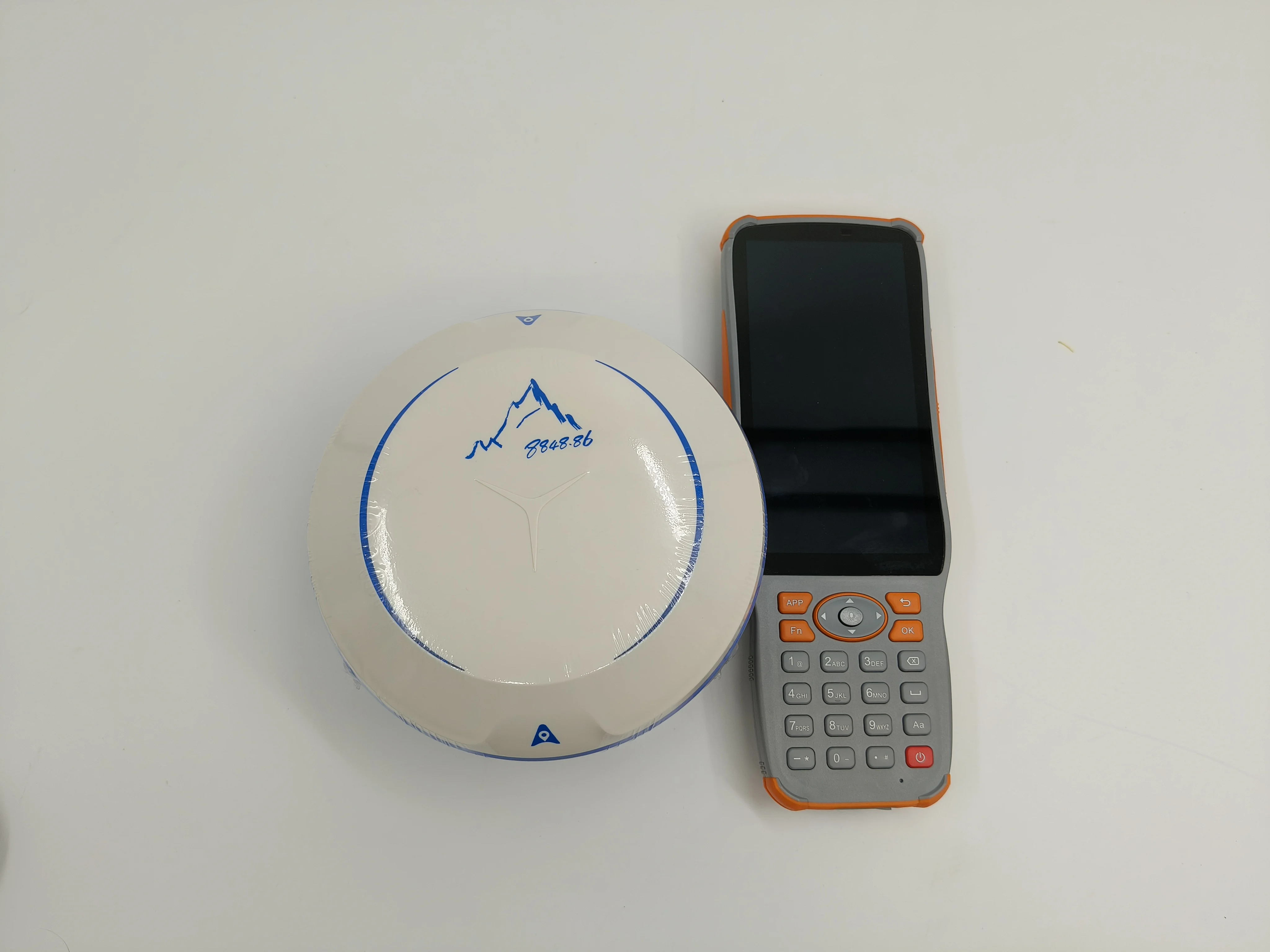
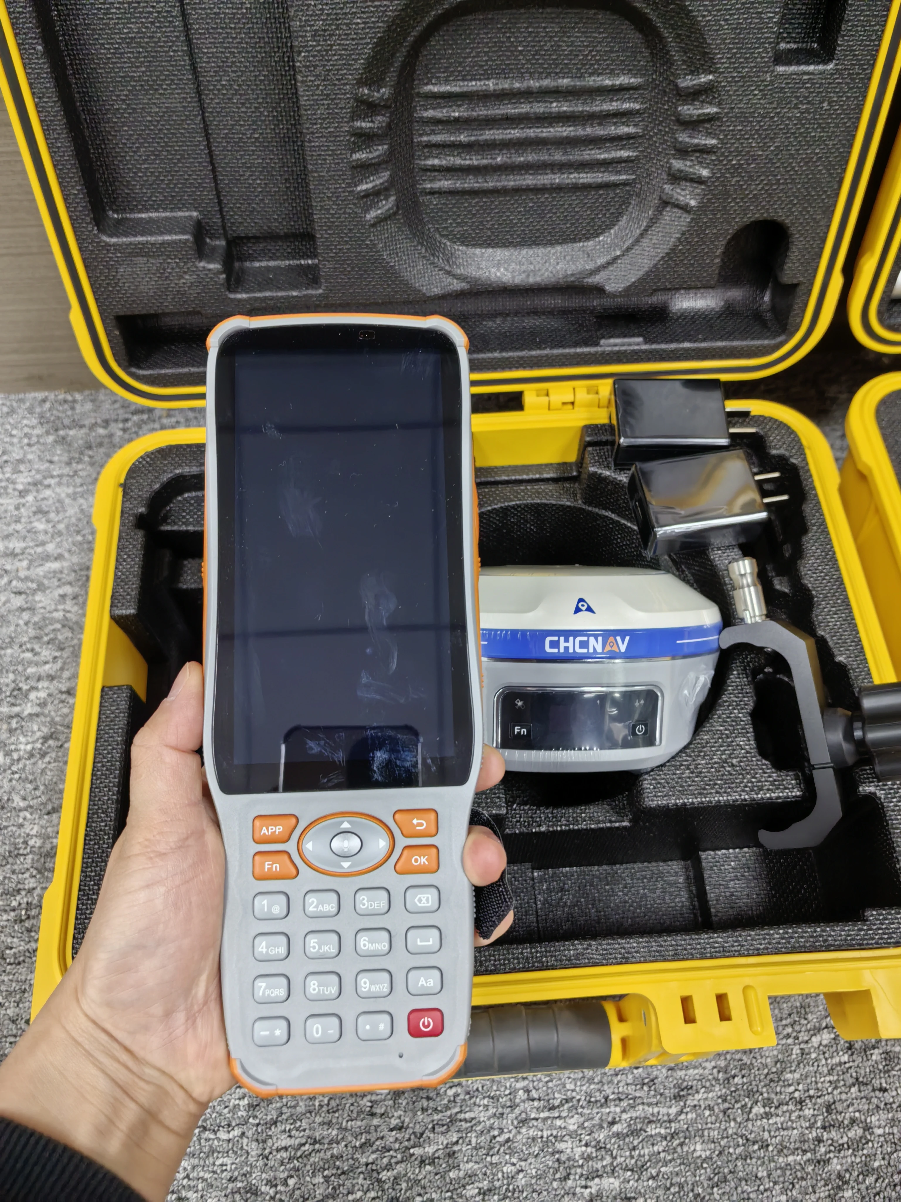
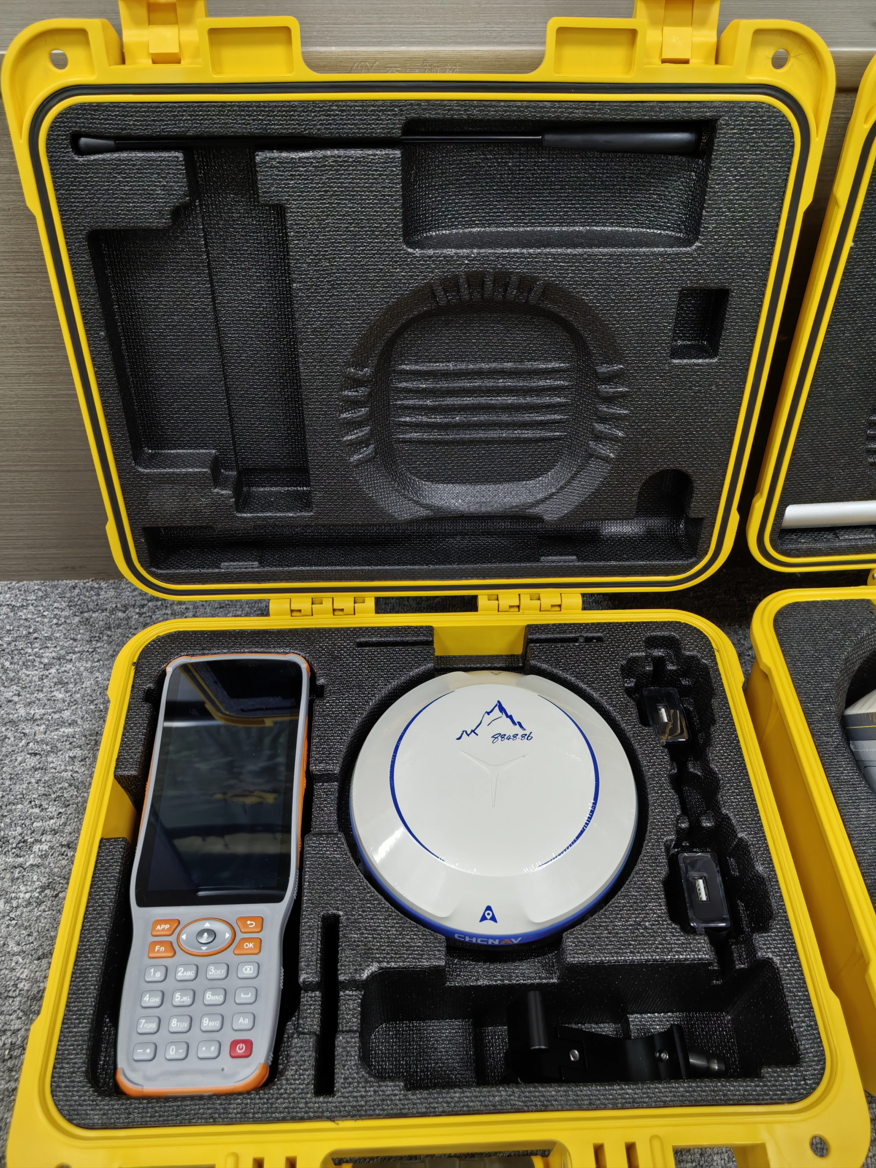
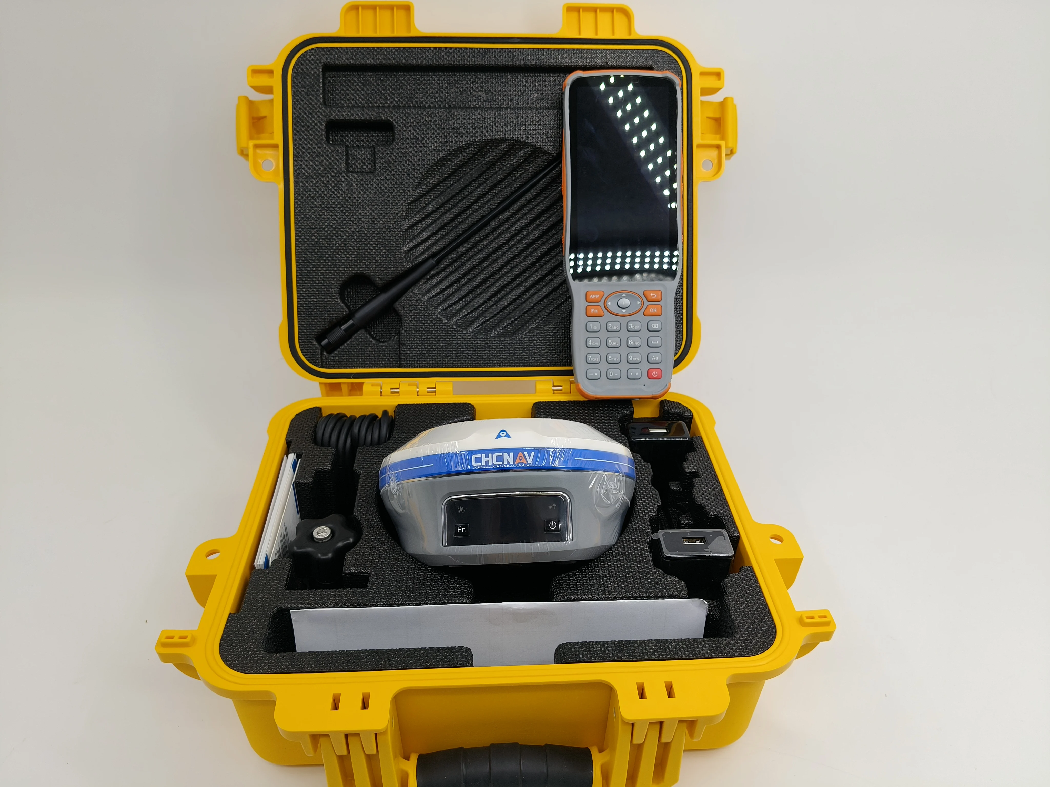
Popular Visual Surveying Dual Cameras 3D Modelling Survey Equipment X16 Pro Gnss Rtk Chcnav I93 with IMU
- Category: >>>
- Supplier: Shanghai Newdi Navigation Technology Co. Ltd.
Share on (1601269040366):
Product Overview
Description
Product Description
Specification
GNSS Performance | ||
Channels | 1408 channels | |
GPS | L1C, A, L2C, L2P(Y), L5 | |
GLONASS | L1, L2, L3 | |
Galileo | E1, E5a, E5b, E6* | |
BeiDou | B1I, B2I, B3I, B1C, B2a, B2b | |
QZSS | L1, L2, L5, L6* | |
PPP | B2b-PPP | |
SBAS (EGNOS Support) | L1, L5 | |
GNSS Accuracies | ||
Real time kinematic (RTK) | H: 8 mm + 1 ppm RMS V: 15 mm + 1 ppm RMS Initialization time: < 10s Initialization time: 99.9% | |
Post-processing kinematic (PPK) | H: 3 mm + 1 ppm RMS V: 5 mm + 1 ppm RMS | |
Post-processing static | H: 2.5 mm + 0.5 ppm RMS V: 5 mm + 0.5 ppm RMS | |
Code differential | H: 0.4 m RMS | V: 0.8 m RMS | |
Autonomous | H:1.5 m RMS | V: 2.5 m RMS | |
Visual survey | Typical 2~4 cm, range 2~15 m | |
Positioning rate | 1 Hz, 5 Hz and 10 Hz | |
Time to first fix | Cold start: < 45 s, Hot start: < 10 s Signal re-acquisition: < 1 s | |
IMU update rate | 200Hz | |
Till angle | 0-60° | |
RTK tilt-compensated | Additional horizontal pole-tilt uncertainty typically less than 10 mm + 0.7 mm/° tilt | |
Environments | ||
Temperature | Operating: -40°C to +65°C (-40°F to +149°F)Storage: -40°C to +85°C (-40°F to +185°F) | |
Humidity | 100% non-condensation | |
Ingress protection | IP67 (according to IEC 60529) | |
Drop | Survive a 2-meter pole-drop | |
Vibration | Compliant with ISO 9022-36-08 and MIL-STD-810G- 514.6-Cat.24. | |
Waterproof and breathable membrane | Prevent water vapor from entering under harsh environments | |
Electrical | ||
Power consumption | UHF/ 4G RTK Rover w/o camera: Typical 2.8 W Visual Stakeout/Visual Survey: Typical 4 W | |
Li-ion battery capacity | Built-in non-removable battery 9,600 mAh, 7.4 V | |
Operating time on internal battery | UHF/ 4G RTK Rover w/o camera: up to 34 h Visual Stakeout/Visual Survey: up to 24 h UHF RTK Base: up to 16 h Static: up to 36 h | |
External power input | 9 V DC to 28 V DC | |
Hardware | ||
Size (D x H) | Φ 152 x 81 mm (Φ 5.98 x 3.19 in) | |
Weight | 1.15 kg (2.54 lb) | |
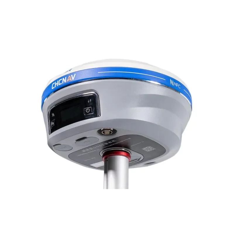
Front panel | 1.1'' OLED Color Display 2 LED, 2 physical buttons | |
Tilt sensor | Calibration-free IMU for pole-tilt compensation. Immune to magnetic disturbances. E-Bubble leveling. | |
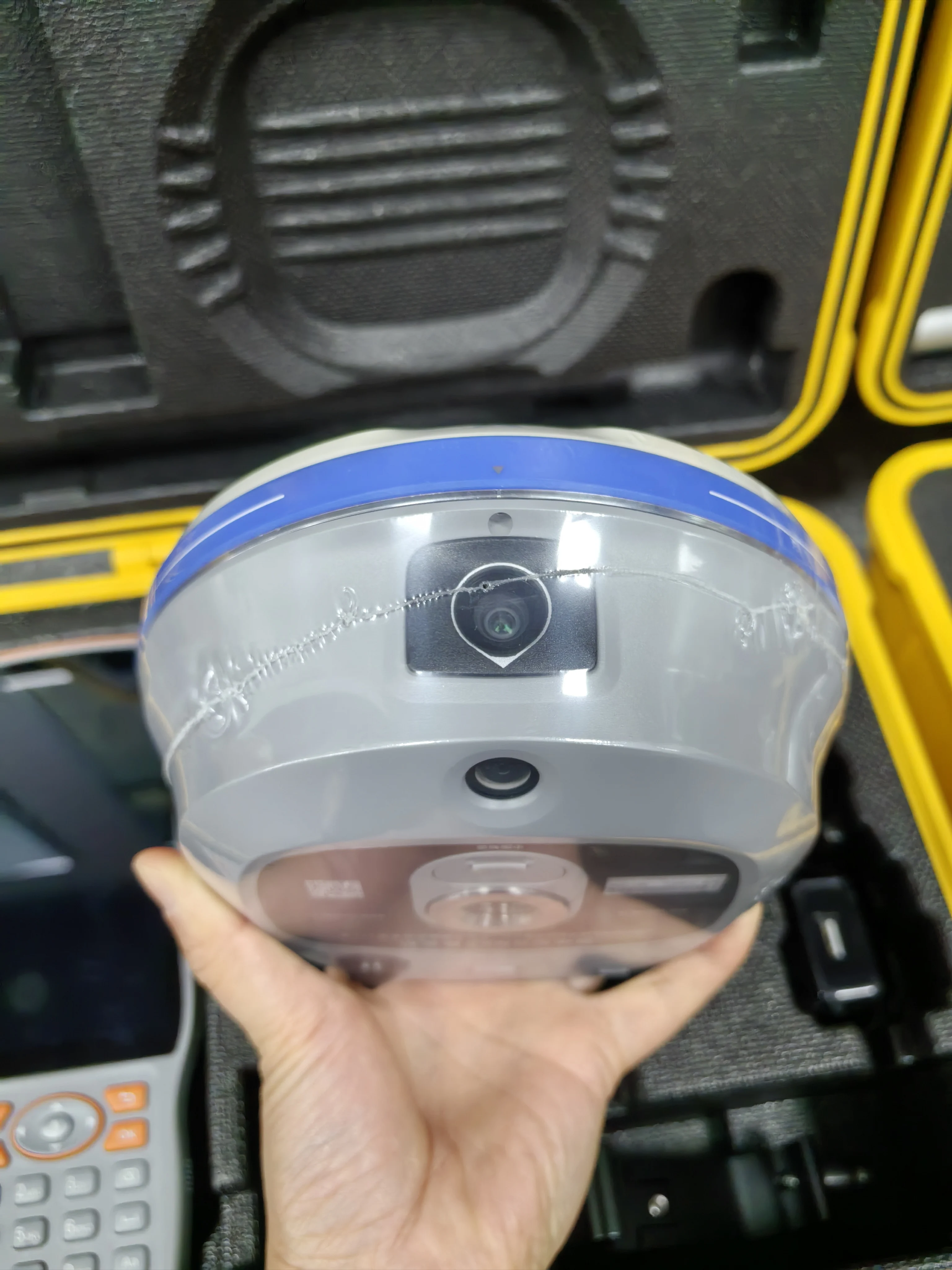
Cameras | ||
Sensor pixels | Global shutter with 2 MP & 5 MP | |
Field of view | 75° | |
Video frame rate | 25 fps | |
Image group capture | Method: video photogrammetry. Rate: typically 2 Hz, up to 25Hz. Max. capture time: 60s with an image group size of appr. 60MB. | |
lllumination | Starlight-grade camera. OmniPixel®-GS technology. Maintain full color at illumination levels as low as 0.01 lux. | |
Communication | ||
SIM card type | Nano-SIM card | |
Network modem | Integrated 4G modem: TDD-LTE, FDD-LTE, WCDMA, EDGE, GPRS, GSM | |
Wireless connection | NFC for device touch pairing | |
Wi-Fi | Wi-Fi IEEE 802.11a/b/g/n/ac, access point mode | |
Bluetooth® | 5.0 and 4.2 +EDR, backward compatible | |
Ports | 1 x 7-pin LEMO port (RS-232) 1 x USB Type-C port (external power, data download, firmware update) 1 x UHF antenna port (TNC female) | |
Built-in UHF radio | Rx/Tx: 410 - 470 MHz Transmit Power: 0.5 W to 2 W Protocol: CHC, Transparent, TT450, Satel Link rate: 9 600 bps to 19 200 bps Range: Typical 3 km to 5 km, up to 15 km with optimal conditions | |
Data formats | RTCM 2.x, RTCM 3.x, CMR input / output HCN, HRC, RINEX 2.11, 3.02 NMEA 0183 output NTRIP Client, NTRIP Caster | |
Data storage | 8 GB internal memory. Support 128 GB external expansion | |
Compliance with Laws and Regulations | ||
International standards | NGS Antenna Calibration, IEC 62133-2:2017+A1, IEC 62368- 1:2014, UN Manual Section 38.3 | |
Packing & Delivery


Company Profile
Shanghai Newdi Navigation Technology Company Limited (NEWDI) was established in Shanghai China. We are engaged in providing high-precision surveying and mapping instrument. The involved industries include land survey, construction, marine and UAVTill now, we have a professional sales team with 5 year experience in average. Branch office in the USA, DUBAI, India and South Africa offers local technical support to word wide users. We put technical support and ll be input our Rafter sale service as our highest level principle. 10% of our revenue is input into R&D every year. We never stop developing a better product for our customer. Quality issues are at the forefront of NEWDI's philosophy. NEWDI received ISO 9001 certification from International Standards Organization. It applies to all aspects of NEWDI's every development process and workflow, covering all steps from the initial design to the final delivery. Our distribution network covers more 10 countries. We take the mission to make survey easier. We are proud of the value that customer benefit from our service and returns continuous trust to NEWDI.
FAQ
1. who are we?
We are based in Shanghai, China, start from 2016, sell to Southeast Asia(30.00%), Africa(25.00%), South America(15.00%), NorthAmerica (10.00%), South Asia(5.00%), Mid East(5.00%), Eastern Europe(3.00%), Central America (2.00%), Oceania(2.00%), Southern Europe(2.00%), Eastern Asia(1.00%). There are total about 5-10 people in our office.
2. how can we guarantee quality?
Always a pre-production sample before mass production;
Always final Inspection before shipment;
3.what can you buy from us?
GNSS Receiver, Total Station, Level, UAV, Marine Product
4. why should you buy from us not from other suppliers?
Shanghai Newdi Navigation Technology Company Limited (NEWDI) was established in Shanghai China. We are engaged in providing high-precision surveying and mapping instrument. The involved industries include land survey, construction, marine and UAVTill now,
5. what services can we provide?
Accepted Delivery Terms: FOB,CFR,CIF,EXW,FAS,CIP,FCA,CPT,DEQ,DDP,DDU,Express Delivery,DAF,DES;
Accepted Payment Currency:USD,EUR,HKD,CNY;
Accepted Payment Type: T/T,L/C,Credit Card,Western Union,Cash;
Language Spoken: English, Chinese, Spanish, Japanese, Portuguese, German, Arabic, French, Russian, Korean, Hindi, Italian
We Recommend


New Arrivals
New products from manufacturers at wholesale prices


