Build an Intelligent Emergency Intelligent System Integrating Early Warning, Preplan, Prevention and Rehearsal
- Category: >>>
- Supplier: Shanghai Jigong Intelligent Information Technology Co. Ltd.Shanghai Ltd.
Share on (1601362591325):
Product Overview
Description


Intelligent emergency command system
We designed and developed the Trinity collaborative processing. Build an emergency early warning system with cross-departmental and cross-system communication. Achieve real-time monitoring of global emergency situations such as rainfall, water level, geological deformation, etc. As the center, form the basic emergency center handling capabilities of man-marking defense, command and dispatch, material allocation, and grid allocation, form the basic efficiency of event statistics, post-review, and simplify business flow.


Core function | ||
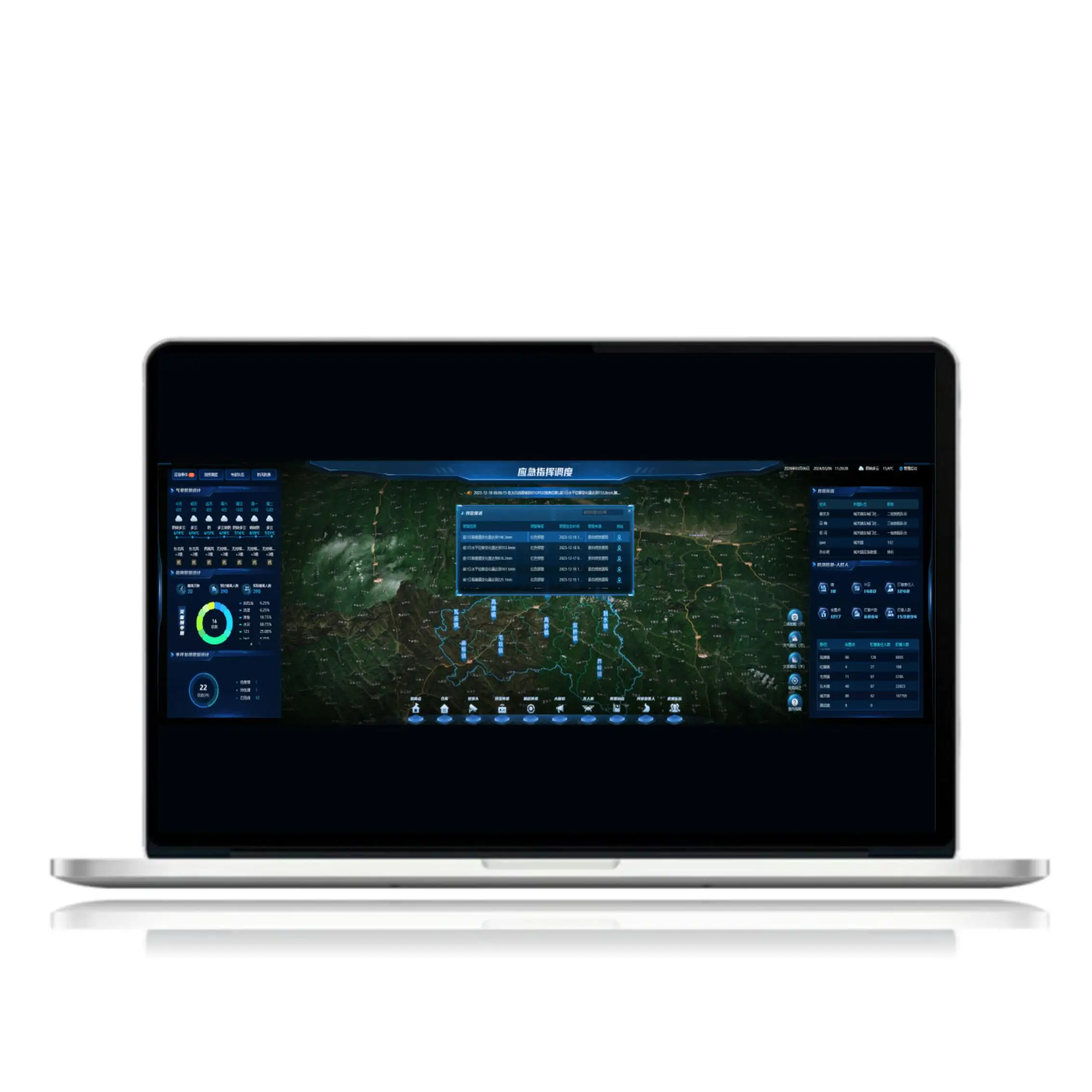
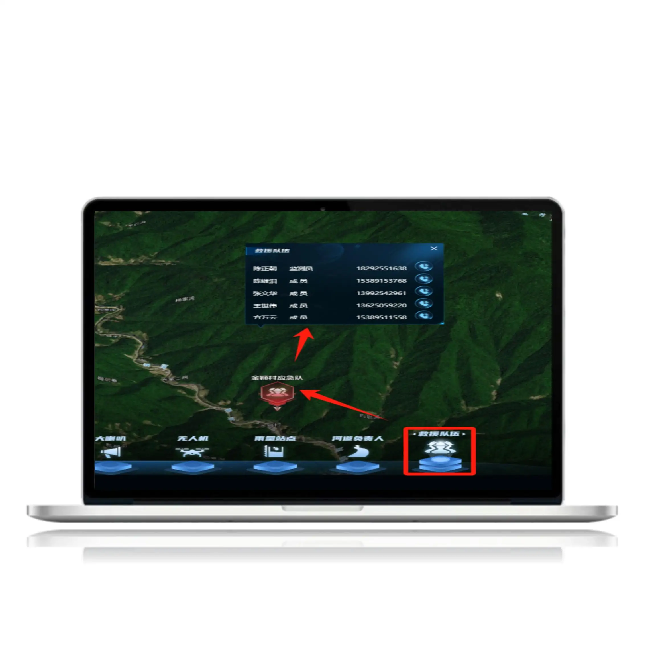
Command screen | The emergency screen has many functions such as emergency events, early warning information, command and dispatch, expert team, weather, flood and skid prevention, evacuation point, warehouse, immersion sensor, offset sensor, camera, loudspeaker, drone, rainfall station, river superintendent, rescue team and so on | |
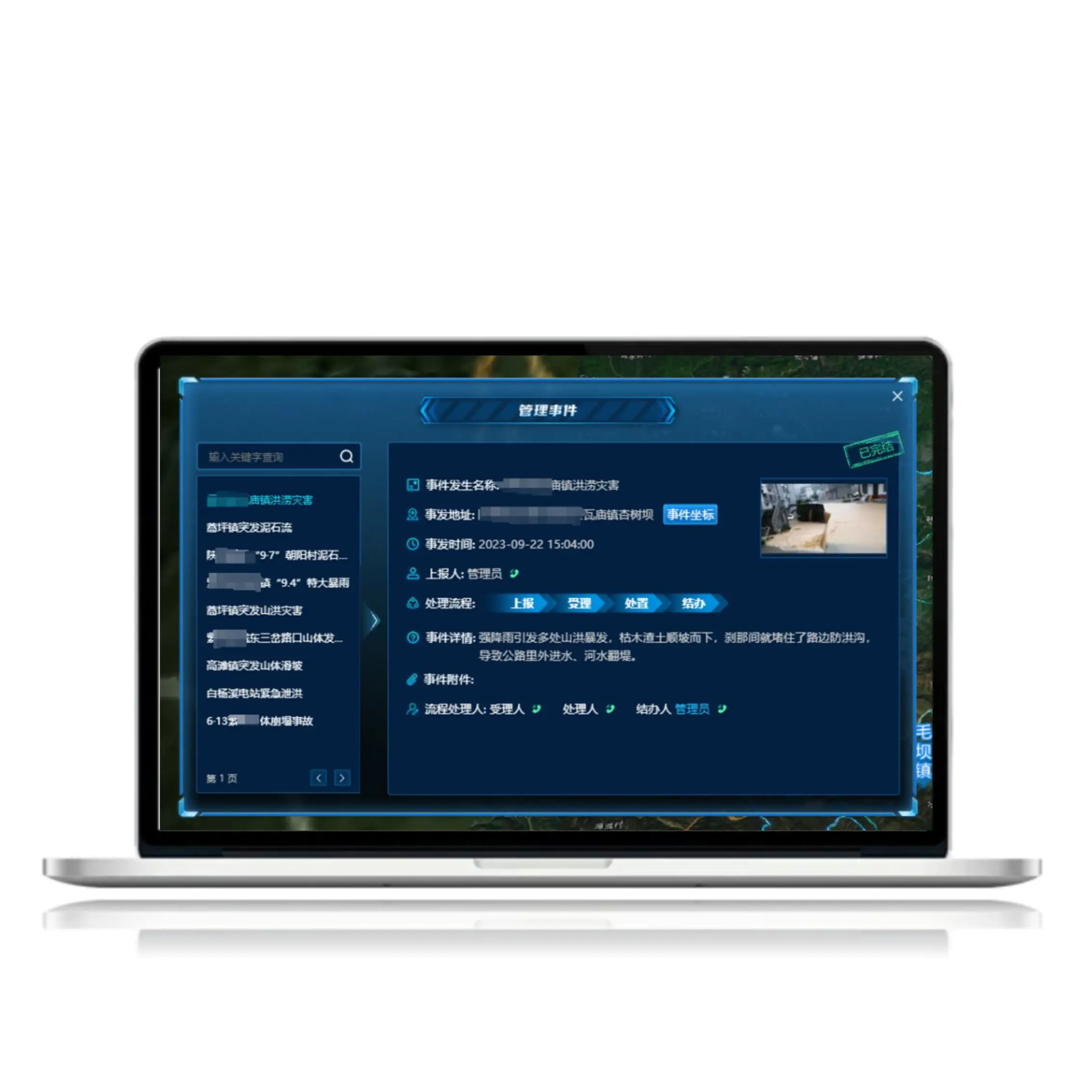
emergency | When the system receives an event, the screen displays a message indicating that an emergency event is reported, and you can view the event details, such as the event name, event address, event content, scene photo, event attachment, report person, and contact information. And the map can view the rescue team, evacuation point, camera, material information, various sensor equipment information and other equipment information within 500 meters of the event. | |
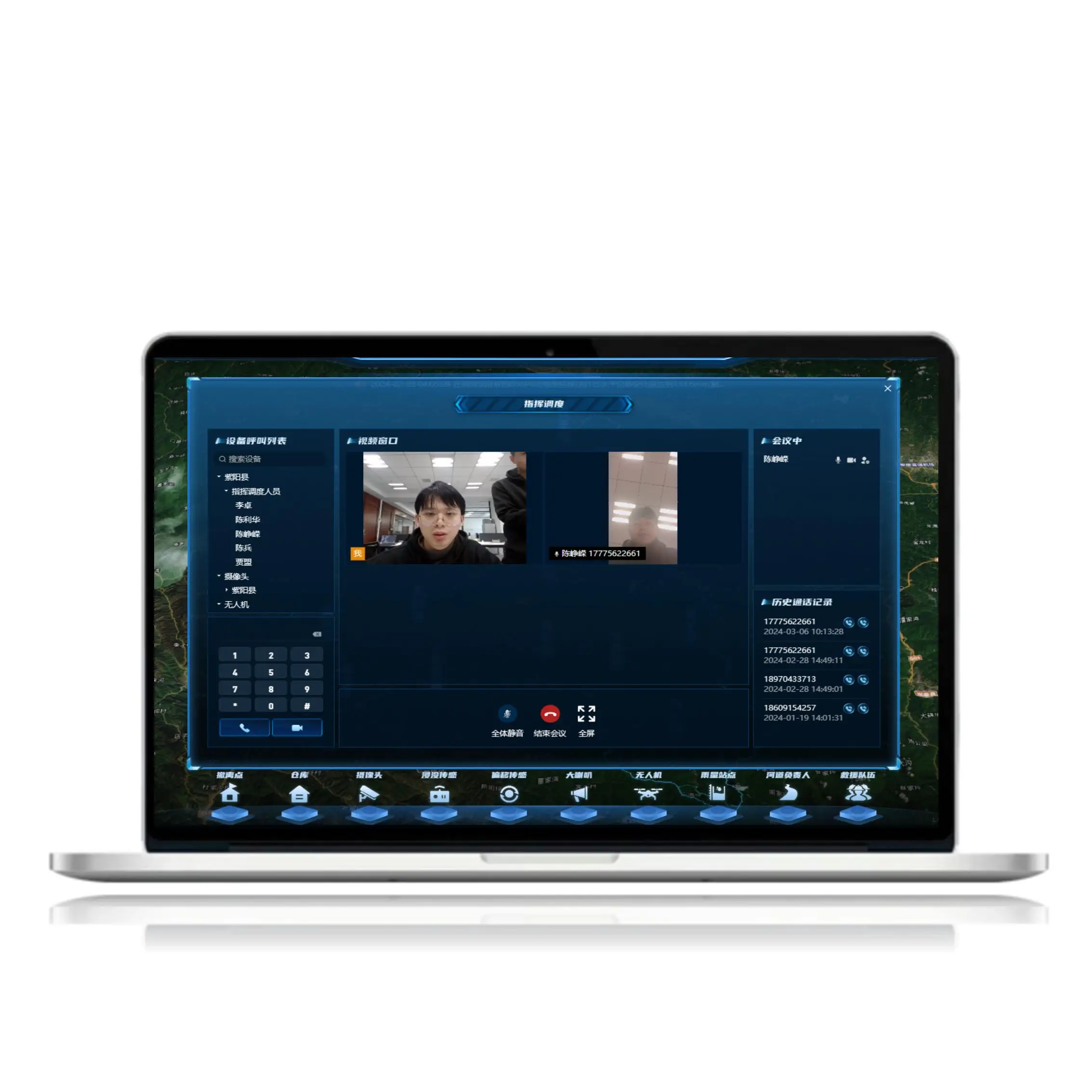
Command and dispatch | Command and dispatch mainly includes the following functions: command and dispatch contact list, drone video, surveillance video, historical call record information. You can make a call, make a video call, or organize a multi-person video conference. | |
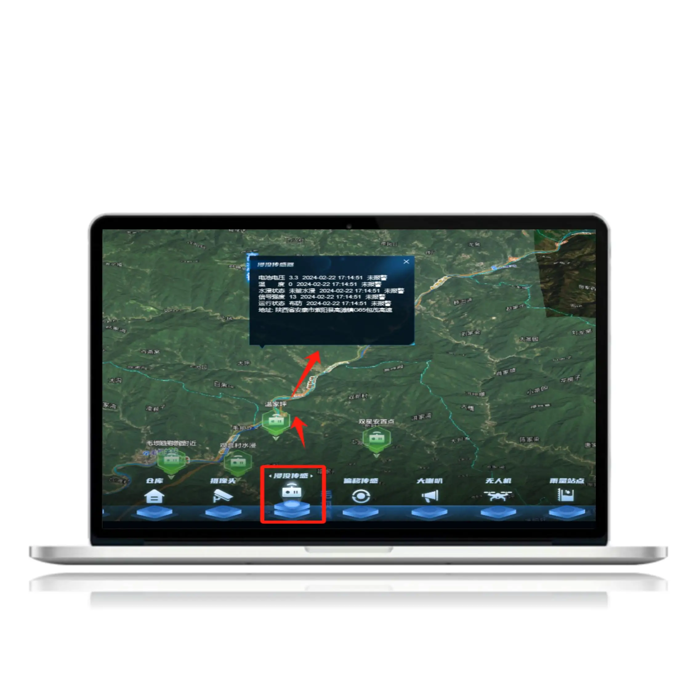
Early warning push | When the data of the immersion sensor, offset sensor, and rain sensor reaches the set threshold, the system will push the warning information to the large screen and form a record. The large screen allows you to view detailed warning information, locate the exact location on the map, and view detailed sensor data | |
Rescue team | You can view all the information of the rescue team in the function list, you can also view the specific location of the rescue team on the map, as well as the name, title, contact information, etc. You can directly call the phone number of the team members for video call | |
sensor | By clicking on different sensor ICONS, you can view various types of sensors on the map, as well as sensor location, parameter details, etc. | |
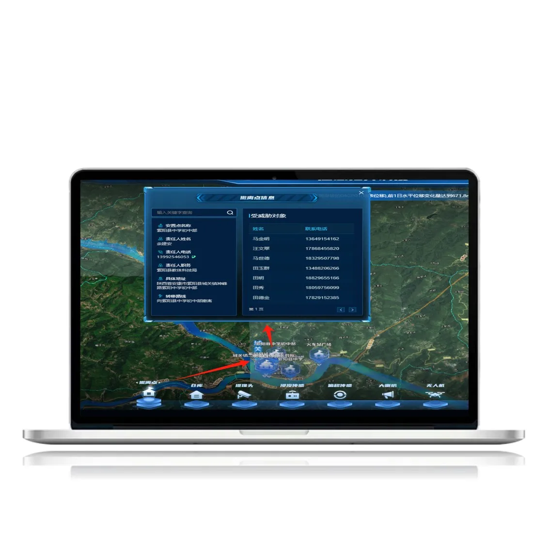
Extraction point | The evacuation point is also called the safety point, when the disaster occurs, the threatened people can be evacuated to the evacuation point through the safe evacuation route. You can view the location of the evacuation point, the person responsible, the contact information, and the details of the threatened object | |


After-Sales Service
Q: What after-sales service do you offer?
A: We offer a one-year free warranty and a service to resolve problems when they occur.
Q: What after-sales service do you offer?
A: We offer a one-year free warranty and a service to resolve problems when they occur.
Delivery time
Q: How long does it take from order to delivery?
A: The delivery time will be stipulated in the contract. Delivery will be on time.
Q: How long does it take from order to delivery?
A: The delivery time will be stipulated in the contract. Delivery will be on time.
Charging standard
Q: How do you charge?
A: We need to have a detailed understanding of your specific needs, consider the functionality and workload, evaluate a reasonable quotation.
Service content
Q: What services do you provide?
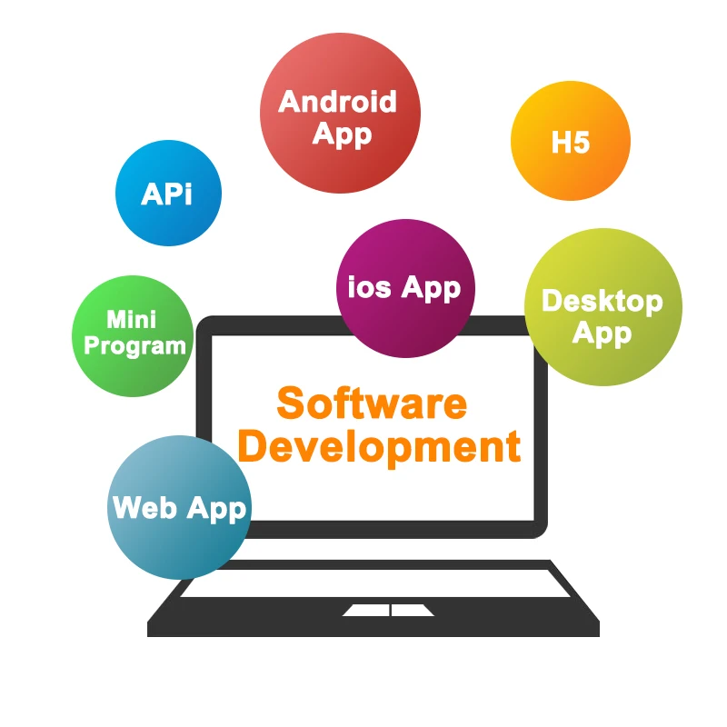
A: App development, software customization, website customization, Internet of Things, smart devices, GIS,BI,AI.
Q: What services do you provide?
A: App development, software customization, website customization, Internet of Things, smart devices, GIS,BI,AI.

We Recommend


New Arrivals
New products from manufacturers at wholesale prices